The Lost Carson Mine

OP
OP
UncleMatt

UncleMatt

Bronze Member
Jul 14, 2012
2,389
2,530
Albuqerque, NM / Durango, CO
Detector(s) used
Garrett Infinium & Gold Bug II, Bazooka Super Prospector Sluice
Primary Interest:
All Treasure Hunting
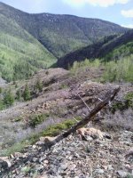
The thing is I have all claims back to the mid 80's in my database, and none of them were in this area. So I am stumped. And yes, the long thin stakes I showed in the photos looked like they had been left up there just a few weeks earlier, if not days. Yet I found no signs of recent activity like foot prints, fire areas, or campsites. I did see an intact blue tarp covering something about 75 feet to the left of that cave I show in the last photo, but I respect people's stuff and didn't even go look to see what was up over there.
 

OP
OP
UncleMatt

UncleMatt

Bronze Member
Jul 14, 2012
2,389
2,530
Albuqerque, NM / Durango, CO
Detector(s) used
Garrett Infinium & Gold Bug II, Bazooka Super Prospector Sluice
Primary Interest:
All Treasure Hunting
I would like to determine if the caves I found were natural or man made. I see evidence for both in the one I show in the photo. You can see a big quartz vein running across the back of it. As you walk around there are quartz veins in just about every piece of exposed country rock, from paper thin to quite thick. I can easily see that its possible for one of them to have had mineralization, even though most don't appear to be mineralized.

I have so many areas I want to explore, I just don't have the time to get to them all in the 2 weeks of vacation I have each year. I want to go up to the area where the Carson mine was supposedly located this year.
 

Last edited:

Rebel - KGC

Gold Member
Jun 15, 2007
21,680
14,739
I would like to determine if the caves I found were natural or man made. I see evidence for both in the one I show in the photo. You can see a big quartz vein running across the back of it. As you walk around there are quartz veins in just about every piece of exposed country rock, from paper think to quite thick. I can easily see that its possible for one of them to have had mineralization, even though most don't appear to be mineralized.

I have so many areas I want to explore, I just don't have the time to get to them all in the 2 weeks of vacation I have each year. I want to go up to the area where the Carson mine was supposedly located this year.

The SECRET is just ONE thing... just choose ONE "sites", and DO IT; ONLY! HH! Good Luck!
 

OP
OP
UncleMatt

UncleMatt

Bronze Member
Jul 14, 2012
2,389
2,530
Albuqerque, NM / Durango, CO
Detector(s) used
Garrett Infinium & Gold Bug II, Bazooka Super Prospector Sluice
Primary Interest:
All Treasure Hunting
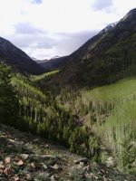
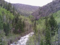
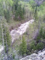
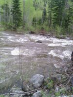
Okay, my recon guy says that Lime Road is now clear of snow. He was able to take the following photos of the area near Lime Creek. He was unable to cross the creek because the snow melt runoff and recent rains have the creek running very fast and very deep.

11358748_10153299651312856_410092594_n.jpg

11245313_10153299651387856_498990772_n.jpg

11292625_10153299653567856_170279159_n.jpg

11131851_10153299653842856_186712187_n.jpg

11291744_10153299653167856_1775118242_n.jpg
 

OP
OP
UncleMatt

UncleMatt

Bronze Member
Jul 14, 2012
2,389
2,530
Albuqerque, NM / Durango, CO
Detector(s) used
Garrett Infinium & Gold Bug II, Bazooka Super Prospector Sluice
Primary Interest:
All Treasure Hunting
Making plans to hit this area the week of July 20th. I'm hoping rain will not be an issue, and that runoff down Twilight Creek will be lower than when these last photos were taken. I also plan to hit Silverton and see if I can find any old newspaper reports or documentation about the Carson Mine. I would dearly love to find that old framed assay report that I mentioned earlier in the thread. If anyone knows anything about that assay report from Carson's ore, I would love to hear about it. Send me a pm if you like.
 

sdcfia

Silver Member
Sep 28, 2014
3,648
8,861
Primary Interest:
Other
Making plans to hit this area the week of July 20th. I'm hoping rain will not be an issue, and that runoff down Twilight Creek will be lower than when these last photos were taken. I also plan to hit Silverton and see if I can find any old newspaper reports or documentation about the Carson Mine. I would dearly love to find that old framed assay report that I mentioned earlier in the thread. If anyone knows anything about that assay report from Carson's ore, I would love to hear about it. Send me a pm if you like.

The framed document I mentioned to you was a photo of an assay - not an original. In retrospect, I'm assuming that it was of the Carson ore since the photo's owner - the old miner in Ouray named Buddy - told me the assayed ore had come from up high on the Needles and that he had spent some time looking for it when he was younger. Presumably it was the Lost Carson, but I never made that connection until I read about it in the Cornelius book a few years after my contact with Buddy. If Buddy had a photo of the assay, then chances are there may have been others. I believe Silverton has a new mining museum downtown. Hope you're able to get upstream far enough to look things over and size it up. It'd be nice if you could find Carson's camp at the overhang - the vein would probably not be too much higher and would narrow your search area.
 

OP
OP
UncleMatt

UncleMatt

Bronze Member
Jul 14, 2012
2,389
2,530
Albuqerque, NM / Durango, CO
Detector(s) used
Garrett Infinium & Gold Bug II, Bazooka Super Prospector Sluice
Primary Interest:
All Treasure Hunting
Don't envy me too much! This is going to involve crossing a mountain river on foot and a hike up a watershed at very high elevation with a pack full of camping and prospecting gear, and an elevation rise of 3,000 feet. Before I can even start the search.

Sdcfia, I will visit the mining museum, as well as the Silverton Standard & the Miner. That is the local newspaper founded in 1875. I hope I find some documentation to corroborate this lost mine tale.
 

Last edited:
OP
OP
UncleMatt

UncleMatt

Bronze Member
Jul 14, 2012
2,389
2,530
Albuqerque, NM / Durango, CO
Detector(s) used
Garrett Infinium & Gold Bug II, Bazooka Super Prospector Sluice
Primary Interest:
All Treasure Hunting
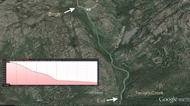
A few days ago I attempted to hike to the search area for the Lost Carson Mine. I climbed down 1,123 feet from the southern most hairpin curve on Lime Creek Road to Lime Creek, and made my way to the junction of Lime Creek and Twilight Peak. This took a great deal of time and effort. So much so that it would have been impossible to try to hike the remaining 3,300 feet up to the search area from that point. I have read accounts on 14ers.com where experienced climbers claimed to have made in one day the hike from that road to the search area, but I doubt that is possible.

However, I did find quite a few interesting things in the watershed. Including 2 very old cabins, and even an abandoned motorcycle. Considering the terrain I encountered on the way down, I was amazed at the presence of a motorcycle and what I found in the cabins. It appears there must be a way down into the watershed that is much easier than the path I took, both for pack animals and the motorcycle to have access.
 

sdcfia

Silver Member
Sep 28, 2014
3,648
8,861
Primary Interest:
Other
A few days ago I attempted to hike to the search area for the Lost Carson Mine. I climbed down 1,123 feet from the southern most hairpin curve on Lime Creek Road to Lime Creek, and made my way to the junction of Lime Creek and Twilight Peak. This took a great deal of time and effort. So much so that it would have been impossible to try to hike the remaining 3,300 feet up to the search area from that point. I have read accounts on 14ers.com where experienced climbers claimed to have made in one day the hike from that road to the search area, but I doubt that is possible.

However, I did find quite a few interesting things in the watershed. Including 2 very old cabins, and even an abandoned motorcycle. Considering the terrain I encountered on the way down, I was amazed at the presence of a motorcycle and what I found in the cabins. It appears there must be a way down into the watershed that is much easier than the path I took, both for pack animals and the motorcycle to have access.

So, was this your route? How long was the trip down? Up? How did it look up Twilight Creek, travel-wise - any obvious trails? Does the search still look viable?

Lime Creek Road to Twilight.jpg
 

OP
OP
UncleMatt

UncleMatt

Bronze Member
Jul 14, 2012
2,389
2,530
Albuqerque, NM / Durango, CO
Detector(s) used
Garrett Infinium & Gold Bug II, Bazooka Super Prospector Sluice
Primary Interest:
All Treasure Hunting
It took several hours to descend, and also to come back up. The route marked on your photo is close, but we started down right from the middle of the hairpin curve, not the wash to the west of it. When we reached Lime Creek we had to cross back and forth several times to avoid talus piles, thick impenetrable brush, and steep slopes. Crossing the creek was easy, not a challenge at all, which was a relief. However, it will take a multi-day hiking effort to ever reach the top of Twilight Creek. I had a 60 pound pack on my back, and still did not have a tent or sleeping bag or all the prospecting tools (including a metal detector) that would be required for any serious prospecting effort at the top. I think there may be an easier path to the junction, but it will take time to pick it out. The fact we found so much heavy stuff in one of the old cabins we found indicate there must be a way for pack animals to descend, but it certainly wasn't the route we took! The elevation change numbers I quoted were straight from my Back Country Trails Pro app, and it also indicated a round trip of only 3 miles. But much of that 3 miles was hell.
 

sdcfia

Silver Member
Sep 28, 2014
3,648
8,861
Primary Interest:
Other
It took several hours to descend, and also to come back up. The route marked on your photo is close, but we started down right from the middle of the hairpin curve, not the wash to the west of it. When we reached Lime Creek we had to cross back and forth several times to avoid talus piles, thick impenetrable brush, and steep slopes. Crossing the creek was easy, not a challenge at all, which was a relief. However, it will take a multi-day hiking effort to ever reach the top of Twilight Creek. I had a 60 pound pack on my back, and still did not have a tent or sleeping bag or all the prospecting tools (including a metal detector) that would be required for any serious prospecting effort at the top. I think there may be an easier path to the junction, but it will take time to pick it out. The fact we found so much heavy stuff in one of the old cabins we found indicate there must be a way for pack animals to descend, but it certainly wasn't the route we took! The elevation change numbers I quoted were straight from my Back Country Trails Pro app, and it also indicated a round trip of only 3 miles. But much of that 3 miles was hell.

Wow. That looks like a job for three or four guys, splitting up the gear to pack, and planning for a week at least in the hills - a long day in, five days in camp, and a long day out. I know you have a plan in mind and aren't looking for advice, but if it was my gig, I'd forego prospecting my way up Twilight Creek (that looks awfully brutal) in lieu of getting to the high northwest face of the Needles as quickly as possible. Yeah, it'd be nice to track the float, but it's the outcropping you want.

This strategy might favor the climbers' higher approach from Crater Lake to the northeast instead of fighting your way up Twilight Creek. Then, above that snowmelt lake, I would grid search and map out the best possibilities for Carson's overhang shelter. The next trip in, I would begin searching above the best shelter targets for the actual vein. This ain't no weekend adventure.
 

OP
OP
UncleMatt

UncleMatt

Bronze Member
Jul 14, 2012
2,389
2,530
Albuqerque, NM / Durango, CO
Detector(s) used
Garrett Infinium & Gold Bug II, Bazooka Super Prospector Sluice
Primary Interest:
All Treasure Hunting
I came across evidence that Twilight Creek has been heavily prospected. Including finding several pieces of 2" flexible dredge hose on site nearby, as well as a gas can. The gas can might have been for the old motorcycle I found up there, but the hose point to some kind of dredge being present. The presence of permanent cabins also points to a lot of time being spent by someone at some time in the immediate area.

I have to say, some elements of the story in Temple's account are suspect after visiting the site. I don't see any way possible that a herd of sheep could be run around in the Twilight Creek watershed. If you will recall a sheepherder supposedly came across Carson's poles and vein while tending sheep in the upper watershed. I would love if someone could explain how such a herd of sheep could get to the spot we reached, let alone higher up. I don't know, maybe sheep can go places I'm thinking they can't. Any thoughts on that?
 

sdcfia

Silver Member
Sep 28, 2014
3,648
8,861
Primary Interest:
Other
I came across evidence that Twilight Creek has been heavily prospected. Including finding several pieces of 2" flexible dredge hose on site nearby, as well as a gas can. The gas can might have been for the old motorcycle I found up there, but the hose point to some kind of dredge being present. The presence of permanent cabins also points to a lot of time being spent by someone at some time in the immediate area.

I have to say, some elements of the story in Temple's account are suspect after visiting the site. I don't see any way possible that a herd of sheep could be run around in the Twilight Creek watershed. If you will recall a sheepherder supposedly came across Carson's poles and vein while tending sheep in the upper watershed. I would love if someone could explain how such a herd of sheep could get to the spot we reached, let alone higher up. I don't know, maybe sheep can go places I'm thinking they can't. Any thoughts on that?


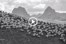
This sheepherder is at 12,000+ feet elevation, above Silverton.

silverton sheep.jpg

https://www.hcn.org/articles/Peru-sheep-Colorado-photography
 

OP
OP
UncleMatt

UncleMatt

Bronze Member
Jul 14, 2012
2,389
2,530
Albuqerque, NM / Durango, CO
Detector(s) used
Garrett Infinium & Gold Bug II, Bazooka Super Prospector Sluice
Primary Interest:
All Treasure Hunting
Its not the altitude I question, but the kind of terrain the herd would have to pass through to arrive at the Junction of Twilight Creek and Lime Creek. Assuming the herd was coming up from Durango, what path would they take to lead them there? As well, what kind of grazing conditions would await them if they climbed up to the headwater area of Twilight Creek? I am not saying it is totally impossible, but I am asking about the specific logistics involved and the motivation to do so. I guess I need to learn more about the habits and practices of sheep herders in the area in the early part of the last century to find my answers.
 

sdcfia

Silver Member
Sep 28, 2014
3,648
8,861
Primary Interest:
Other
Its not the altitude I question, but the kind of terrain the herd would have to pass through to arrive at the Junction of Twilight Creek and Lime Creek. Assuming the herd was coming up from Durango, what path would they take to lead them there? As well, what kind of grazing conditions would await them if they climbed up to the headwater area of Twilight Creek? I am not saying it is totally impossible, but I am asking about the specific logistics involved and the motivation to do so. I guess I need to learn more about the habits and practices of sheep herders in the area in the early part of the last century to find my answers.

The sheepherder Juan Quintana allegedly discovered Carson's camp in the 1920s. The southernmost alpine grazing meadows in these mountains seems to be in upper Twilight Creek, so it seems likely that Quintana came in from the Twilight Peak-Snowden Peak-et al meadows to the north. If his herd originated in Durango, the sheep may have been shipped on the railroad to Silverton, then driven up to the high country on existing trails. Or, depending on what roads and trails existed in the 20s, the herd may have been driven up to, say, the Molas Lake area from Durango, following today's highway route, and then up to the meadows for the summer season. A Lime Creek approach seems very unlikely. Who knows? In any event, the reports of similar Carson ore being found in lower Twilight Creek, if true, support the Twilight Creek target - no matter how Quintana got his sheep into the upper stretches.
 

OP
OP
UncleMatt

UncleMatt

Bronze Member
Jul 14, 2012
2,389
2,530
Albuqerque, NM / Durango, CO
Detector(s) used
Garrett Infinium & Gold Bug II, Bazooka Super Prospector Sluice
Primary Interest:
All Treasure Hunting
I had not considered that the sheep might have been transported up into the high country by train. I have never seen anything that would indicate that was actually done back then, but I will look into that.
 

lastleg

Silver Member
Feb 3, 2008
2,876
658
I once had the opportunity to watch a sheep herd from I expect the Ute Creek watershed
being herded past where I was on the Rio Grande. Have no idea where the shearing was
to take place. I had almost forgotten about it until now. Around '89 I think. I'm sure they
were loaded onto trucks somewhere around 7 mile bridge south of Creede.

Also there is a sheepherder cairn on top of the divide on San Juan mountain.
 

Barton

Sr. Member
Apr 21, 2005
446
320
Abiquiu, NM
Detector(s) used
What ever is needed for the project I am working on--I am a cache hunter
Primary Interest:
Cache Hunting
Let's put those four bags of gold he hauled on his burros into a modern perspective. ( post # 3 )

$ 2,800 dollars divided by $ 20 per ounce which was gold was worth in 1895 means he was hauling 140 ounces of gold.
(actually it is more than that as the refiners would have charged him a cut of 10% to 20% refining charge --probably 14 to 28 ounces of his gold )

If gold now sells lets just pick a ball park number of $ 1,100 per ounce--then the 140 ounces of gold were worth 1,100 X 140 = $ 154,000.00
 

Top Member Reactions

Users who are viewing this thread

Top