Last edited:
You are using an out of date browser. It may not display this or other websites correctly.
You should upgrade or use an alternative browser.
You should upgrade or use an alternative browser.
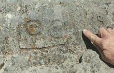
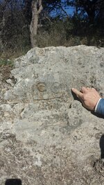
Would anyone like to comment on this?
- Thread starter coldfeet
- Start date
dsty
Bronze Member
Hello cold feet, Looks like a symbol for a place of rest, perhaps a church, kind of interesting that there are a couple of directions to go big line to small line on the 7 and big 0 to small o, perhaps there may be two places of rest, measure from the ground to the top off the boulder for the distance.
Blind.In.Texas
Bronze Member
Maybe a survey symbol? It's not an interpretable rock formation so, you likely won't get much help around here. Do a lot of research about survey symbols. There will be a lot of those out in the sticks. A few links:
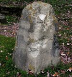
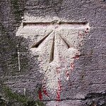 Similar to the one below but, the website content is unrelated.
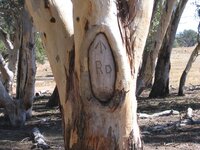 When things like this become a hundred years old, they really can be intriguing.
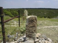
 This one could be used as a shrine in a hundred years when the Ancient Spanish move in to mine the area.
I should note that none of those images are mine. I posted them as links but, tnet has removed the url. They are all found on the web. I think I used "land survey marks or symbols" or something like that.

 Similar to the one below but, the website content is unrelated.
 When things like this become a hundred years old, they really can be intriguing.
 This one could be used as a shrine in a hundred years when the Ancient Spanish move in to mine the area.
I should note that none of those images are mine. I posted them as links but, tnet has removed the url. They are all found on the web. I think I used "land survey marks or symbols" or something like that.
Last edited:
Blind.In.Texas
Bronze Member
How about horseshoes? Go left.
- Thread starter
- #6
You're getting warmer. I wanted to get "cold" input without giving clues about what I think, etc. I'll spill a few beans now. The rock is in the vicinity of an old, remote Spanish settlement, on the general route from a distant "mother" settlement. There are legends about Spanish mines in the area. The rock is parallel to the presumed trail between the settlements (or the mine). The Cs are usually referred to as mule shoes. They point the direction of the trail and indicate the distance. More shoes, more leagues. The horizontal line signifies a trail. The vertical line at the end of the horizontal line indicates the end of the trail, or the walls of the fortifications at the remote settlement. The arrow at the top right confirms the direction.
Methinks it's a classic Spanish trail marker.
Methinks it's a classic Spanish trail marker.
Top Member Reactions
-
 2347
2347 -
 1126
1126 -
 1055
1055 -
 893
893 -
 824
824 -
 784
784 -
 750
750 -
 749
749 -
 607
607 -
 500
500 -
 490
490 -
 473
473 -
 462
462 -
 423
423 -
 393
393 -
 392
392 -
 386
386 -
O
383
-
 382
382 -
 377
377
Users who are viewing this thread
Total: 2 (members: 0, guests: 2)
