Stone Cross with signs

ivobg

Sr. Member
Jun 20, 2013
414
224
Forgot
Detector(s) used
Garrett 150
Primary Interest:
All Treasure Hunting
20170308_130002.jpg
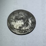
Can anyone recognize something ? ???
 

miboje

Hero Member
Mar 21, 2016
780
789
Detector(s) used
Garrett GTA 1000 PowerMaster
Primary Interest:
All Treasure Hunting
What country is this in?
 

OP
OP
ivobg

ivobg

Sr. Member
Jun 20, 2013
414
224
Forgot
Detector(s) used
Garrett 150
Primary Interest:
All Treasure Hunting
50-60 cm
looks east
 

dsty

Bronze Member
Dec 2, 2007
1,300
736
Randal County
boogeyman, you may be right, sure not much to work with, some of my thoughts could be that when this country was settled this may have been a Platt Map, solid lines generally indicate property lines, or roads, several things that could indicate distance including height what you expect to find, perhaps the square boxes that's connected maybe square leagues and with a hash mark 1/2 league. There two things that a person must have to follow a map Distance and Direction. Is this in Tenn or Ky. There's several clues that could help, upside down V with dot. what does the sides and backside look like
 

OP
OP
ivobg

ivobg

Sr. Member
Jun 20, 2013
414
224
Forgot
Detector(s) used
Garrett 150
Primary Interest:
All Treasure Hunting
They are blank
 

dsty

Bronze Member
Dec 2, 2007
1,300
736
Randal County
Would a couple glasses of stout and mild help any, just kidding, It sure looks to be something connected with surveyor and Church property, my thoughts are you are looking at a map of Church / Government property, I would start with the 4 directions and Google Earth, If the boxes are property indicator's each one could = 2.5 miles. I would start by going East first then North / South Looks like may be 25 miles wide ( kinda interesting that its similar to the Township method that they may have used in the U.S. ) It seems that there no information on the back side and looking Toward the East then to the Left and to the Right seems to be Three directions followed, Looks to be the 1800,s which It may belong to the Church, the marker you show may be on the South property line, it looks to the East then the two directions left would be North and South, All of the corners that I have found seem to be in the South East corner that had Information on them.
 

dsty

Bronze Member
Dec 2, 2007
1,300
736
Randal County
He may be doing the maps of the area, locating sources and such for the area and its summer time there also, 4 /6 months will make a lot of difference. I had information on Old Spanish and Portugal measurements, at one time. If you will help perhaps some of the folks here may find it useful as far as distance markers, most of my stuff has been pertaining to the track of land set aside for settlers when they arrived here from Spain, most of the markers pertain those simply because there's more of them, then I started messing with trail markers and some on the Royal trail markers ( Lost Horse found some that's interesting,) she's well versed and has really been around, I make a lot of noise when I'm out and about. I don't know what her range is and I'm pretty sure that when she's about she's probably packin, Anyone interesting looking up" Old Spanish and Portugal Measurement " and posting them. Thanks
 

OP
OP
ivobg

ivobg

Sr. Member
Jun 20, 2013
414
224
Forgot
Detector(s) used
Garrett 150
Primary Interest:
All Treasure Hunting
I will post update in octomber/november when the place is clear
Old maps show nothing than wilderness
 

dsty

Bronze Member
Dec 2, 2007
1,300
736
Randal County
Looking forward to seeing the country side with out brush, marker seems to be about knee high X 2 for a distance
 

Last edited:

boogeyman

Gold Member
Jun 6, 2006
5,016
4,398
Out in the hills near wherendaheckarwe
Detector(s) used
WHITES, MINELAB, Garrett
Primary Interest:
All Treasure Hunting
ivobg, I don't know why folks don't check the height and direction, on carving's while they are taking the photo
Pocket notebooks are cheap, so are pencils. Pencils = follow the 1 to use 3 to lose rule. Leave the ink pens home unless you like pocket stains. Take a pic make a note pic note. When you get home use a program like EXIF Pilot (freeware) to add your notes in the EXIF data. Scan the pages of your notebook and save em to a CD or DVD.:thumbsup:

Thought everyone knew this grief saver technique? Us oldsters that got no recall after the Monday morning brain farts.:laughing7:
 

OP
OP
ivobg

ivobg

Sr. Member
Jun 20, 2013
414
224
Forgot
Detector(s) used
Garrett 150
Primary Interest:
All Treasure Hunting
Did some research and its 99% sure its not ancient but modern religious stone i think they made animal sacrifices near it
Ill still check it later this year
 

OP
OP
ivobg

ivobg

Sr. Member
Jun 20, 2013
414
224
Forgot
Detector(s) used
Garrett 150
Primary Interest:
All Treasure Hunting
Little late with the response
checked it and didnt find anything
found 2 more of this stones though :laughing9:
 

Quinoa

Bronze Member
Nov 25, 2011
1,888
3,273
Purgatory
Detector(s) used
Garrett atx pi 12+20inch coil, Garrett mh series, Garrett 2500+t-hound attchmnt, fisher tw-6 two box, Pulsestar pro ii with various coils up to 98 inches, pulsemaster pro w/1.2 m coil
Primary Interest:
Other
Kinda looks like an information stone, similar to a stella/stellae telling what happened in the area or description or boundary. Maybe even like one of those ancient tsunami marker monuments you find up above major cities that say "do not build below this marker". And they build below it anyways.
 

OP
OP
ivobg

ivobg

Sr. Member
Jun 20, 2013
414
224
Forgot
Detector(s) used
Garrett 150
Primary Interest:
All Treasure Hunting
Makes sense because its very close to a river
But as far as my research got people celebrated some holidays around it years ago
age of the other two is early 20th century so this one is also that age maybe
 

Top Member Reactions

Users who are viewing this thread

Top