Just gotta keep this up front for the information it contains, I wish he had shared the trail that took him to this location, ALL trails lead somewhere, It is my belief that the collection of different direction, at one location ( area ) is used to show something in that direction, = Trail's much like a wagon wheel's spokes, from the hub
Hello Casca, I don't believe I answered your post about how to find a settlers league, Sorry about that, I find them by using a known site such as Spanish Fort Texas, or a site at the west edge of Konawa Oklahoma at Sacred Heart Cemetery then 2.52 miles due west 10 X 2.5 = 25 miles or use the 2.5 miles X 100 = 250 miles should give you some type of religious site every 25 miles make a line across Google Earth west then make a line South of your point of interest to intersect the line you made west from that point make a X to get the four corners NE / NW / SE / SW 1.25 miles, if possible visit all of the corners Using Google Earth ( saves a lot of walking and good luck, It will be using Magnetic they didn't know about Grid. Keep in touch, Would you be able to help me with compass degree's it might get pretty deep, I believe that different compass's have the degrees + the depth multiplier, for mines and the distance ,multiplier is carved in stone at the site, The information that I gave you should be a Church / Religious /Cemetery location it should be in the middle of a 25 league square,
Maybe I misinterpret my comment, I asked you if I had solved the windrose.
I have a site with those tracks, I have found both triangles of the system. But I have not found any treasure, at least I checked one of the triangles well, but there was nothing.
Only two turtles on the floor, 8 feet apart.
As I tell you, I still have to check the other triangle, I already have it.
Garrett atx pi 12+20inch coil, Garrett mh series, Garrett 2500+t-hound attchmnt, fisher tw-6 two box, Pulsestar pro ii with various coils up to 98 inches, pulsemaster pro w/1.2 m coil
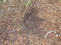
No, it's likely just telling you the boulder was an important marker they would be looking for on a map. Some will have multiple holes , often much larger. Each site is a little different, but there will probably be other boulders up away from the stream here for a layout or a trail intersection that they were telling you to leave the stream bottom..


.JPG")
B.jpg")