Spanish missions google earth?

architecad

Hero Member
Nov 25, 2008
742
4
Maryland
Detector(s) used
Garrett CX-II, GTI 2500, Sea hunter, Eagle Eye two box
Re: Spanish missions google earth?

I found a lots of them on Google map, specialty on the Caribbean.

Arch
 

auferret

Sr. Member
Sep 25, 2007
420
73
Tennessee
Detector(s) used
White's MXT
Sunray DX-1
Falcon MD20
Garrett Seahunter Mark II
Primary Interest:
All Treasure Hunting
Re: Spanish missions google earth?

Real de Tayopa said:
Hi: there are some that are not in the official records.

Don Jose de La Mancha
Those would be the "secret" missions....you know, spy stuff. Very hush hush.
 

gollum

Gold Member
Jan 2, 2006
6,729
7,594
Arizona Vagrant
Detector(s) used
Minelab SD2200D (Modded)/ Whites GMT 24k / Fisher FX-3 / Fisher Gold Bug II / Fisher Gemini / Schiebel MIMID / Falcon MD-20
Primary Interest:
All Treasure Hunting
Re: Spanish missions google earth?

RELICDUDE07 said:
Hey what happen to the post about all the spanish missions & they were on google earth?

Depends on which Spanish Missions you are referring to. Most of the missions built in the desert areas were made of adobe, and unless they have been pretty well maintained, there would be almost nothing left to see (especially on a satellite pic).

Best-Mike
 

OP
OP
RELICDUDE07

RELICDUDE07

Bronze Member
Oct 2, 2007
2,128
54
Pascagoula Ms.
Detector(s) used
minelab exp.
Re: Spanish missions google earth?

It was in the treasure by STATE?Alabama (civil war bullet find)? :dontknow:
 

Nov 8, 2004
14,582
11,942
Alamos,Sonora,Mexico
Primary Interest:
All Treasure Hunting
Re: Spanish missions google earth?

Hi gullum: you posted -->.Most of the missions built in the desert areas were made of adobe, and unless they have been pretty well maintained, there would be almost nothing left to see (especially on a satellite pic).
******************
True, but they would, in general, still be in an identifiable form by Aerial or Stat photographs. As you pointed out, they were constructed of adobe which probably has long since melted away. However, since most used a rock base for their walls, they may still be visible.

In any event, the ground where they were built, would clearly show the difference between the texture of the soil and adobe. Many that I have found this way, were very visible if you knew what to look for.

The outline of the walls was clearly outlined, but not visible from the ground level.

In the search for La Tarasca, we could never find the base stones of the mission to prove it, even though we knew where the walls were. Then one day an Indian took us to us to a near looong cattle watering trough. The owner had constructed it using the orig mission wall base rocks.

Old trails, arroyos, roads are easily seen due to different compaction of the earth. They stand out like the proverbial sore thumb.

Don Jose de La Mancha
 

architecad

Hero Member
Nov 25, 2008
742
4
Maryland
Detector(s) used
Garrett CX-II, GTI 2500, Sea hunter, Eagle Eye two box
Re: Spanish missions google earth?

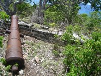
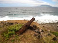
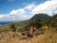
Here there is some old batteries to detect. All them are located in the Caribbean.
 

Attachments

  • Bouillé Battery.jpg
    Bouillé Battery.jpg
    766.2 KB · Views: 1,264
  • Corre Corre Battery.jpg
    Corre Corre Battery.jpg
    462.4 KB · Views: 1,133
  • Fort Panga.jpg
    Fort Panga.jpg
    456.5 KB · Views: 1,222

birdman

Gold Member
Jan 28, 2005
7,458
2,393
Choctaw Beach Florida
🥇 Banner finds
1
🏆 Honorable Mentions:
1
Detector(s) used
Equinox 800 and ORX, tesoro Cibola with garret,whites and minelab pinpointers
Primary Interest:
All Treasure Hunting
Re: Spanish missions google earth?

Man, those would be awesome places to hunt!! :icon_pirat:
 

Top Member Reactions

Users who are viewing this thread

Top