sgtfda
Bronze Member
The bars were cast from stuff in the mines tailing pile. The mine is shut down. Lot of lead in that bar. Nice gun. Dave was a friend.
Yes, those grips probably took him many hours out in the shop to make them.What a great memento of Dave, AZ and Silver King ore - thanks for posting the photo
Sorry to hear that. He was always nice when I stopped in. I got all my Wilburn pamphlets from him. RIPLouie is dead from cancer. I liked him!
Fran Zeller has owned it since at least 2011, He ended up with it from Rays estate. Frank might know more about that partnership and how it all worked out. Last time I was there this spring, Fran was behind the counter.Yes, those grips probably took him many hours out in the shop to make them.
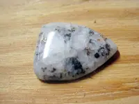
Dave had worked on Louie Ruiz for years and finally had gotten some Black Queen ore out of him. He was going to incorporate some Black Queen "shields" into the grips originally, but the second one he was making came apart on him while he was polishing it. So he wasn't able to use the Black Queen stuff but he sent the one "shield" to me along with the grips.
He told me Louie got moved off the Bluebird a while back, not sure who's there now.
The deal was that Fran would take care of Louie and allow him to live there in the old house. Something happened.Fran Zeller has owned it since at least 2011, He ended up with it from Rays estate. Frank might know more about that partnership and how it all worked out. Last time I was there this spring, Fran was behind the counter.
You continue to make this claim but have presented no evidence that the Silver Chief ever produced a single ounce of silver. You have often quoted the 1883 Congressional report from the director of the U.S. mint but you neglect to mention that at that point in time the Silver Chief had not produced any silver.
Here is the full text from the 1883 Congressional report:
Rogers district is 14 miles north of Pinal.
There is plenty of wood and water in this district, offering facilities for mining and milling that are unsurpassed. The country rock is granite and porphyry. There are three main ledges running parallel, southeast and northwest,dipping to north, on which the chief development work has been done. The Snap, Chloride King, and Monarch are on one. the Columbia, SilverChief, Manhattan, and World Beater on another. the Blanch. Dickens ,Goodenough, and Plato on the third. The Silver Chief was the first discovered in the district, in 1875. andis now the best developed mine in it. There is. 200. foot tunnel onthe ledge, which is carbonate ore showing native silver, from. to 12 feet in width. Free gold has also been found in the tunnel. Assays of the ore go from. 120 to. 2,500. At. depth of 20 feet there is an 80 foot shaft to the surface. About 300 feet west of this shaft is another 60-foot shaft, at the bottom of which the ledge is 12 feet wide, and theyare going to work in the tunnel to reach this shaft, which they will do at. depth of about 250 feet. Further surface work has been done on the mine, making altogether about 400 feet. The World Beater has. 60. foot shaft and. 75- foot tunnel on the ledge. At latest developments the ledge is. feet wide, of chloride ore, assay.ing from $90 to $4,000. Native silver is found throughout. There are now on the dump about 40 tons of. 120 ore. The Dickens has. shaft 90 feet deep. The ledge on the surface is. feet wide, of carbonate of lead. In the last few feet they have struckextra rich carbonate ore. There are about 50 tons on the dump that will average about. 160.The Chloride King has two incline shafts following the vein,one about 30 feet in depth and one about 20 feet. The ledge is over 3 feet in width between walls,carrying a pay streak of about 14 inches.The latest assay gave $785. The Manhattan has a tunnel started in about30 feet,and expects to strike the ledge at 120 feet by running 40 feet farther. The ledge is from 1 to 3 feet wide, of the same character of ore as those already described. The Robin has a shaft 30 feet down on a 3-foot vein of ore containing silver glance that will average. 400. Some 300 feet east of this shaft is a tunnel in about 20 feet on the ledge. The Plato, an extension of the Dickens, shows. stratum of rich sulphuret ore, which can be traced here and there for. distance of 200 feet. An assay made last week of surface rock from this claim went. 320 .The Mabel and Glance adjoin the Columbia and Silver Chief on the west side of the mountain. The former has. ledge 14 feet in width, and the latter one of two feet, carrying the fine chloride ore characteristic of this district.The Columbia, which is the first west extension of the Silver Chief, has. 40. foot tunnel on. vein about. foot wide. ore similar to that in the Silver Chief. The Snap,. west extension of the Chloride King, ha a. shaft 20 feet, showing up a ledge of good ore. The Monarch has a shaft down 40 feet in good ore.There are many other good properties lying within this district, but mostly in an undeveloped condition.
I've highlighted the first bit of fluff in the report. As you know the area you also know that timber and water are in very short supply.
If you actually read the full report you will see that the producing mines have their monthly smelter receipts published in the report. Here is the actual smelter reports for the nearby Silver King mine:
View attachment 2073245
You won't find those reports for the Silver Chief because by 1882 it had not produced any saleable silver - as was true of all the mines in the Rogers District.
Was silver ever mined in the Rogers canyon area? I don't know. I do know that I can find no (zero) reports of silver ever being produced in this district. Lead and copper yes but no silver or gold. Perhaps you have some more documentation that leads you to believe the Silver Chief did produce silver at some time?
You stated that on your 1980 visit to the Silver Chief "They winzed off in different directions but found nothing at the Silver Chief of any value, neither gold nor silver." I think that's the most accurate assessment I've read since it was made by miners at the mine with the intent of discovering valuable minerals to mine.
Yeah I've got that book, what a hoot! I'm pretty sure the guy just wrote what he read in the newspapers.Richard J. Hinton's The Handbook of Arizona (1878), reprinted by Ed Bartholomew as 1000 Old Arizona Mines (1970) states in the Pinal and Maricopa Counties table that the "Silver Chief" (Pine Grove or Randolph "District or Placer") produced "450 pound nugget - half silver." The other "Silver Chief" (Silver King "District or Placer") has no remarks.
Good luck to all,
The Old Bookaroo
At the Sherman, five miles distant, a half silver nugget weighing 450 lbs. was obtained.

Yeah I've got that book, what a hoot! I'm pretty sure the guy just wrote what he read in the newspapers.
His account is pretty messed up. He correctly puts the famous Pine Grove Mining District just north of the Tip Top District in the Bradshaws in the xlix appendix but continues to think there is also a Pine Grove district in Pinal. Pine Grove in Pinal County is the name the miners used for Top of the World/Pinal Ranch/Mason's Valley area 8 miles away - not a mining district.
On page 79 he attributes the same nugget to the Sherman Mine in the Silver King District.
I like that he thinks the Silver King district didn't deserve any remarks. It was the most productive silver mine in Arizona history!
Since you seem to prefer the popular travel journals of the time another interesting read I have is "The Resources of Arizona - A Manual of Reliable Information Concerning the Territory, compiled by Patrick Hamilton (1881)".
I'm pretty sure Patrick just got his info from the newspaper too but he was reading different newspapers than Hinton. He puts the Silver Chief in the Baboquivari/Arivaca District Southwest of Tuscon and another Silver Chief in the Peck District adjacent to the real Pine Grove District south of Prescott.
Myself, I'll stick with the many professional mine and geology reports available. Like the 1883 Congressional Report I linked to before. It's less interesting story wise than the popular press of the time but the results are more verifiable.
Thanks for sharing. I'd forgotten about that book.
The SEM/EDS tests conducted by Thomas Glover weren't about stretching geography or including Goldfield mines in the geology of the Superstitions. There's a simple reason why these ores were included in the tests.Considering that the Mammoth, Bulldog and Black Queen producing gold mines are within the Apache Junction city limits I think it's stretching geography more than a bit to include them in the Superstition mountain range.
In fact the Mammoth, Bulldog, Tomahawk, Goldfield, Yankee, Hillside, Old Wasp and Black Queen gold mines are in the Goldfield mountains which are several miles to the northwest from the Superstitions.
The mines in Miami and Globe have more to do with the geology and mineralization in the Superstitions than the Apache Junction/Goldfield mines.