Tommi
Sr. Member
- #1
Thread Owner
Hello Fellow TH's
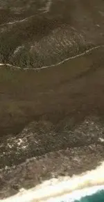
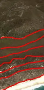
I am after some tips and techniques on spotting terrain differences, I have been studying aerial shots of an area, and I'm looking for a buried shipwreck. How I could I spot a buried shipwreck? EG: Lack of trees growing, increased erosion, discolouration of the sand, maybe even a kind of bog hole?
I believe I have found a possible site of interest. Its located near a inland Lake that has a surface area of 7.3 hectares and a maximum depth of 9.4 meters. The lake is a depression that extends below the island?s water table. The Lake is approx 1.2miles from the shore line. Therefore it is possible that 400yrs could equal 1.2miles of sand build up? And it is also possible that 400yrs ago this was a bay?


") Canada is a good guess, but I'm on the other side of the world
Canada is a good guess, but I'm on the other side of the world ")