MT_Joe
Hero Member
- Feb 22, 2013
- 747
- 309
- Detector(s) used
- Bounty Hunter Tracker IV
- Primary Interest:
- Other
Frontier Forts of Pennsylvania - Volumes 1 and 2 1896 1370+ Pages - Many Color Maps & Sketches
This CD is WORD SEARCHABLE
PUBLISHER: State Printers of Pennsylvania
SUBJECT: History, Genealogy, Military, Pennsylvania
PHYSICAL DESCRIPTION: 1370+ p. total: color maps and illustrations on CD
NOTES: Volumes 1 and 2.
PRICE: 8.95 + FREE Same Day S&H! - TOTAL=$8.95 CLICK HERE for more info! or PM me.
Part of our PA State/County History Series
This original 2 volume book set usually sells for more than $500. Now you can own this valuable info for a fraction of that price!
One of the best resources for researching the early frontier forts of Pennsylvania, Volume 1 of this set covers the Indian forts of the Blue Mountains, the frontier forts within the North and West branches of the Susquehanna River, the frontier forts in the Cumberland and Juniata Valleys, and the frontier forts within the Wyoming Valley region. Volume 2 of this set covers the Frontier Forts of Western Pennsylvania including the Counties of Fayette, Washington, Greene, Indiana, Beaver, Venango, Erie, Westmoreland, Allegheny, Armstrong, and Crawford. This volume also describes local houses and buildings that were used as protection from the Indians as far back as the early 1700s. There are many detailed color maps and color illustrations of how some of these forts looked when in use. The maps show incredible detail, right down to nearby houses and outbuildings. The maps would be a wonderful resource for treasure hunters or those with a metal detector as some of these forts were never found, and still remain hidden in the Pennsylvania woods, waiting to be rediscovered. A must have for the PA military historian.
This CD contains electronic reprints of the pages in the book “Frontier Forts of Pennsylvania Volume 1 1896” and “Frontier Forts of Pennsylvania Volume 2 1896”.
There are many surnames mentioned throughout the book. This book has no contents but there is an index and we have also created an extensive bookmark file for easy navigation of this CD. These eBooks on CD are also completely TEXT SEARCHABLE. Search any surname and within seconds the Adobe Reader will show the results of that surname found in these 1370+ pages. A wonderful tool!


Outline of forts covered:
Volume I.
I. THE INDIAN FORTS OF THE BLUE MOUNTAINS.
Prefatory Note. Forts Harris and Hunter.
Illustration of Log House of John Harris 1720.
Map of Site of Fort Hunter.
Forts Manada and Brown.
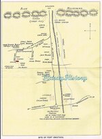
Map of Site of Forts Manada, Brown, and Swatara.
Map of Site of Robinson Fort.
Map of Harper's and Reed's Block Houses.
Fort Swatara.
Map of Site of Fort Swatara.
Map of Site of Line of Forts Along Blue Mountains.
Map of Site of Fort Swatara and Hess' Block House.
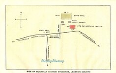
Map of Site of Moravian Church Stockade, Lebanon County.
Map of Site of Ulrich Fort or Block House.
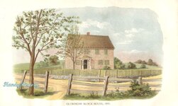
Illustration of Gloninger Block House, 1895.
Map of Site of Gloninger Fort or Block House.
Map of Site of Zeller Fort Block House.
Illustration of Zeller Block House, 1895.
Illustration of Brietenbach Block House, 1895.
Fort Henry.
Map of Site of Fort Henry, Berks County.
Fort Northkill.
Map of Present Site of Fort Northkill.
Fort At Dietrich Snyder's, Lebanon (and William), and Franklin.
Map of Present Site of Fort Lebanon.
Map of Present Site of Fort Franklin.
Forts Everett, at Lehigh Gap and South of Lehigh Gap.
Map of Present Site of Fort Everett.
Map of Site of Fort Lehigh.
Map of Site of Kern's Block House (Trucker's Fort).
Indian Outbreak of 1763, Forts Deshler and Ralston (Brown's of Northampton Co.)
Illustration of Front View of Deshler's Fort, 1895.
Map of Site of Deshler's Fort or Block House.
Illustration of Deshler Fort or Block House, Built 1760.
Illustration of Ralston and Brown's Stockade. "Irish Settlement.
" (1) Illustration of Ralston and Brown Stockade, in the "Irish Settlement.
" (2) Map of Site of Ralston's Fort or Block House.
Fort Allen.
Illustration of Plan of Fort Allen. 1756.
Map of Present Site of Fort Allen.
Forts Norris, Near Wind Gap and Peter Doll's Blockhouse.
Map of Present Site of Fort Norris.
Map of Fort or Block House Near Wind Gap.
Map of Site of Doll's Block House.
Nazareth Stockade, Stockaded Mill at Friedenstahl, Gnadenthal & Christian's Spring.
Illustration of Old Whitefield House at Nazareth.
Historical Map of the Barony of Nazareth.
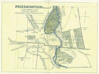
Map of Friedensthal, a Settlement of the Moravian Economy.
Illustration of Christians' Spring. Stockade.
"Rose Inn" and Fort Hamilton.
Illustration of The Rose Tavern. Stockade.
Map of Stroudsburg Showing Site of Fort Hamilton.
Illustration of View of Stroudsburg In 1842, Showing Site of Fort Hamilton.
Forts Hyndshaw, Dupui and Penn.
Map of Site of Fort Hyndshaw.
Illustration of Old Shawanee Church, Site of Fort Dupui
Map of Fort or Block House at Depui's.
Map of Site of Fort Penn at Stroudsburg.
II. THE FRONTIER FORTS NORTH AND WEST BRANCHES OF THE SUSQUEHANNA RIVER.
By John M. Buckalew.
Introduction to Part II and Forts Augusta at Sunbury and Jenkins.
Map of Plan of Fort Augusta.
Illustration of Headquarters of Commandant, Fort Augusta, 1757.
Illustration of a Fort Augusta Cannon.
Illustration of Remains of the Old Magazine of Fort Augusta.
Illustration of Site of Fort Jenkins, Southwest View, Showing North Branch.
Illustration of Site of Fort Jenkins, Southeast View, Showing Old Well.
Forts Wheeler, McClure, Bosley, Rice, Freeland, Boone's Mills, Swartz and Brady.
Illustration of Site of Fort McClure, Town of Bloomsburg.
Illustration of Fort Rice, at Montgomery's, Northumberland County.
Map of Scene of the Sugarloaf Massacre, 1780.
Illustration of Site of Fort Freeland, Showing Spring and Old Kitchen.
Forts Muncy, Menninger, Antes, Horn and Reid at Lock Haven.
III. THE FRONTIER FORTS WITHIN THE WYOMING VALLEY REGION.
By Sheldon Reynolds, M. A.,
President of the Wyoming Historical and Geographical Society.
Introduction to Part III, Memoriam, Forts Durkee, Forty, Wintermoot's & Jenkins.
Map of Position of the Wyoming Forts.
Illustration of Forty Fort, Wyoming, in 1778.
Forts Pittston, Stewart's Blockhouse, Wallenpaupack, Sullivan & Wyoming.
Illustration of Pittston Fort on Susquehanna at Pittston.
Illustration of Stewart's Block House.
IV. THE FRONTIER FORTS IN THE CUMBERLAND AND JUNIATA VALLEYS.
By Jay Gulfillan Weiser.
Introduction, Forts of Bedford and Blair Counties.
Map of Disposition of the Pennsylvania Troops in the
Western District for the Winter Season, 1764.
Illustration of Original Plan of Fort Bedford.
BEDFORD COUNTY FORTS: BEDFORD - RAYSTOWN, MARTIN, PIPER, WINGAWN.
BLAIR COUNTY FORTS: FETTER, HOLLIDAY, LOWREY, ROBERDEAU, ROLLER.
Forts of Centre and Cumberland Counties.
CENTRE COUNTY. POTTER'S.
Map of Site of Fort Potter.
CUMBERLAND COUNTY: Lowther, Morris, Franklin, Letort, Croghan, Dickey, Ferguson, McAlister, McComb's.
Map of Site of Fort Lowther.
Plan of Fort Lowther, Carlisle.
Map of Shippensburg, Pa.
Forts of Dauphin and Franklin Counties.
DAUPHIN COUNTY: Halifax
Map of Site of Fort Halifax.
Illustration of Plan of Fort Halifax.
FRANKLIN COUNTY: Chambers, Davis, Loudoun, McCord, McDowell, Steel, McConnell's, Lyttleton.
Map of Site of Forts in Lower Cumberland Valley.
Forts of Huntingdon County: Anderson, Hartsog, Lytle, McCormick's, Crum's, McAlcvy's, Shirley, Standing Stone, Bingham.
Forts of Juniata, Mifflin, Perry and Snyder Counties.
JUNIATA COUNTY: Patteron 1 and 2.
MIFFLIN COUNTY: Granville
Map of Site of Fort Granville, Mifflin Co., Near Lewistown.
PERRY COUNTY: Robinson
SNYDER COUNTY: Hendricks, A Blockhouse; McKee's.
Illustration of Remains of Hendricks' Block House, Snyder County.
Volume II.
Index Vol. 2
Fort Le Boeuf, 1796.
Illustration of Title Page.
Every Name Index, Vol II.
Father Bonnecamp's Map (1749) and Explanation.
Introduction and Notes, Jumonville's Camp and Fort Necessity and Notes.
Illustration of Fort Necessity
Fort Duquesne.
Historical Map of Southwestern Pennsylvania
Illustration of Fort Duquesne.
Map showing Braddock's Route, 1755.
Illustration 1 of Troup Formations, Braddock's Battle.
Illustration 2 of Troup Formations, Braddock's Battle.
Fort Pitt.
Illustration of the First Fort Pitt, 1758.
Illustration of Fort Pitt and Environs, 1759.
Illustration of Redoubt at Pittsburg.
Plan of Fort Pitt, 1761.
Illustration of Old Redoubt at Fort Pitt.
Illustration of Fort Pitt in 1795.
Fort Fayette and Notes. (Including Notes to FortDuquesne and Fort Pitt.)
Fort Ligonier. Part I and Part II. (Including Notes to Fort Ligonier. Remarks.)
Facsimile of Washington's Account of Engagement Near Ft. Ligonier.
Plan of Fort Ligonier with Part of the Retranchment.
Hannastown and Notes, Miller's Station, Fort Hand and Notes.
Map of Hannastown with Line of the Forbes Road and Route of the Indians
at the Time of its Destruction July 13th, 1782.
Carnahan's Blockhouse, Forts Crawford and Notes, Wallace and Barr's.
Forts: Palmer's, Shields', Walthour's, Pomeroy (Pomroy's), Wilson and Rugh's Blockhouses, Allen
(Hempfield Twp.), Kepple's, & Stokely's & McDowell's & Marchand's Blockhouses, Shippen at Capt. John Proctor's, Lockry's Blockhouse, Philip Klingensmith's House, Gaspard Markle's House and Station.
Map of Fairfield Twp & Part of Ligonier Valley, Westmoreland, Co.
Plan of Fort Palmer.
Forts: Burd - Redstone Old Fort & Notes, Settlers' Forts of Fayette Co. & Notes: Minter's, Gaddis', Pearse's, Craft's, Cassell's, Ashcraft's, Mason's, Conwell's, Spark's, Beeson's, Graybill's & Valentine Crawford's Blockhouse.
Illustration of Fort Burd or Redstone, Brownsville, PA.
Catawba Trail. Forts of Washington County: Rice's, Lindley's, Wolf's, Miller's (Blockhouse), Beelor's, Dillow's, Vance's, Hoagland's, Allen's, Dinsmore's, Roney's, Reynold's (Blockhouse), Wells', Doddridge's, Teeters', Beeman's (Blockhouse), Marshall's (Blockhouse), Burgett's, Campbell's (Blockhouse), Froman's, Williamson's Station, Bayon's (Blockhouse), Taylor's, Norris', Cherry's, Lamb's Becket's, Milliken & McFarland, Woodruff's (Blockhouse), Cox's, McDonald's Station.
Forts of Greene and Indiana Counties.
GREENE COUNTY: Jackson's, Garard's, Swan & Van Meter, Ryerson's, Statler's, Martin's, Harrison's.
INDIANA COUNTY: Moorhead's & Inyard's (Blockhouse), Robinson's Strong-House, Station at Black-Legs Creek, Armstrong - (Kittanning), Notes, Description of Indian Town at Kittanning.
BEAVER COUNTY (1): Fort McIntosh and Notes
Illustration of Fort McIntosh - Site of Town of Beaver.
Illustration of Site of Fort McIntosh Beaver.
Beaver County Forts (2): Battle of Bushy Run & Notes
Sketch of Col. Bouquet's Engagement with 400 Indians, 1763.
Beaver County Forts (3): Presqu' Isle & Notes
Map of the Borough of Erie, 1837.
Illustration of Plan of City of Erie.
Plan of Presque Isle and Harbor of Erie, 1793.
Erie County: Fort Le Boeuf and Notes.
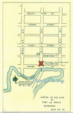
Sketch of the Site of Fort Le Boeuf, Waterford, Erie Co., PA.
Illustration of Fort Le Boeuf, 1796.
Venango County: Forts Machault & Notes, Venango & Notes, Franklin, the Old Garrison & Notes.
Illustration of French Fort Machault.
Illustration of English Fort Venango, 1760-1763.
Blockhouses and Stations and Places of Defense Erected or Used After 1783 on the Western Frontier of Pennsylvania: Reed's Station - (Westmoreland Co.), Blockhouse at Freeport or Buffalo Creek - (Armstrong Co.), Fort Green - (Armstrong Co.), Clark's Blockhouse - (Armstrong Co.), Claypoole's Blockhouse - (Armstrong Co.), Blockhouse at Bull Creek - (Allegheny Co.)
INDIANA COUNTY: McConaughy's, Allison's, Peelor's, Elder's, Thompson's, McCartney's Blockhouses.
CRAWFORD COUNTY: Mead's Blockhouse - (Meadville)
This CD is WORD SEARCHABLE
PUBLISHER: State Printers of Pennsylvania
SUBJECT: History, Genealogy, Military, Pennsylvania
PHYSICAL DESCRIPTION: 1370+ p. total: color maps and illustrations on CD
NOTES: Volumes 1 and 2.
PRICE: 8.95 + FREE Same Day S&H! - TOTAL=$8.95 CLICK HERE for more info! or PM me.
Part of our PA State/County History Series
This original 2 volume book set usually sells for more than $500. Now you can own this valuable info for a fraction of that price!
One of the best resources for researching the early frontier forts of Pennsylvania, Volume 1 of this set covers the Indian forts of the Blue Mountains, the frontier forts within the North and West branches of the Susquehanna River, the frontier forts in the Cumberland and Juniata Valleys, and the frontier forts within the Wyoming Valley region. Volume 2 of this set covers the Frontier Forts of Western Pennsylvania including the Counties of Fayette, Washington, Greene, Indiana, Beaver, Venango, Erie, Westmoreland, Allegheny, Armstrong, and Crawford. This volume also describes local houses and buildings that were used as protection from the Indians as far back as the early 1700s. There are many detailed color maps and color illustrations of how some of these forts looked when in use. The maps show incredible detail, right down to nearby houses and outbuildings. The maps would be a wonderful resource for treasure hunters or those with a metal detector as some of these forts were never found, and still remain hidden in the Pennsylvania woods, waiting to be rediscovered. A must have for the PA military historian.
This CD contains electronic reprints of the pages in the book “Frontier Forts of Pennsylvania Volume 1 1896” and “Frontier Forts of Pennsylvania Volume 2 1896”.
There are many surnames mentioned throughout the book. This book has no contents but there is an index and we have also created an extensive bookmark file for easy navigation of this CD. These eBooks on CD are also completely TEXT SEARCHABLE. Search any surname and within seconds the Adobe Reader will show the results of that surname found in these 1370+ pages. A wonderful tool!


Outline of forts covered:
Volume I.
I. THE INDIAN FORTS OF THE BLUE MOUNTAINS.
Prefatory Note. Forts Harris and Hunter.
Illustration of Log House of John Harris 1720.
Map of Site of Fort Hunter.
Forts Manada and Brown.
Map of Site of Forts Manada, Brown, and Swatara.
Map of Site of Robinson Fort.
Map of Harper's and Reed's Block Houses.
Fort Swatara.
Map of Site of Fort Swatara.
Map of Site of Line of Forts Along Blue Mountains.
Map of Site of Fort Swatara and Hess' Block House.
Map of Site of Moravian Church Stockade, Lebanon County.
Map of Site of Ulrich Fort or Block House.
Illustration of Gloninger Block House, 1895.
Map of Site of Gloninger Fort or Block House.
Map of Site of Zeller Fort Block House.
Illustration of Zeller Block House, 1895.
Illustration of Brietenbach Block House, 1895.
Fort Henry.
Map of Site of Fort Henry, Berks County.
Fort Northkill.
Map of Present Site of Fort Northkill.
Fort At Dietrich Snyder's, Lebanon (and William), and Franklin.
Map of Present Site of Fort Lebanon.
Map of Present Site of Fort Franklin.
Forts Everett, at Lehigh Gap and South of Lehigh Gap.
Map of Present Site of Fort Everett.
Map of Site of Fort Lehigh.
Map of Site of Kern's Block House (Trucker's Fort).
Indian Outbreak of 1763, Forts Deshler and Ralston (Brown's of Northampton Co.)
Illustration of Front View of Deshler's Fort, 1895.
Map of Site of Deshler's Fort or Block House.
Illustration of Deshler Fort or Block House, Built 1760.
Illustration of Ralston and Brown's Stockade. "Irish Settlement.
" (1) Illustration of Ralston and Brown Stockade, in the "Irish Settlement.
" (2) Map of Site of Ralston's Fort or Block House.
Fort Allen.
Illustration of Plan of Fort Allen. 1756.
Map of Present Site of Fort Allen.
Forts Norris, Near Wind Gap and Peter Doll's Blockhouse.
Map of Present Site of Fort Norris.
Map of Fort or Block House Near Wind Gap.
Map of Site of Doll's Block House.
Nazareth Stockade, Stockaded Mill at Friedenstahl, Gnadenthal & Christian's Spring.
Illustration of Old Whitefield House at Nazareth.
Historical Map of the Barony of Nazareth.
Map of Friedensthal, a Settlement of the Moravian Economy.
Illustration of Christians' Spring. Stockade.
"Rose Inn" and Fort Hamilton.
Illustration of The Rose Tavern. Stockade.
Map of Stroudsburg Showing Site of Fort Hamilton.
Illustration of View of Stroudsburg In 1842, Showing Site of Fort Hamilton.
Forts Hyndshaw, Dupui and Penn.
Map of Site of Fort Hyndshaw.
Illustration of Old Shawanee Church, Site of Fort Dupui
Map of Fort or Block House at Depui's.
Map of Site of Fort Penn at Stroudsburg.
II. THE FRONTIER FORTS NORTH AND WEST BRANCHES OF THE SUSQUEHANNA RIVER.
By John M. Buckalew.
Introduction to Part II and Forts Augusta at Sunbury and Jenkins.
Map of Plan of Fort Augusta.
Illustration of Headquarters of Commandant, Fort Augusta, 1757.
Illustration of a Fort Augusta Cannon.
Illustration of Remains of the Old Magazine of Fort Augusta.
Illustration of Site of Fort Jenkins, Southwest View, Showing North Branch.
Illustration of Site of Fort Jenkins, Southeast View, Showing Old Well.
Forts Wheeler, McClure, Bosley, Rice, Freeland, Boone's Mills, Swartz and Brady.
Illustration of Site of Fort McClure, Town of Bloomsburg.
Illustration of Fort Rice, at Montgomery's, Northumberland County.
Map of Scene of the Sugarloaf Massacre, 1780.
Illustration of Site of Fort Freeland, Showing Spring and Old Kitchen.
Forts Muncy, Menninger, Antes, Horn and Reid at Lock Haven.
III. THE FRONTIER FORTS WITHIN THE WYOMING VALLEY REGION.
By Sheldon Reynolds, M. A.,
President of the Wyoming Historical and Geographical Society.
Introduction to Part III, Memoriam, Forts Durkee, Forty, Wintermoot's & Jenkins.
Map of Position of the Wyoming Forts.
Illustration of Forty Fort, Wyoming, in 1778.
Forts Pittston, Stewart's Blockhouse, Wallenpaupack, Sullivan & Wyoming.
Illustration of Pittston Fort on Susquehanna at Pittston.
Illustration of Stewart's Block House.
IV. THE FRONTIER FORTS IN THE CUMBERLAND AND JUNIATA VALLEYS.
By Jay Gulfillan Weiser.
Introduction, Forts of Bedford and Blair Counties.
Map of Disposition of the Pennsylvania Troops in the
Western District for the Winter Season, 1764.
Illustration of Original Plan of Fort Bedford.
BEDFORD COUNTY FORTS: BEDFORD - RAYSTOWN, MARTIN, PIPER, WINGAWN.
BLAIR COUNTY FORTS: FETTER, HOLLIDAY, LOWREY, ROBERDEAU, ROLLER.
Forts of Centre and Cumberland Counties.
CENTRE COUNTY. POTTER'S.
Map of Site of Fort Potter.
CUMBERLAND COUNTY: Lowther, Morris, Franklin, Letort, Croghan, Dickey, Ferguson, McAlister, McComb's.
Map of Site of Fort Lowther.
Plan of Fort Lowther, Carlisle.
Map of Shippensburg, Pa.
Forts of Dauphin and Franklin Counties.
DAUPHIN COUNTY: Halifax
Map of Site of Fort Halifax.
Illustration of Plan of Fort Halifax.
FRANKLIN COUNTY: Chambers, Davis, Loudoun, McCord, McDowell, Steel, McConnell's, Lyttleton.
Map of Site of Forts in Lower Cumberland Valley.
Forts of Huntingdon County: Anderson, Hartsog, Lytle, McCormick's, Crum's, McAlcvy's, Shirley, Standing Stone, Bingham.
Forts of Juniata, Mifflin, Perry and Snyder Counties.
JUNIATA COUNTY: Patteron 1 and 2.
MIFFLIN COUNTY: Granville
Map of Site of Fort Granville, Mifflin Co., Near Lewistown.
PERRY COUNTY: Robinson
SNYDER COUNTY: Hendricks, A Blockhouse; McKee's.
Illustration of Remains of Hendricks' Block House, Snyder County.
Volume II.
Index Vol. 2
Fort Le Boeuf, 1796.
Illustration of Title Page.
Every Name Index, Vol II.
Father Bonnecamp's Map (1749) and Explanation.
Introduction and Notes, Jumonville's Camp and Fort Necessity and Notes.
Illustration of Fort Necessity
Fort Duquesne.
Historical Map of Southwestern Pennsylvania
Illustration of Fort Duquesne.
Map showing Braddock's Route, 1755.
Illustration 1 of Troup Formations, Braddock's Battle.
Illustration 2 of Troup Formations, Braddock's Battle.
Fort Pitt.
Illustration of the First Fort Pitt, 1758.
Illustration of Fort Pitt and Environs, 1759.
Illustration of Redoubt at Pittsburg.
Plan of Fort Pitt, 1761.
Illustration of Old Redoubt at Fort Pitt.
Illustration of Fort Pitt in 1795.
Fort Fayette and Notes. (Including Notes to FortDuquesne and Fort Pitt.)
Fort Ligonier. Part I and Part II. (Including Notes to Fort Ligonier. Remarks.)
Facsimile of Washington's Account of Engagement Near Ft. Ligonier.
Plan of Fort Ligonier with Part of the Retranchment.
Hannastown and Notes, Miller's Station, Fort Hand and Notes.
Map of Hannastown with Line of the Forbes Road and Route of the Indians
at the Time of its Destruction July 13th, 1782.
Carnahan's Blockhouse, Forts Crawford and Notes, Wallace and Barr's.
Forts: Palmer's, Shields', Walthour's, Pomeroy (Pomroy's), Wilson and Rugh's Blockhouses, Allen
(Hempfield Twp.), Kepple's, & Stokely's & McDowell's & Marchand's Blockhouses, Shippen at Capt. John Proctor's, Lockry's Blockhouse, Philip Klingensmith's House, Gaspard Markle's House and Station.
Map of Fairfield Twp & Part of Ligonier Valley, Westmoreland, Co.
Plan of Fort Palmer.
Forts: Burd - Redstone Old Fort & Notes, Settlers' Forts of Fayette Co. & Notes: Minter's, Gaddis', Pearse's, Craft's, Cassell's, Ashcraft's, Mason's, Conwell's, Spark's, Beeson's, Graybill's & Valentine Crawford's Blockhouse.
Illustration of Fort Burd or Redstone, Brownsville, PA.
Catawba Trail. Forts of Washington County: Rice's, Lindley's, Wolf's, Miller's (Blockhouse), Beelor's, Dillow's, Vance's, Hoagland's, Allen's, Dinsmore's, Roney's, Reynold's (Blockhouse), Wells', Doddridge's, Teeters', Beeman's (Blockhouse), Marshall's (Blockhouse), Burgett's, Campbell's (Blockhouse), Froman's, Williamson's Station, Bayon's (Blockhouse), Taylor's, Norris', Cherry's, Lamb's Becket's, Milliken & McFarland, Woodruff's (Blockhouse), Cox's, McDonald's Station.
Forts of Greene and Indiana Counties.
GREENE COUNTY: Jackson's, Garard's, Swan & Van Meter, Ryerson's, Statler's, Martin's, Harrison's.
INDIANA COUNTY: Moorhead's & Inyard's (Blockhouse), Robinson's Strong-House, Station at Black-Legs Creek, Armstrong - (Kittanning), Notes, Description of Indian Town at Kittanning.
BEAVER COUNTY (1): Fort McIntosh and Notes
Illustration of Fort McIntosh - Site of Town of Beaver.
Illustration of Site of Fort McIntosh Beaver.
Beaver County Forts (2): Battle of Bushy Run & Notes
Sketch of Col. Bouquet's Engagement with 400 Indians, 1763.
Beaver County Forts (3): Presqu' Isle & Notes
Map of the Borough of Erie, 1837.
Illustration of Plan of City of Erie.
Plan of Presque Isle and Harbor of Erie, 1793.
Erie County: Fort Le Boeuf and Notes.
Sketch of the Site of Fort Le Boeuf, Waterford, Erie Co., PA.
Illustration of Fort Le Boeuf, 1796.
Venango County: Forts Machault & Notes, Venango & Notes, Franklin, the Old Garrison & Notes.
Illustration of French Fort Machault.
Illustration of English Fort Venango, 1760-1763.
Blockhouses and Stations and Places of Defense Erected or Used After 1783 on the Western Frontier of Pennsylvania: Reed's Station - (Westmoreland Co.), Blockhouse at Freeport or Buffalo Creek - (Armstrong Co.), Fort Green - (Armstrong Co.), Clark's Blockhouse - (Armstrong Co.), Claypoole's Blockhouse - (Armstrong Co.), Blockhouse at Bull Creek - (Allegheny Co.)
INDIANA COUNTY: McConaughy's, Allison's, Peelor's, Elder's, Thompson's, McCartney's Blockhouses.
CRAWFORD COUNTY: Mead's Blockhouse - (Meadville)
Amazon Forum Fav 👍
Last edited:


