Kevlardini
Sr. Member
- Joined
- May 18, 2015
- Messages
- 335
- Reaction score
- 370
- Golden Thread
- 0
- Location
- Massachusetts
- Detector(s) used
- Fisher F-4
Vulcan 360 Pinpointer
Garret Treasure Ace 300
I started of using a bounty hunter junior! :)
- Primary Interest:
- All Treasure Hunting
OK. Who's ready for some history? Gather round my friends for a short story.
It was back in 1852 when our local lake (now used for boating and other recreational sports) was created. It was specifically made to send water down a brook called "The Catacunemaug" (cat-a-cune-i-maug). Along this river where a few mills that would now receive water from the lake for power. Along this river where a few saw mills, some shoddy mills, some blacksmith shops, train bridges, and even a small village. However, one day in 1856, something bad happened. The dam that controlled the water output from the lake broke! The river flooded and became a raging torrent destroying anything in its path. OK. maybe that's a TOO bit dramatic... but the flooded river did end up destroying "four bridges, five milldams, two blacksmith shops, the sawmill and a railroad bridge."
(come on though. Only four years and the dam breaks! I bet no one ever hired that company to make their dams again!)
Here's the source in case you want to read up on it more:
Read more: Fields and farms still contain the remnants of town history - Nashoba Publishing Online
So anyways, the mills and other things were a total loss, and basically were abandoned and left to rot.
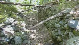
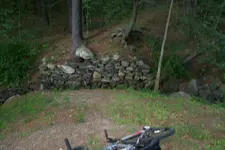
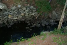
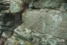
That's when I came along and discovered this little path going of the side of the road. I'd been down there a few times, and never thought much of it. There was an old bridge, and that's it. Or so I thought. But today, I took my new waders (found at a yard sale for FREE! Score!) and went across the stream to the other side of the bridge. After all it had fallen down, so obviously you couldn't go over it. On the other side was a narrow path that went through the woods, and leaded towards this drop off. At first I thought, "another bridge?" as I got closer I saw rocks "Oh yes, probably another bridge" And closer YES! it's another old bridge!. Looking down it though, it really wasn't a bridge. It was actually this man made canal with the sides lined by huge stone walls. Cool I thought, but what is it? It turns out it is a canal that connected to the main river and created small ponds for each individual mill. (Can't wait to go back and hunt the place!)
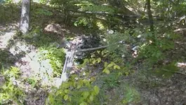
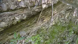
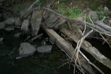
Then I waded around in the river, and while nothing promising on the surface, I bet there are some old bottles underneath. Getting ready to go back, I cam across this huge timber off to the side off the river. The thing is, it had iron parts on it. It turns out, it was part of a humongous water wheel, from one of the original mills that got destroyed by the flood.
I'll try to go back later and get more pictures, but as some of you know I've been having real rough times with my cameras. I can explain in detail if you want. But man, what a history rich place! Can't wait to go back.
The bridge:
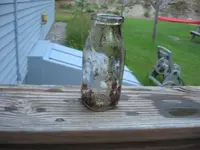
A milk bottle from the river:
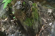
A rock:
It was back in 1852 when our local lake (now used for boating and other recreational sports) was created. It was specifically made to send water down a brook called "The Catacunemaug" (cat-a-cune-i-maug). Along this river where a few mills that would now receive water from the lake for power. Along this river where a few saw mills, some shoddy mills, some blacksmith shops, train bridges, and even a small village. However, one day in 1856, something bad happened. The dam that controlled the water output from the lake broke! The river flooded and became a raging torrent destroying anything in its path. OK. maybe that's a TOO bit dramatic... but the flooded river did end up destroying "four bridges, five milldams, two blacksmith shops, the sawmill and a railroad bridge."
(come on though. Only four years and the dam breaks! I bet no one ever hired that company to make their dams again!)
Here's the source in case you want to read up on it more:
Read more: Fields and farms still contain the remnants of town history - Nashoba Publishing Online
So anyways, the mills and other things were a total loss, and basically were abandoned and left to rot.
That's when I came along and discovered this little path going of the side of the road. I'd been down there a few times, and never thought much of it. There was an old bridge, and that's it. Or so I thought. But today, I took my new waders (found at a yard sale for FREE! Score!) and went across the stream to the other side of the bridge. After all it had fallen down, so obviously you couldn't go over it. On the other side was a narrow path that went through the woods, and leaded towards this drop off. At first I thought, "another bridge?" as I got closer I saw rocks "Oh yes, probably another bridge" And closer YES! it's another old bridge!. Looking down it though, it really wasn't a bridge. It was actually this man made canal with the sides lined by huge stone walls.
Then I waded around in the river, and while nothing promising on the surface, I bet there are some old bottles underneath. Getting ready to go back, I cam across this huge timber off to the side off the river. The thing is, it had iron parts on it. It turns out, it was part of a humongous water wheel, from one of the original mills that got destroyed by the flood.
I'll try to go back later and get more pictures, but as some of you know I've been having real rough times with my cameras. I can explain in detail if you want. But man, what a history rich place! Can't wait to go back.
The bridge:


A milk bottle from the river:

A rock:


Upvote
11


 Patience, and planning! I know on the first few trips I'd want to sample all over the place. Then you get to know the place and see the potential at each spot. Then you'll know how to approach it!
 One of the ponds the canal goes to is off limits, however there is a smaller pond that I can go to which I'll have to check out. As for treasures, none! Just an old nail and some rusty cans and buckets.