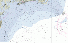
You will find a mixture. I have some charts that will read anything below 3 fathoms in feet and anything 3 and above in fathoms. Some of the charts are two sided with the shallow areas near shore in feet and on the other side it will show a wider area with measurements in fathoms The east coast of SC is very shallow within 10 miles of shore and is better measured in feet.
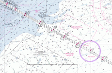
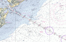
Goldfever: As for the program I am using, I have a copy of OziExplorer that works great. You can now download Raster (BSB) charts from NOAA for free that are compatible with OziExplorer. It does a lot! Good for plotting, download and uploading waypoints, and can be used in real time with your GPS.
Robert in SC
 Does anyone know of a map database that shows the depths as you travel out from the east coast? Or, how deep it might be 10 miles out from Charleston, SC ? Thanks,

")