skyhawk1251
Sr. Member
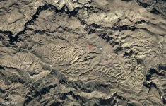
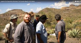
In the TV series "Legend of the Superstition Mountains", Season 1 Episode 3, titled "Decoding the Dutchman's Clues" or "The Dutchman's Code", the Dutch hunting team is guided to a location near Fish Creek Canyon by Bob Schoose, who has shown Wayne Tuttle a map pinpointing that place. The location is on, or very near, a line drawn from Four Peaks to Weavers Needle. Does anyone know exactly where the team was standing to see the "signs" that Bob Schoose pointed out to them?