cw0909
Silver Member
- Dec 24, 2006
- 4,364
- 3,222
- Primary Interest:
- Other
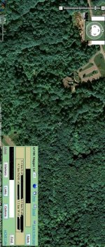
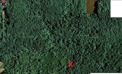
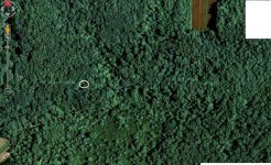
thank you,im new to map dowsing,i hope i did the map right
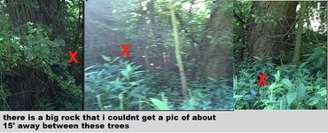
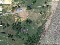
teleprospector said:It looks ok. Did you need the area searched under the acme mapping box? Maybe you can remove that and repost if you do. Google maps/earth does not show this box as far as I know.
Jon
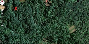
cw0909, a zoomed out map would be fine to start with, then to follow up the close ups when ready.cw0909 said:thanks Red_desert,should i start a new thread for friends map,or just put it here
it may be awhile she seems to be having probs, with the map captures,i think the
area was to big for one capture,i guess it has to do with where the items were lost
and it was a lg farm at the time,and one item was lost at one end,she thinks,and
the other item was near the side of the farm at other end,i told her to just cap the
whole area,and make sure there are overlaps,she says then it would,be like 5 caps
i dont think that matters,as long as they are lg enough to see. was my advice on the
caps correct,or should i give her dif instructions
thanks again,cant wait to start looking at my area
Red_desert said:cw0909, a zoomed out map would be fine to start with, then to follow up the close ups when ready.cw0909 said:thanks Red_desert,should i start a new thread for friends map,or just put it here
it may be awhile she seems to be having probs, with the map captures,i think the
area was to big for one capture,i guess it has to do with where the items were lost
and it was a lg farm at the time,and one item was lost at one end,she thinks,and
the other item was near the side of the farm at other end,i told her to just cap the
whole area,and make sure there are overlaps,she says then it would,be like 5 caps
i dont think that matters,as long as they are lg enough to see. was my advice on the
caps correct,or should i give her dif instructions
thanks again,cant wait to start looking at my area