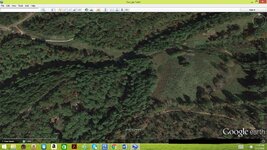
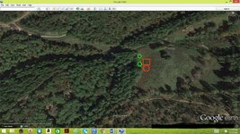
There was an old home site here and supposedly a catch of some sort was buried here. Could you guys give me a hand? Thanks
Map Request Please
- Thread starter msimmons
- Start date


Top Member Reactions
-
 2272
2272 -
 1114
1114 -
 1027
1027 -
 912
912 -
 863
863 -
 767
767 -
 753
753 -
 735
735 -
 608
608 -
 499
499 -
 490
490 -
 481
481 -
 424
424 -
 421
421 -
O
420
-
 407
407 -
 401
401 -
 393
393 -
 378
378 -
 371
371

