finding old homesites

HollandsBrook

Full Member
Jun 27, 2008
103
6
Scotch Plains, NJ
Detector(s) used
CTX 3030
Primary Interest:
All Treasure Hunting
hello. other than looking at old maps, are there any other resources for discovering old home sites that cease to exist? also if you are in a wooded area, what kind of things should you look for to lead you to an old cabin or home site? perhaps types of plants/trees/stones/ground/water? any known signs to look for? thanks!
 

Seamuss

Bronze Member
Jan 27, 2009
1,160
10
Found under a rock, in Washington State.
Detector(s) used
Garrett Scorpion, Garrett pro pointer
Research old news papers at the library and archives for real estate, land records, birth and obituaries for address's that no longer exist. Find out if these properties are owned by local people. if the land is still in the family of the original owner then get permission and have at it.

Happy hunting. Jim
 

dcinffxva

Full Member
Apr 9, 2008
245
3
I was out the other day, and in the middle of nowhere was a row of daffodils. The foundation of an old house was there, and recovered quite a few things from it, nothing of huge value, but some neat items nonetheless. Finding cut nails in quantity is a pretty good indicator, same with bricks.

Plants that are out of place are a pretty good clue. Some things like roses, daffodils etc. will keep growing even when they aren't tended to.

Everyone needed water, and although well technology has been around for a while, I'll always work creekbeds. The areas I go are normally Civil War/Revolutionary War. I'll go through the woods and try and imagine how several thousand troops would have made the journey. Look for big, flat areas that would have invited people to sit and rest, go to the creeks where several hundred may have refilled canteens etc.

If you are hunting large wooded areas, put yourself in the 1800's or 1700's. Where would you build a house that would offer a nice level area, with water access, that also has a fairly easy way in and out ?
 

extractor

Silver Member
Sep 27, 2007
2,941
53
Sal Sagev Adaven
Detector(s) used
E-TRAC,,,, SOVEREIGN GT,,,, GP 3500,,,,
GB PRO.
Primary Interest:
Metal Detecting
To Locate old home sites try Stanborn Maps
 

Feb 23, 2009
364
8
Moscow-ish, Pa
Detector(s) used
Minelab X-Terra 705 w/7.5&3kHz coils
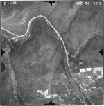
I've been using a set of Ariel photo's that have been scanned to huge HI-RES images.

The scans date to May-July of 1939.

I'm deeply immersed in crawling all over these scans because there is so much that was there THEN but isn't there NOW.

I live in a very rural wooded (sorta mountainous) area and I am SHOCKED by a lot of what I see in the pics. It is ironic about how we are rightfully concerned about deforestation, yet MUCH of my area was open farmland back in the early 1900's! We have many more tree's now that we did then!

Farming was big, I suppose. And there are many open areas (in the 1939 pic) where you can see the soft tufts of row after row of newly planted trees......which is now thickly wooded!


Anyways - what I do is look carefully at the pics. I slowly scroll/follow the roads. I see where there are homes/barns/structures where I know there NOW isn't.

I look for telltale signs of activity in the fields (obvious ball parks).

My area hasn't been 'urbanized' yet.......so all the original but abandoned 'township schools' are still standing. They are worn out relics in of themselves and much is grown in/over. I use the old pics to see where the kids used to play. Did they appear to have 'gathering' areas (summer picnics?).

I know where there are current-day foundation remnants. I have now gone back to see not only what the home looked like, but where the shed (no gone) used to be. Where the missus likely hung the clothes to dry. Etc....

GREAT STUFF!


-
 

Feb 23, 2009
364
8
Moscow-ish, Pa
Detector(s) used
Minelab X-Terra 705 w/7.5&3kHz coils
-


OK - I'm gonna do y'all a favor here......and this contradicts the 'attitude' in my "Does this offend you?" thread.

I'm going to share a spot with you. I JUST found it myself using the method I described above. (see....I'm not THAT bad! <wink!>)

--------------------------

Open the attached pic (what a pain in the bum THAT was to get resized! Photosharing sites are blocked work!).

Then click this link:
http://maps.google.com/maps?hl=en&q...302,-75.555205&spn=0.001803,0.005472&t=h&z=18

DON'T scroll that Google map just yet!!! But you CAN click the << symbol to give you a full page view (all that white on the left of the screen is wasted screen space!)

Now.....Ya see where the car is driving southbound on the road (he's driving from top to bottom)? (Oops...I just noticed that there are actually TWO southbound cars. Focus on the larger light colored sedan at the top of the map view.)
Now....imagine moving that vehicle about 4 car lengths forward (down) and imagine getting out of that car and walking about 10-15 feet off the road (passenger side).
Keep that in mind.


Now go back to the attached pic. Zoom out (NOT IN) so that you see the WHOLE pic. See the 'white' road that snakes from south to north? THAT is modern day Rt435 (as seen in the Google Maps view). Kinda neat how the 1939 road appears to be unpaved, eh? Dirt roads baby!
OK. You are still zoomed out.


HERE IS A CRITICAL CLUE when trying to orient yourself from OLD aerial photos to your modern day perception of your area:
WATER is WATER is WATER. Always has been and always will be.
In the attached aerial pic.....see the three evenly spaced streams that flow from the right edge of the pic and cross dirt road Rt435? You can tell the water by either seeing and knowing it....or in my area, pines and 'dark foliage' like to grow along the stream. Toggle over to the Google Maps pic and zoom out - SEE? Water is still there, eh? Except the southern stream NOW has a big azz highway runnin' atop it! Get yourself zoomed BACK to the original spot (with the car) by simply clicking 'refresh' on your web browser. That'll take you back to that single car on Rt435.


Now lets get that old homestead of yesteryear!
Go back to the 1939 pic. Look at the spot on the dirt Rt435 road nearly DIRECTLY between the bottom stream and the middle stream. From your computer screen vantage point, you see a 'structure' on the edge of the road. That structure is sitting exactly where we did our mental "4 car lengths, get out, and walk into woods" exercise above. I've spoken to some folks that live in the area and they don't recall this structure let alone what it was.

So - what I do is since I know that MODERN day Rt435 is TWO separate paved roads (runs north & south).......I look at the old pic. I see where the structure is in relation to the east/west stream, the railroad tracks you see there, and the stream that runs BEHIND the property(north/south). That gives me the 'fix'. I then take that mental 'fix' and lay it atop where it would be on Google Maps. Viola! Five car lengths forward and just in the trees.

And here we go <roll eyes> - MD ethics.....I would not break my neck trying to find out who owns the tiny strip of property between the state Rt435 and the railroad tracks. I'll go right in there (besides.....this whole area is heavily run by 4-wheeler quad enthusiasts).

Get onto the land however you like - All i've done is share the means to find some new potential hunt spots.


Please give feedback. Were you able to follow those instructions? Did it make sense? And are you seeing what I'm seeing.


-
 

Attachments

  • lackawanna_051639_aqz_74_187.jpg
    lackawanna_051639_aqz_74_187.jpg
    474.9 KB · Views: 498
Feb 23, 2009
364
8
Moscow-ish, Pa
Detector(s) used
Minelab X-Terra 705 w/7.5&3kHz coils
Sorry - I didn't realize that it was gonna POST the pic in the thread like a Photobucket pic.

I thought it was going to be a thumbnail you click on that opens in your default picture viewer.

Sorry for the visual inconvenience!!!!!


Gosh....And I also just realize that you cannot zoom on that attached pic. Bummer. That really IS a structure/house/building. When I look at it on the Super HI-RES 24mb scans.....it is obvious right down to the driveway!


-


-
 

Top Member Reactions

Users who are viewing this thread

Top