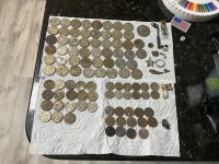
Todays hike..

MadMarshall

Hero Member
Nov 12, 2012
942
1,632
na
Primary Interest:
Prospecting
Boy do I love the American River. I just can't help it. Today I headed to Yankee Jims wanting to shoot a video of an old trail just past the bridge. It is a great trail very rare is it used. Nice in winter time when the river is impossible to cross. This trail is need of little brush work. It has quite a few different paths that lead to the river though most are in poor shape but passable. If you decided to keep walking you could find the way to Ponderosa bridge. Anyway a decent trail to know. Directly on the opposite side the river is the Brunch creek trail.. This trail is short an easy walk and good river access. The brunch creek trailhead can easily be missed. Saw some Kayakers today. Some of the first runs of the year for the NF.. Last Saturday was the very first first run of 2014..About 500 CFS.How do I know that? Anyway I been keeping busy just researching and trying to find some gold. Haven't hit any real payday yet but been getting by alright.


The video of the other trail will be on my page soon. Well hope everyone is well..
 

Upvote 0

goldenmojo

Bronze Member
Dec 9, 2013
1,865
4,753
N. California
Detector(s) used
Bazooka Prospector-Sniper-Supermini Thanks Todd & Chris, Goldhog Multisluice Thanks Doc, My Land Matters Thanks Claydiggins, 6 Senses
Primary Interest:
Prospecting
D*mnit I'm supposed to leave for work right now.... I should know better than to watch your vids in the morning. Great Work. Glad your getting the Gold and I will be up that way by Friday......
 

OP
OP
M

MadMarshall

Hero Member
Nov 12, 2012
942
1,632
na
Primary Interest:
Prospecting
Here is the other Trail.


Running a tad late this morning hope you all have a good day..
 

Clay Diggins

Silver Member
Nov 14, 2010
4,885
14,258
The Great Southwest
Primary Interest:
Prospecting
Aw geez Marshall. I hate to be the one to have to tell you this but the area where Bunch Creek meets the North Fork is claimed on both sides as well as upstream and downstream for about 200 feet. Also the North Fork downstream from there is private land until about a mile above the Ponderosa Bridge.
 

goldenmojo

Bronze Member
Dec 9, 2013
1,865
4,753
N. California
Detector(s) used
Bazooka Prospector-Sniper-Supermini Thanks Todd & Chris, Goldhog Multisluice Thanks Doc, My Land Matters Thanks Claydiggins, 6 Senses
Primary Interest:
Prospecting
There is a rock stack on the bar on the south side of the river about 200 feet above the junction of the two. Looks like a corner marker to me...
 

OP
OP
M

MadMarshall

Hero Member
Nov 12, 2012
942
1,632
na
Primary Interest:
Prospecting
What are the names of these Claims? Above mineral bar is wild and scenic.. below that is considered a State Park there is some private property withen the parks boundries but no mining claims.. That area by brunch creek was dredged recreationally for years before the dredging ban. My brother and I used to work the banks and watch them.. This was back in 2008..No claims were on the river then none now..
 

OP
OP
M

MadMarshall

Hero Member
Nov 12, 2012
942
1,632
na
Primary Interest:
Prospecting


An old claim marker on the river Between YJ bridge and Mineral bar.
 

Clay Diggins

Silver Member
Nov 14, 2010
4,885
14,258
The Great Southwest
Primary Interest:
Prospecting
What are the names of these Claims? Above mineral bar is wild and scenic.. below that is considered a State Park there is some private property withen the parks boundries but no mining claims.. That area by brunch creek was dredged recreationally for years before the dredging ban. My brother and I used to work the banks and watch them.. This was back in 2008..No claims were on the river then none now..

There are three current claims in that section Marshall. There is a current active claim (the Eileen) on and above the mineral bar campground too , as I have pointed out before. The land just downstream from Bunch creek is still private. The ASRA is not a State park, as I've explained before. It is a jointly managed recreation area. The status of the ASRA can change any day, nothing is set in stone there.

In 2008 there was a claim right there on Bunch creek - the two time. That may be who you saw dredging. Guy's name is Keene, ring any bells?

That same two time claimant has refiled there again. Your fellow miners are having a battle with the BLM to make them recognize the land status there. The land is locatable according to the "non-metalliferous" powersite withdrawal. I tend to agree with Keene, the BLM should recognize the land status instead of playing games with the records.

Although you may feel differently please respect the claims locations of your fellow miners and the private property of the landowners along the river. I'm trying to help you understand where those areas are.

Even though it doesn't affect that portion of the river you might want to pay attention to when the current withdrawal expires. It's going to be an interesting year on the American River. 8-)

As I've said before, some of the richest placer ground in California is in the North American drainage and it's open to prospecting. There's really no reason to continue to prospect someone else' claim or private property. This has nothing to do with any incursion on your mining rights Marshall. It is all about getting you some gold on land open to prospecting.

Good luck with your ongoing adventures. I've enjoyed reading about them.

Heavy Pans
 

OP
OP
M

MadMarshall

Hero Member
Nov 12, 2012
942
1,632
na
Primary Interest:
Prospecting
EILEEN IS AN OLD CLAIM ON SORE FINGER POINT it is way Closer to Ponderosa Bridge. . EILEEN CAMC9683 T15N R9E SEC36 SW.. not even really that close to Brunch creek/Yankee Jims or Mineral Bar for that matter!!.. Sore Finger Point is private property. I very very rarely even tread near Ponderosa Bridge area/Sore Finger Point as it is one of the ugliest parts of the NF AMERICAN. But anyway their is no claims by mineral bar or anywhere else for that matter. 3? what's the other 2? THE TWO TIME? Can't find any record of it.. Anyway I suppose it ultimately up to the individual to know the land status.
 

Clay Diggins

Silver Member
Nov 14, 2010
4,885
14,258
The Great Southwest
Primary Interest:
Prospecting
EILEEN IS AN OLD CLAIM ON SORE FINGER POINT it is way Closer to Ponderosa Bridge. . EILEEN CAMC9683 T15N R9E SEC36 SW.. not even really that close to Brunch creek/Yankee Jims or Mineral Bar for that matter!!.. Sore Finger Point is private property. I very very rarely even tread near Ponderosa Bridge area/Sore Finger Point as it is one of the ugliest parts of the NF AMERICAN. But anyway their is no claims by mineral bar or anywhere else for that matter. 3? what's the other 2? THE TWO TIME? Can't find any record of it.. Anyway I suppose it ultimately up to the individual to know the land status.

The Eileen CAMC9683 is at T15N R9E Sec 36 in the W1/2 of the SESW which is exactly at the mineral bar campground Marshall. It has been there since 1960.

Sore Finger Point is in T14N R9E Sec 36 - more than six miles away from the Eileen claim. You are a Township (36 square miles) off.

The Ponderosa bridge is at T13N R9E Sec 11 - more than seven miles away from the Eileen.

Yes it is up to the individual to know the land status. Now you know. :thumbsup:
 

Lanny in AB

Gold Member
Apr 2, 2003
5,659
6,356
Alberta
Detector(s) used
Various Minelabs(5000, 2100, X-Terra 705, Equinox 800, Gold Monster), Falcon MD20, Tesoro Sand Shark, Gold Bug Pro, Makro Gold Racer.
Primary Interest:
Prospecting
OP
OP
M

MadMarshall

Hero Member
Nov 12, 2012
942
1,632
na
Primary Interest:
Prospecting
I was off figures rushing myself. Anyway no active claims are at mineral bar though. Land is under ASRA RULES and REGULATION with the exception of the private property.. Their are no active claims! Do you know how many people pan and sluice that area? lots and lots. No Claim signs? No markers? Why? The ASRA will tell you its open to Rock hounding! at least a hundred people a year put a pan to water in that area.
http://www.parks.ca.gov/pages/502/files/asrabrochure032807.pdf
Seems the lower NF American River is considered a state park to me.. Has been for a while. As for the Where Brunch creek enters the NF American. All part of the ASRA.
 

goldenmojo

Bronze Member
Dec 9, 2013
1,865
4,753
N. California
Detector(s) used
Bazooka Prospector-Sniper-Supermini Thanks Todd & Chris, Goldhog Multisluice Thanks Doc, My Land Matters Thanks Claydiggins, 6 Senses
Primary Interest:
Prospecting
Marshall looks like you panning is working well for you.

GM
 

AU_Solitude

Sr. Member
Feb 24, 2014
280
380
Vacaville CA
Detector(s) used
SDC2300, GBII, Geo Picks & Hammers
Primary Interest:
Prospecting
Hi guys, first time posting but had to jump on it as I am new to the prospecting scene but happened to be in the area.

I did some panning up near "Green Valley" area of the North Fork this Saturday, found what looked to be an illegal dredging operation abandoned on the south side of the river - sleeping bags, pots and pans just left laid out like someone never came back, pine needles and leaves starting to cover all of it - as far as I know this was all ARSA, and or private property a long the river.

I had a hell of a day - my first time out panning and definitely have not aquired the finesse of working the pan yet. That said I found a pretty good honey hole and pulled three sizable pickers along with some flour gold (Later lost this crossing the river a long with my favorite knife :tongue3:). Very interesting area, the history and scarring from mining up to present day is definitely noticeable though.

I'm guessing that I picked an off season to be there as I didn't see anyone else the entire time. Also, I have a sluice but didn't bring it with as I don't know if it was allowed in ARSA area's?
 

H&F909ORO

Sr. Member
Dec 26, 2013
410
243
California East Bay
Primary Interest:
Other
My favorite spot has been at mineral bar. I never saw any sign or any claims at the bar. Last time I was there I was with about 10 other miners on the river.
 

bug

Full Member
Jun 5, 2008
236
392
Nor Cal
Primary Interest:
All Treasure Hunting
I'm guessing the claim owners at mineral bar must realize they are within a campground and rec area. Many people for years have been camping there exclusively to prospect. Like said above, there is no signage posted to state the claim, or discourage prospecting. So it appears they do not seem to be too concerned. But all the same, it is a valid paid claim according to the blm records. It would be interesting to know why they even keep this claim.
 

Last edited:

Oakview2

Silver Member
Feb 4, 2012
2,807
3,348
Prather CA
Detector(s) used
Whites GMT
Primary Interest:
Other
I am guessing those are highly prized dredge claims, and most claimholders are betting that they will get justice at some point from the courts.
 

Top Member Reactions

Users who are viewing this thread

Top