My bench deposit question

Ragnor

Sr. Member
Dec 7, 2015
445
422
Primary Interest:
All Treasure Hunting
I've been trying to sort this out in my head for a while. I didn't want to hijack anyone else's bench thread so here it goes.

My target area is about 4.5 miles down stream from the primary ore body which emplaced the free gold. The average mean grade from 'known' source to bench area is 12%.

The free milling gold veins are located between 3100 and 4100 feet ams.
The benches are between 1600 and 1800 feet ams.

conveniently located on the inside bend
[Image missing]

I half heartedly dug into the middle bench one day while taking a smoke break on my way into the canyon. Below the pumice layer I hit jaged pieces of bedrock and decided I was wrong, that I was not on a bench, just a flat spot. (long time ago)
Now that I can look at these modern images I am pretty darn certain it is a bench and that land slide materials have probably just covered the old river material.

My question is this, to the more experienced bench hunters.
given the information here would you guys concur with my supposition that these are old high bench stream channels and are the parameters listed condusive to a probable deposit worthy of further investigation?

Obviously the only real answer can be found on the ground in the field. None the less I would imagine the more seasoned fellers on here can get a pretty fair idea by the information provided.
 

Last edited:
Upvote 0

arizau

Bronze Member
May 2, 2014
2,485
3,870
AZ
Detector(s) used
Beach High Banker, Sweep Jig, Whippet Dry Washer, Lobo ST, 1/2 width 2 tray Gold Cube, numerous pans, rocker box, and home made fluid bed and stream sluices.
Primary Interest:
Prospecting
If the elevations on the right side of the river are equal to or progressively higher than the left side that could be a possibility to my logic. Finding river run, rounded rocks in those areas would bear that out.

Good luck.
 

OP
OP
Ragnor

Ragnor

Sr. Member
Dec 7, 2015
445
422
Primary Interest:
All Treasure Hunting
Well that seams like pretty good logic. But I tell you, that right side aint much less than a 70% slope. As I recall when I crossed it about 20 years ago in places I had to step from tree to tree because the pitch was too steep to step on the dirt without it sliding. That's some extreme prospecting right thar.
 

arizau

Bronze Member
May 2, 2014
2,485
3,870
AZ
Detector(s) used
Beach High Banker, Sweep Jig, Whippet Dry Washer, Lobo ST, 1/2 width 2 tray Gold Cube, numerous pans, rocker box, and home made fluid bed and stream sluices.
Primary Interest:
Prospecting
Well that seams like pretty good logic. But I tell you, that right side aint much less than a 70% slope. As I recall when I crossed it about 20 years ago in places I had to step from tree to tree because the pitch was too steep to step on the dirt without it sliding. That's some extreme prospecting right thar.

Are you talking about the slope between the road (white line) and the creek(blue line)? That makes sense but not to the right of the creek which looks to be valley floor or a rising trend as you go further right.
 

OP
OP
Ragnor

Ragnor

Sr. Member
Dec 7, 2015
445
422
Primary Interest:
All Treasure Hunting
deleted
 

Last edited:

et1955

Hero Member
Jan 10, 2015
913
1,783
Shoreline,wa
Detector(s) used
Equinox 800
Primary Interest:
Prospecting
Do you know what the host rock is that is carrying the free milling gold, if so, check the stream for any pieces of it and test it, crush and pan it. Do you find gold in or near the stream, also test around the high water line, if no gold move on.
 

OP
OP
Ragnor

Ragnor

Sr. Member
Dec 7, 2015
445
422
Primary Interest:
All Treasure Hunting
Do you know what the host rock is that is carrying the free milling gold, if so, check the stream for any pieces of it and test it, crush and pan it. Do you find gold in or near the stream, also test around the high water line, if no gold move on.

Oh there is a wee bit of gold in and around that stream. I know the host rock well. But I have never actually crushed and panned it from the stream. Sure was allot of fools gold down in that canyon. :laughing7:
 

OP
OP
Ragnor

Ragnor

Sr. Member
Dec 7, 2015
445
422
Primary Interest:
All Treasure Hunting
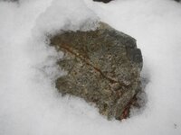
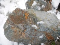
The ore looks allot like this

ore1.jpg ore2.jpg
 

Clay Diggins

Silver Member
Nov 14, 2010
4,885
14,258
The Great Southwest
Primary Interest:
Prospecting
I hate to bring you bad news Ragnor but those aren't benches they are DEM artifacts in the shaded elevation map. The "benches" are simply errors in the mapping process.

Your map DEM (Digital Elevation Model) was created from tracing the contour lines from a topo map. Those contour lines represent, at best, 40 foot elevation changes and they are lines. Most of those contour lines were made back in the 1940's - 1960's so there is nothing "modern" about the data your map is modeled on.

Changing lines into a 3D model involves making up the missing information between the lines. The original contour lines were "made up" too. Nobody ever walked the ground taking measurements to make the original contour lines on the topo map. So mapmakers have two made up sets of data to make a map from that represents a three dimensional surface. A guesstimated contour line becomes a 3D slope on your map but in reality it's still all based on a line.

The wider the "bench" on your map the less the slope in that area of the hill. The map can't predict flat spots like benches but it can show you generally where the shallowest slopes are. Keep in mind that the original resolution of the contour mapping was 40 foot so even though an area appears to have a smooth or flat slope there could still be 40 foot cliffs or boulders in that slope that wouldn't show up on your map.

You may find flat spots in that area but the shaded elevation you are looking at couldn't possibly be used to find those flat spots. In a different terrain with a lot less vegetation and slope you could get some hints from the shaded elevation but in steep areas with heavy vegetation all you can assume is different levels of slope.

Here's a link to show how mapmakers make 3D objects out of contour lines. It's a pretty involved process and the r.surf algorithms are pretty obscure but that page has some good pictures to provide a visual of the process and results.

Heavy Pans
 

Last edited:
OP
OP
Ragnor

Ragnor

Sr. Member
Dec 7, 2015
445
422
Primary Interest:
All Treasure Hunting
I hate to bring you bad news Ragnor but those aren't benches they are DEM artifacts in the shaded elevation map. The "benches" are simply errors in the mapping process.

Your map DEM (Digital Elevation Model) was created from tracing the contour lines from a topo map. Those contour lines represent, at best, 40 foot elevation changes and they are lines. Most of those contour lines were made back in the 1940's - 1960's so there is nothing "modern" about the data your map is modeled on.

Changing lines into a 3D model involves making up the missing information between the lines. The original contour lines were "made up" too. Nobody ever walked the ground taking measurements to make the original contour lines on the topo map. So mapmakers have two made up sets of data to make a map from that represents a three dimensional surface. A guesstimated contour line becomes a 3D slope on your map but in reality it's still all based on a line.

The wider the "bench" on your map the less the slope in that area of the hill. The map can't predict flat spots like benches but it can show you generally where the shallowest slopes are. Keep in mind that the original resolution of the contour mapping was 40 foot so even though an area appears to have a smooth or flat slope there could still be 40 foot cliffs or boulders in that slope that wouldn't show up on your map.

You may find flat spots in that area but the shaded elevation you are looking at couldn't possibly be used to find those flat spots. In a different terrain with a lot less vegetation and slope you could get some hints from the shaded elevation but in steep areas with heavy vegetation all you can assume is different levels of slope.

Here's a link to show how mapmakers make 3D objects out of contour lines. It's a pretty involved process and the r.surf algorithms are pretty obscure but that page has some good pictures to provide a visual of the process and results.

Heavy Pans

I was under the impression that these 3-D sattelite topo's would be the product of a thematic mapper.

*Also, in the case of this particular example. I have hiked the area extensively, on many ocassions, conducting visual surveys and the ground layout is consistant with the 3-D topo image on the map with surprising accuracy. The only real areas it does miss are the 10-30 foot cliff faces between some of the flat spots. These areas are generally obscured by trees and only visible once your too close to them, or on them. Most are covered with a matting of moss and soil and sallal and are not readily recognized for sheer faces immediatly.

But yeah those flat spots do exist to one extent or another. I been there I seen em and they are the only flat parts of the trail, so they are real noticable cause it's easy walking long enough to catch your breath.
 

Last edited:
OP
OP
Ragnor

Ragnor

Sr. Member
Dec 7, 2015
445
422
Primary Interest:
All Treasure Hunting
The first question that came to me was right there in your 2nd paragraph of the OP. Why are you not 4.5 miles upstream hacking away at the deposit?

Well, I'm working on that :thumbsup: Lot's and lots of research........ The most important part, so Ive found, is to know what your looking at when you see it.
 

Top Member Reactions

Users who are viewing this thread

Top