Strike and dip. Hanging wall. Footwall.

TerryC

Gold Member
Jun 26, 2008
7,735
10,996
Yarnell, AZ
Detector(s) used
Ace 250 (2), Ace 300, Gold Bug 2, Tesoro Cortes, Garrett Sea Hunter, Whites TDI SL SE, Fisher Impulse 8, Minelab Monster 1000, Minelab CTX3030, Falcon MD20, Garrett Pro-pointer, Calvin Bunker digger.
Primary Interest:
Metal Detecting
Upvote 0

Jim in Idaho

Silver Member
Jul 21, 2012
3,320
4,698
Blackfoot, Idaho
Detector(s) used
White's GM2, GM3, DFX, Coinmaster, TDI-SL, GM24K, Falcon MD20, old Garrett Masterhunter BFO
'Way Too Cool' dual 18 Watt UV light
Primary Interest:
Prospecting
Strike is the direction of the fault, or vein, across the ground surface. Dip is the angle the vein goes into the earth, from horizontal. Straight down would be 90*. The hanging wall is the portion of the fault that is above the vein. The footwall is below the vein. This is assuming the vein follows the fault line, which is almost always the case. Hanging Wall & Foot Wall | OpenSHA
Jim
 

Last edited:
OP
OP
TerryC

TerryC

Gold Member
Jun 26, 2008
7,735
10,996
Yarnell, AZ
Detector(s) used
Ace 250 (2), Ace 300, Gold Bug 2, Tesoro Cortes, Garrett Sea Hunter, Whites TDI SL SE, Fisher Impulse 8, Minelab Monster 1000, Minelab CTX3030, Falcon MD20, Garrett Pro-pointer, Calvin Bunker digger.
Primary Interest:
Metal Detecting
Strike is the direction of the fault, or vein, across the ground surface. Dip is the angle the vein goes into the earth, from horizontal. Straight down would be 90*. The hanging wall is the portion of the fault that is above the vein. The footwall is below the vein. This is assuming the vein follows the fault line, which is almost always the case. Hanging Wall & Foot Wall | OpenSHA
Jim
Tnx, Jim. Hanging wall and footwall were relatively easy. Although I've never seen a definition of the walls using a vein. I can visualize the vein being dug out resulting in a "foot" wall underfoot and a "hanging" wall above. The tricky part is the "dip" in strike and dip. That figure usually has a compass direction with it. I am confusing it with the "azimuth" of the strike. It is difficult to separate the dip degree with the strike direction as all descriptions are "2D", not "3D". Tnx agn. Clay.... you check your PMs lately? TTC
 

OP
OP
TerryC

TerryC

Gold Member
Jun 26, 2008
7,735
10,996
Yarnell, AZ
Detector(s) used
Ace 250 (2), Ace 300, Gold Bug 2, Tesoro Cortes, Garrett Sea Hunter, Whites TDI SL SE, Fisher Impulse 8, Minelab Monster 1000, Minelab CTX3030, Falcon MD20, Garrett Pro-pointer, Calvin Bunker digger.
Primary Interest:
Metal Detecting
Jim, I see you have a UV light. I know some minerals fluoresce. I collected some fluorite southwest of Stanton a few years ago. Are you aware that scorpions also glow bright green under UV light? Used to collect them a lot! TTC
 

OP
OP
TerryC

TerryC

Gold Member
Jun 26, 2008
7,735
10,996
Yarnell, AZ
Detector(s) used
Ace 250 (2), Ace 300, Gold Bug 2, Tesoro Cortes, Garrett Sea Hunter, Whites TDI SL SE, Fisher Impulse 8, Minelab Monster 1000, Minelab CTX3030, Falcon MD20, Garrett Pro-pointer, Calvin Bunker digger.
Primary Interest:
Metal Detecting
Strike is the direction of the fault, or vein, across the ground surface. Dip is the angle the vein goes into the earth, from horizontal. Straight down would be 90*. The hanging wall is the portion of the fault that is above the vein. The footwall is below the vein. This is assuming the vein follows the fault line, which is almost always the case. Hanging Wall & Foot Wall | OpenSHA
Jim
If no one noticed, Volcanic and seismic activity (faults) are the reasons we are able to collect the precious metals out of the earth here in the western states. Yes, other places too but I believe volcanos (ancient?) and seismic activity is required. "Gold became highly concentrated in California, United States as the result of global forces operating over hundreds of millions of years. Volcanoes, tectonic plates and erosion all combined to concentrate billions of dollars' worth of gold in the mountains of California". Wikipedia. TTC
 

Last edited:

Jim in Idaho

Silver Member
Jul 21, 2012
3,320
4,698
Blackfoot, Idaho
Detector(s) used
White's GM2, GM3, DFX, Coinmaster, TDI-SL, GM24K, Falcon MD20, old Garrett Masterhunter BFO
'Way Too Cool' dual 18 Watt UV light
Primary Interest:
Prospecting
Yup, Terry, I did know that. Did you know that rattlesnakes also fluoresce green? I found scorpions in Wyoming while blacklight prospecting. They exist clear up to 6,500'. I found them from 1/4" to 2" long.
On the metals prospecting...you can find metals in any intrusion-caused broken rock, even if the intrusion doesn't come all the way to the surface....even if there are no volcanics involved. The surface water flowing down through the broken rock will cause metals to be deposited, assuming the correct chemicals are in the country rock, and there is sufficient water to cause deposition. One of my favorite prospecting areas is the Birch Ck valley in southern Idaho. Almost all of the metal discoveries were small, shallow, and quickly ran out. Exactly fits the description of surface deposits.
The compass heading with dip is the direction it dips at.....if you stood with your back to the vein, and the dip going from your back toward your front, the direction you're looking is the direction of the dip. If the dip was at 90*, it would have no direction. You could say the direction of dip is 90* off the strike direction. which 90* is determined by the dip angle.....left or right as you're looking along the strike direction.
In the old days, all this stuff was really important to identify a find....not so much anymore.
Jim
 

Last edited:

Jim in Idaho

Silver Member
Jul 21, 2012
3,320
4,698
Blackfoot, Idaho
Detector(s) used
White's GM2, GM3, DFX, Coinmaster, TDI-SL, GM24K, Falcon MD20, old Garrett Masterhunter BFO
'Way Too Cool' dual 18 Watt UV light
Primary Interest:
Prospecting
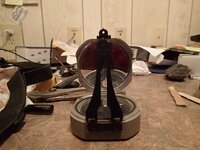
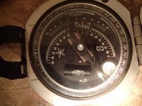
Brunton Prospector's Compass

Terry, here's some pics of my Brunton prospector's compass. you look though the eyepieces, along the strike, to get the strike direction. Using the mirror, you can hold the unit level, and see the compass needle, which can be locked when needed. To get the dip angle, you hold the compass vertical, and put the dark needle parallel to the dip, and adjust the compass rotation until the little level is right, and the needle is right with the dip, and then read the angle on the scale. Note it goes from 0 to 90 either left or right. Second pic is upside down...LOL
P5140001.JPG P5140003.JPG
 

Last edited:

seekerGH

Hero Member
Jan 25, 2016
887
570
Primary Interest:
All Treasure Hunting
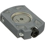
I use an inclinometer...
brunton_f_omnislope_omni_slope_sighting_clinometer_995215.jpg

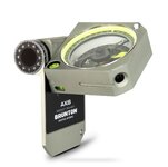
modern day transit
brunton-axis-pocket-compass.jpg

Interesting video on how to use
 

Last edited:

Jim in Idaho

Silver Member
Jul 21, 2012
3,320
4,698
Blackfoot, Idaho
Detector(s) used
White's GM2, GM3, DFX, Coinmaster, TDI-SL, GM24K, Falcon MD20, old Garrett Masterhunter BFO
'Way Too Cool' dual 18 Watt UV light
Primary Interest:
Prospecting
Nice, Seeker. mine is definitely "old school"...LOL
Jim
 

OP
OP
TerryC

TerryC

Gold Member
Jun 26, 2008
7,735
10,996
Yarnell, AZ
Detector(s) used
Ace 250 (2), Ace 300, Gold Bug 2, Tesoro Cortes, Garrett Sea Hunter, Whites TDI SL SE, Fisher Impulse 8, Minelab Monster 1000, Minelab CTX3030, Falcon MD20, Garrett Pro-pointer, Calvin Bunker digger.
Primary Interest:
Metal Detecting
Terry, here's some pics of my Brunton prospector's compass. you look though the eyepieces, along the strike, to get the strike direction. Using the mirror, you can hold the unit level, and see the compass needle, which can be locked when needed. To get the dip angle, you hold the compass vertical, and put the dark needle parallel to the dip, and adjust the compass rotation until the little level is right, and the needle is right with the dip, and then read the angle on the scale. Note it goes from 0 to 90 either left or right. Second pic is upside down...LOL
View attachment 1450783 View attachment 1450784
I've got the 5010Geo. With tripod and proprietary holder was 900! Now it is a little less. It might be still in FL.... I hope. Glowing Rattlers, Batman! A new one to me! Well, may I say..... faults are the results of seismic activity? I always thought lava (molten rock-intrusive type) was required (heat and pressure) to put the minerals in solution, filling the fissures of the faults, cooling over a few hundred million years, and VOILA! Veins! I always thought lava tends to move up, not down. Granted, extrusive rocks will form in a slightly different way than intrusive, but, isn't that still your basic seismic/volcanic relationship? NOT contradicting you, just looking for more clarification. Tnx. TTC
 

Jim in Idaho

Silver Member
Jul 21, 2012
3,320
4,698
Blackfoot, Idaho
Detector(s) used
White's GM2, GM3, DFX, Coinmaster, TDI-SL, GM24K, Falcon MD20, old Garrett Masterhunter BFO
'Way Too Cool' dual 18 Watt UV light
Primary Interest:
Prospecting
Heat definitely speeds things up. I guess when I think of volcanic I think of extrusive, but that's probably incorrect. Most of central Idaho's metals are the result of the Idaho Batholith, which is granitic. Even in places where it didn't come to the surface, I know it's down there, lifting things up, and causing faults, breakage, etc. Most of Idaho's lode gold is found within a mile of the boundary between the granite and the country rock, and can be in veins in either one. Both the granite and the country rock get fractured as the mountains are forced up. I read one geologist who said there is more metal deposited, by far, from water trickling down through the fractured rock than by water coming up from below. From what I've seen, I tend to believe him. I think a lot of those surface deposits were probably formed at shallow depths, and not really very hot. Acidic water dissolves the host rock, freeing the chemicals, and then they get redeposited in a more concentrated form (lucky for us). Or maybe the deposits were formed before they were pushed to the surface, and while they were still at great depths? I doubt anybody knows for sure. I've spent a lot of time thinking about it, and the only conclusion I've reached is that I don't know.
Birch Ck valley has deposits just above the valley floor, and farther north there are deposits at 10,000'. Almost a vertical mile of difference. No way to know how deep those peaks were when it all started rising up. Also, there were different intervals of lifting. The old Lost Texas Jack deposit looks to me like it came later. Going in the adits (2), you can see at the face of the drift where the intrusion caused a seam of breakage in the rock across the face of the drift. obviously that silver was visible at the surface, and they drove the shaft in about 50', and cleaned it all out. When they couldn't see any more visible metal, they quit. Could still be metal there, of course, but no way to know which direction....except to keep following the breakage fault. Too spendy for this old man, though it would be fun. You can "read" the intrusion from the outside, and when I estimated I knew the likely spot for another metal seam to be, I went through the brush and found the second adit. I think I'm the only person who knows it's there. It goes in about 90'. Cleaned it out, and quit, again. All that work was done in one summer..1950. The deposit was originally found in the 1880's, but Texas Jack died, and nobody could find the lode. The guys that worked it just happened on it when bear hunting in the fall of 1949. I didn't know it had been found, but using Jack's directions, I found it in 4 months of searching in 2012. After finding it, I went to the county and found the original claim notice filed in the spring of 1950. it wasn't renewed in 1951.
There's also, according to geologists, a 3/4 mile section of old gold-bearing riverbed at about 8,000'. That was worked for gold for a couple of years in the 19th century, but lack of water probably ended that. You can still find some evidence of the work done. So, that particular part of the mountain range had to spend some years down in the valley...and maybe thousands of years. I've spent some time detecting that area, but haven't found any gold.
The Lost Texas Jack Mine story was mentioned in the 1975 edition of the Gold Digger's Atlas by H. Cyril Johnson of Susanville, CA.
Jim
 

Jim in Idaho

Silver Member
Jul 21, 2012
3,320
4,698
Blackfoot, Idaho
Detector(s) used
White's GM2, GM3, DFX, Coinmaster, TDI-SL, GM24K, Falcon MD20, old Garrett Masterhunter BFO
'Way Too Cool' dual 18 Watt UV light
Primary Interest:
Prospecting
Terry, I had no idea those pocket instruments had gotten so expensive! That one of yours is now $600, without the tripod. I bought mine back when I still thought I'd have a use for it....LOL I'd be surprised if I ever used it now.
jim
 

OP
OP
TerryC

TerryC

Gold Member
Jun 26, 2008
7,735
10,996
Yarnell, AZ
Detector(s) used
Ace 250 (2), Ace 300, Gold Bug 2, Tesoro Cortes, Garrett Sea Hunter, Whites TDI SL SE, Fisher Impulse 8, Minelab Monster 1000, Minelab CTX3030, Falcon MD20, Garrett Pro-pointer, Calvin Bunker digger.
Primary Interest:
Metal Detecting
Very engrossing story, Jim. My hat goes off to you. I was a year old in '50! I can only HOPE living to your age, let alone still active. I am not really up on whether Idaho's mountains are part of the pacific/north American tectonic activity or volcanic. Probably both. You are not alone in just not knowing. Indeed, geology is all theory! Rock and mineral composition - fact. Geological mapping of minerals - fact. But how and why, still conjecture. My response here has not done your most recent post justice (nice post!). And I'll admit that I am not up on the Idaho area. Later. TTC
 

Jim in Idaho

Silver Member
Jul 21, 2012
3,320
4,698
Blackfoot, Idaho
Detector(s) used
White's GM2, GM3, DFX, Coinmaster, TDI-SL, GM24K, Falcon MD20, old Garrett Masterhunter BFO
'Way Too Cool' dual 18 Watt UV light
Primary Interest:
Prospecting
LOL...I'm only 2 years older than you, Terry. I was born in '48.

Lots of weird stuff in Idaho. The lower end of Birch CK has basalt overlaying the country rock. That basalt is the result of the current Yellowstone hot spot. There are a series of volcanics along the Snake River plain as the surface moved southwest over that hot spot. The last eruption at Craters of the Moon was only 1,800 years ago. Certainly, some of the metal deposits in the southern portion of the central Idaho mountains, were caused by that volcanic activity. The intrusions associated with that caused some shallow deposits at the mouth of the Birch Ck valley. Farther up the valley, the deposits are the result of the granitic intrusion. Same thing in the Big Lost and Little Lost valleys, which parallel Birch Ck to the west.
One geologist I read said that geologists were really good at telling the miners why the metals were there............after the miners had found them!
I can only imagine the metal deposits that lie under the basalt that covers the plain below the mountains. That basalt is hundreds of feet deep in places. Makes me wonder how much gold got washed down out of the mountains and was then covered with lava. The Snake River alone was pushed about 80 miles south by the eruptions....the old river channel filled in with new lava. it's assumed that Birch Ck, Big Lost and Little Lost rivers all flowed into the Snake at one time. Now they simply vanish into the lavas....thus the "lost" in their names.
Jim
 

OP
OP
TerryC

TerryC

Gold Member
Jun 26, 2008
7,735
10,996
Yarnell, AZ
Detector(s) used
Ace 250 (2), Ace 300, Gold Bug 2, Tesoro Cortes, Garrett Sea Hunter, Whites TDI SL SE, Fisher Impulse 8, Minelab Monster 1000, Minelab CTX3030, Falcon MD20, Garrett Pro-pointer, Calvin Bunker digger.
Primary Interest:
Metal Detecting
Hey Dave! Good to hear from ya! MANY mines and prospects east of Murphys. Mostly hard rock but some placers. Collier (near powerplant?), Deer Lodge, Homestake, Mascot, Cataract & Wide Awake, and others (CA state Mining Bureau - 1915). They also list a large gravels placer (Duck Bar) 6 miles east of Vallecito on north fork of the Stan. This is a bit in error as the north fork is 7.5 east of V.

Mines.JPG
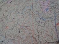
Above is the area "of the house". We are 5 miles east of Murphys just over the top of the Table Mountain chain. Judy's 80 is the S1/2 NW1/4 sec36 T4N R14E MDM. (bottom error of Murphys 2001 topo shows range as T14E, not R14E) At least one other error (I'm showing off) shows the Adit 4 tunnel ending right at the house, not continuing southwest to gulch going down to power plant - Collierville. Anyway, on the west side of pic is a dot I put showing the location of the "wall" I recently posted. That is on John Walter's 40. Around there, he had 3 shafts dozed over about 5 years ago. Down that gulch, on Yvonne's place (sorry guys, both locations are private) are two more tunnels that I will soon pic and post. One still shows the large quartz vein above the walk-in entrance. Red Top is also up here at Tim and Gloria's. The other two dots are dwelling sites (with grave) that also contained fenced corrals for domestic animals; the fencing is still under the grass. And.... a stove pipe (from tent?) was found on the east end of this open meadow. Judy's east and south lot lines are BLM land that I have not yet explored.... very steep. I am sure that the 1962 paper (bulletin 73) will show more gold workings in the area. This year I hope to find the reason the dwellings are up here! I'll look for you at Rod'z real soon. Take care, my friend. TTC
Edit: At the very lower left of pic is the Red Top symbol.
 

Last edited:
OP
OP
TerryC

TerryC

Gold Member
Jun 26, 2008
7,735
10,996
Yarnell, AZ
Detector(s) used
Ace 250 (2), Ace 300, Gold Bug 2, Tesoro Cortes, Garrett Sea Hunter, Whites TDI SL SE, Fisher Impulse 8, Minelab Monster 1000, Minelab CTX3030, Falcon MD20, Garrett Pro-pointer, Calvin Bunker digger.
Primary Interest:
Metal Detecting
OOPS! I interpreted your post to mean you did the '50s work. Sorry. TTC
 

OP
OP
TerryC

TerryC

Gold Member
Jun 26, 2008
7,735
10,996
Yarnell, AZ
Detector(s) used
Ace 250 (2), Ace 300, Gold Bug 2, Tesoro Cortes, Garrett Sea Hunter, Whites TDI SL SE, Fisher Impulse 8, Minelab Monster 1000, Minelab CTX3030, Falcon MD20, Garrett Pro-pointer, Calvin Bunker digger.
Primary Interest:
Metal Detecting
I was writing about the highway 4 corridor,like Arnold and such.Know about Colliuerville and those areas..
MY BAD! Misinterpretation. Sorry. TTC
 

OP
OP
TerryC

TerryC

Gold Member
Jun 26, 2008
7,735
10,996
Yarnell, AZ
Detector(s) used
Ace 250 (2), Ace 300, Gold Bug 2, Tesoro Cortes, Garrett Sea Hunter, Whites TDI SL SE, Fisher Impulse 8, Minelab Monster 1000, Minelab CTX3030, Falcon MD20, Garrett Pro-pointer, Calvin Bunker digger.
Primary Interest:
Metal Detecting
Jim,
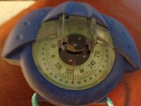
Here is my stand-in until I find the Brunton. Plastimo Iris 50. I own two (nothing wrong with redundancy on a sailboat). Although marine-specific, the sight-across-the-top feature allows me to cross a section with less than 15 foot accuracy. (THAT is a challenge boast!) I am a MAP guy! I used to teach map and compass classes. I own several baseplates, sighters, cammengas, and others. Fave is still the Brunton. I don't see a "prospector's" version at rocgear.com What would be today's version of the "P"?

Plastimo.JPG Iris 50.JPG TTC
 

Top Member Reactions

Users who are viewing this thread

Top