Amount of time for a new claim

blackchipjim

Full Member
Dec 25, 2016
213
194
ohio
Detector(s) used
bounty hunter time ranger
Primary Interest:
All Treasure Hunting
I have been doing my research on an area that I'm interested in prospecting in Arizona when I make it out there this year. I'm at a disadvantage since I don't live there so all my research has to be done online till I get out there to walk around and go to the county and further research it. I wonder if anyone actually tracks how much time and effort and expense they spend from start to finish
 

Upvote 0

Clay Diggins

Silver Member
Nov 14, 2010
4,886
14,260
The Great Southwest
Primary Interest:
Prospecting
Most of the County Recorders in Arizona have location notices available online for free.

Use the Land Matters Mining Claim maps and click on the link for County Records in the information window. Each County records system is different but with a little practice you can do most of the research online before you visit. :thumbsup:

Heavy Pans
 

Bejay

Bronze Member
Mar 10, 2014
1,026
2,530
Central Oregon Coast
Detector(s) used
Whites GMT
Garret fully underwater
Primary Interest:
Prospecting
I have been doing my research on an area that I'm interested in prospecting in Arizona when I make it out there this year. I'm at a disadvantage since I don't live there so all my research has to be done online till I get out there to walk around and go to the county and further research it. I wonder if anyone actually tracks how much time and effort and expense they spend from start to finish

If you have intentions on filing a claim on your prospect; it takes a lot of time and effort. Not a quick easy task. But it can be done. I have solicited and paid for certain aspects of such endeavors to be done;.... living out of state.

Bejay
 

OP
OP
B

blackchipjim

Full Member
Dec 25, 2016
213
194
ohio
Detector(s) used
bounty hunter time ranger
Primary Interest:
All Treasure Hunting
Hey Clay, can you tell me if the recorders office online would have the map of the claims that are noted. I see the area section has 4lode and 6placer claims and the boundaries are listed but do I have to figuire out each claim and lay it out my self? I was running a program that was mentioned in another thread and boom. The area that was listed next to the area i researched was listed by a private land owner even though land matters and county recorder listed it as no claims and blm land. This confused the nuggets out me for sure. I begining to doubt my ability to properly research the areas I want to prospect online.
 

Clay Diggins

Silver Member
Nov 14, 2010
4,886
14,260
The Great Southwest
Primary Interest:
Prospecting
Depends on where you are researching but most counties allow you to download a copy of the location notice. In Arizona each location notice has a map, usually on the second page of the notice. The quality of the map is a different issue, some are good some are worthless. If the claim is a placer located by aliquot part you don't really need a map, just locate the claim according to the legal description on the first page of the location notice.

For lodes or odd shaped placers just take the map from the location notice and draw the location out on a topo map. Rinse and repeat for that section and the adjacent sections and you will end up with a map of all the claims in those sections. I usually map the section of interest plus the eight adjacent sections. It really takes all nine sections because even the smallest claim can be located in up to four sections. When you finish you will know where you can go when you put boots on the ground. Check for new claims when you get there.

I wish it was as easy as claim/no claim but land status is more complex than that. Before I even start downloading and assembling claim location notices for an area of interest I download the Master Title Plat (MTP) for that area. That will tell you the land status, ownership and restrictions. If the area isn't open to claim you can move on before you start mapping the claims. You can get the MTP for any area from the Land Status Maps on Land Matters.

Heavy Pans
 

winners58

Bronze Member
Apr 4, 2013
1,729
4,058
Oregon
Primary Interest:
All Treasure Hunting
have to search County recorders to get the description any online claim records come from BLM
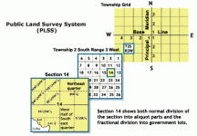
and only go to the quarter quarter section (160 acres), like NE1/4 and such, one section is 640 acres.
plssinfo.gif
.
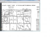
search county tax maps or Master Title Plat https://glorecords.blm.gov/search/default.aspx?searchTabIndex=0&searchByTypeIndex=1
.
Untitled.jpg
edit*
Thanks Clay didn't know getting the MTP was that easy :icon_thumright:
Land Status Maps on Land Matters.
 

Last edited:
OP
OP
B

blackchipjim

Full Member
Dec 25, 2016
213
194
ohio
Detector(s) used
bounty hunter time ranger
Primary Interest:
All Treasure Hunting
I was just curious as to the amount of time most people take in the process. I'm a little slow when it comes to the steps it takes to do the research. I have certain parameters I'm following and that is some of the fun of it all. I feel like a first grade kid trying to do fifth grade work at times.
 

Clay Diggins

Silver Member
Nov 14, 2010
4,886
14,260
The Great Southwest
Primary Interest:
Prospecting
There is a learning curve so time spent is directly related to experience.

I have all the tools at hand to do this research and have a method and order of doing the research that's efficient. I have a lot of experience. No way to estimate the time for any given project but if you start with land status before you worry about where particular claims are located you will often find the land status and history will lead you to your answers.

Looking up claim information before looking up land status can be very discouraging. Just because claims already exist in an area doesn't mean the land is open to location. The BLM is slow about closing claims located on closed land because as long as they complete their paperwork before closing the claims they get to keep the money.

Heavy Pans
 

delnorter

Hero Member
Oct 28, 2008
907
2,300
Northern California
Primary Interest:
All Treasure Hunting
Clay, why do I get only a page of code instead of a map when I try to view a Master Title Plat? It tries to open in Notepad.

Thanks,
Mike
 

Clay Diggins

Silver Member
Nov 14, 2010
4,886
14,260
The Great Southwest
Primary Interest:
Prospecting
Clay, why do I get only a page of code instead of a map when I try to view a Master Title Plat? It tries to open in Notepad.

Thanks,
Mike

Quite a few of the MTPs are only available as JPEG 2000 images. Microsoft products can't read that and many other image formats so you will need a third party image viewer. There are a few good free viewers to choose from. I prefer Faststone viewer.

Perhaps other posters can chime in with their favorite free viewers. :thumbsup:

Heavy Pans
Barry
 

KevinInColorado

Gold Member
Jan 9, 2012
7,037
11,370
Summit County, Colorado
Detector(s) used
Grizzly Goldtrap Explorer & Motherlode, Gold Cube with trommel or Banker on top, Angus Mackirk Expedition, Gold-n-Sand Xtream Hand pump
Primary Interest:
Prospecting
I use Irfanview. Works great :)
 

minerrick

Sr. Member
Feb 18, 2013
277
357
Detector(s) used
Makro Racer
Primary Interest:
All Treasure Hunting
So, I am the dopey, quiet kid in the back of the class that is actively raising his hand: ME! ME! ME! PICK ME! I'M THE IDIOT WITH THOUSANDS OF HOURS OF RESEARCH!.

I have "invested" more than 4000 hours researching mining claims. I started out mapping the quadrants claims were in from the LR2000. When I first started doing that, I mapped all the actives and closed by quadrant in N California from Marin County northward--- probably took me 6 months to do. The bad news is I was mapping them on google earth and as you add more information to the program, it starts getting bogged down wiggy, to the point where you need to empty the cache- often. One REALLY BAD THING about google earth is when it says it is saving your work, it isn't. Trust me on this. I lost all that data in several crashes, and when I looked for the backup, and there wasn't one- so 6 months of work went poof! in an instant. Now when I save, I save it to a .kml file on my desktop. Did I say often? Like every time I add a new location?

So after waiting 6 months after that first crash, I thought I would work at rebuilding my database, but I would change some of the parameters I used- after all a crash that wipes your data away is a GREAT opportunity to start over and do it better. Word of advice- back up often on your desktop, because if you get lazy, GE will crash on you just to piss you off. Has happened to me more times than I can remember. I think on my 3rd or 4th rebuild of the database, I decided to actually go to the recording offices and get actual images of all the mining claims filed out there, but rather than just the quandrant it was in, so I expanded my search and photocopied the exact boundaries of all active mining claims. So now I can go in once a month and update my map so I can see where EXACTLY all the actual claims lay.... getting pretty cool.... but then I got to thinking.... I wonder where all the HISTORIC mining claims were????? Due to the LR2000 online data, EVERYONE with online access can determine approximately where claims filed since 1980 are, but the LR2000 doesn't go back before that to make any earlier determinations.... But the recorder's office has all those records.....So basically, I worked my way up into a frenzy looking for the proverbial "needle in the haystack"- where the old timers were finding gold. I spent the next couple of years making 3x weekly trips to the recorders office to photocopy EVERY CURRENTLY AVAILABLE MINING CLAIM FILED FROM 1870 FORWARD. My present maps told me where the active claims that were already filed were, so I didn't need to know those locations.... but I didn't know where the historical gold was found. Why did I choose 1870? Previous to 1870, the descriptions of the mining claims on the filings read something like this "in a canyon, one corner with 6 rocks piled, another corner with oak tree with metal tag..... in other words, in 1870, the description could have meant something, but 150 years later... it meant nothing. In 1870, at least some of the descriptions mentioned well known mining concerns which still exist today; canyons which still carry the same name (lots of canyons have names which were lost in time- anyone heard of School Marm Canyon near Downieville? If so, contact me), etc.... so at least I had a clue. And as you move forward in time, around the 1920's is when the PLSS was pretty much standardized, which made it a lot easier to figure out where everything was. But a big caveat in all this is even up to the 1960's probably 50% of the recordings I have looked at- I cannot figure out what they were describing (a pile of rocks, tree with crook in it, in an unnamed canyon)- so bad descriptions are timeless and I would say that 50% of all the recordings I looked at had bad descriptions and are useless today to figure out where they were. .....And you gotta remember, up until 1960's mining was an actual INDUSTRY, so people didn't file claims to go camping on- they did it as a viable commercial industry. Upshot of all this is it has turned into an obsession. Now that I have base maps of all the active claims, I can compare the actives to closed to historic and in Washoe, Nevada, Sierra, Placer, Plumas, Butte and a little bit of El Dorado counties I have literally 150,000 acres of old mining claims which are available to go explore and I know where their EXACT footprint was. A lot of these claims from the 1940's back haven't been claimed since, probably because they are located in a location where people didn't expect to find gold. Due to the easy accessibility of the LR2000, it ends up that presently, the same claims get filed upon over and over, because all someone has to do is to go online to see the claims from 1980 forward to reclaim... The old stuff is what I am looking for and I have more old stuff to explore than I have years left alive. I want to go where no modern man has gone before.

It started out as "something interesting to do" and has become an obsession. I love maps, mapping, historical research so I have overlayed every possible historic map ever created onto google earth and because of such, I even found a ghost town that I don't believe anyone else
had ever found. And using my maps of placer claims, and maps of known channels, I have created my own maps linking old minor channels together by connecting the string of placer claims (and more lately, lode claims) together.

Short answer to a very long thread..... I have more time into this thing than I care to even try to assess a value. The good news is I KNOW WHERE EVERYTHING WAS- down to the exact claim boundaries, so when I go out looking, I know exactly what I am looking for... I have a searchable database of all the photocopies I have, filed by Township/Range/Section; I have map layers of what is claimed, what isn't, how long it has been unclaimed, the years the claim was held for and if it was a very historic claim- I know WHO claimed it so I can do further research. Hours "invested"...... I am guessing 4000, but probably any multiple of that and none of it is billable.

Trust me, I know how to make my own fun.
 

mikep691

Hero Member
Aug 6, 2015
858
1,759
Northeastern Sierra's
Primary Interest:
All Treasure Hunting
So, I am the dopey, quiet kid in the back of the class that is actively raising his hand: ME! ME! ME! PICK ME! I'M THE IDIOT WITH THOUSANDS OF HOURS OF RESEARCH!.

I have "invested" more than 4000 hours researching mining claims. I started out mapping the quadrants claims were in from the LR2000. When I first started doing that, I mapped all the actives and closed by quadrant in N California from Marin County northward--- probably took me 6 months to do. The bad news is I was mapping them on google earth and as you add more information to the program, it starts getting bogged down wiggy, to the point where you need to empty the cache- often. One REALLY BAD THING about google earth is when it says it is saving your work, it isn't. Trust me on this. I lost all that data in several crashes, and when I looked for the backup, and there wasn't one- so 6 months of work went poof! in an instant. Now when I save, I save it to a .kml file on my desktop. Did I say often? Like every time I add a new location?

So after waiting 6 months after that first crash, I thought I would work at rebuilding my database, but I would change some of the parameters I used- after all a crash that wipes your data away is a GREAT opportunity to start over and do it better. Word of advice- back up often on your desktop, because if you get lazy, GE will crash on you just to piss you off. Has happened to me more times than I can remember. I think on my 3rd or 4th rebuild of the database, I decided to actually go to the recording offices and get actual images of all the mining claims filed out there, but rather than just the quandrant it was in, so I expanded my search and photocopied the exact boundaries of all active mining claims. So now I can go in once a month and update my map so I can see where EXACTLY all the actual claims lay.... getting pretty cool.... but then I got to thinking.... I wonder where all the HISTORIC mining claims were????? Due to the LR2000 online data, EVERYONE with online access can determine approximately where claims filed since 1980 are, but the LR2000 doesn't go back before that to make any earlier determinations.... But the recorder's office has all those records.....So basically, I worked my way up into a frenzy looking for the proverbial "needle in the haystack"- where the old timers were finding gold. I spent the next couple of years making 3x weekly trips to the recorders office to photocopy EVERY CURRENTLY AVAILABLE MINING CLAIM FILED FROM 1870 FORWARD. My present maps told me where the active claims that were already filed were, so I didn't need to know those locations.... but I didn't know where the historical gold was found. Why did I choose 1870? Previous to 1870, the descriptions of the mining claims on the filings read something like this "in a canyon, one corner with 6 rocks piled, another corner with oak tree with metal tag..... in other words, in 1870, the description could have meant something, but 150 years later... it meant nothing. In 1870, at least some of the descriptions mentioned well known mining concerns which still exist today; canyons which still carry the same name (lots of canyons have names which were lost in time- anyone heard of School Marm Canyon near Downieville? If so, contact me), etc.... so at least I had a clue. And as you move forward in time, around the 1920's is when the PLSS was pretty much standardized, which made it a lot easier to figure out where everything was. But a big caveat in all this is even up to the 1960's probably 50% of the recordings I have looked at- I cannot figure out what they were describing (a pile of rocks, tree with crook in it, in an unnamed canyon)- so bad descriptions are timeless and I would say that 50% of all the recordings I looked at had bad descriptions and are useless today to figure out where they were. .....And you gotta remember, up until 1960's mining was an actual INDUSTRY, so people didn't file claims to go camping on- they did it as a viable commercial industry. Upshot of all this is it has turned into an obsession. Now that I have base maps of all the active claims, I can compare the actives to closed to historic and in Washoe, Nevada, Sierra, Placer, Plumas, Butte and a little bit of El Dorado counties I have literally 150,000 acres of old mining claims which are available to go explore and I know where their EXACT footprint was. A lot of these claims from the 1940's back haven't been claimed since, probably because they are located in a location where people didn't expect to find gold. Due to the easy accessibility of the LR2000, it ends up that presently, the same claims get filed upon over and over, because all someone has to do is to go online to see the claims from 1980 forward to reclaim... The old stuff is what I am looking for and I have more old stuff to explore than I have years left alive. I want to go where no modern man has gone before.

It started out as "something interesting to do" and has become an obsession. I love maps, mapping, historical research so I have overlayed every possible historic map ever created onto google earth and because of such, I even found a ghost town that I don't believe anyone else
had ever found. And using my maps of placer claims, and maps of known channels, I have created my own maps linking old minor channels together by connecting the string of placer claims (and more lately, lode claims) together.

Short answer to a very long thread..... I have more time into this thing than I care to even try to assess a value. The good news is I KNOW WHERE EVERYTHING WAS- down to the exact claim boundaries, so when I go out looking, I know exactly what I am looking for... I have a searchable database of all the photocopies I have, filed by Township/Range/Section; I have map layers of what is claimed, what isn't, how long it has been unclaimed, the years the claim was held for and if it was a very historic claim- I know WHO claimed it so I can do further research. Hours "invested"...... I am guessing 4000, but probably any multiple of that and none of it is billable.

Trust me, I know how to make my own fun.

This spew of BULL sh!t comes from a person that has admitted to never getting any gold, or even seeing any other than in pictures. That's a lot of words to convince someone he is actually a miner.
 

OP
OP
B

blackchipjim

Full Member
Dec 25, 2016
213
194
ohio
Detector(s) used
bounty hunter time ranger
Primary Interest:
All Treasure Hunting
Holy crap I would never do that much work for a hobby unless I was taking pictures of naked women.
 

minerrick

Sr. Member
Feb 18, 2013
277
357
Detector(s) used
Makro Racer
Primary Interest:
All Treasure Hunting
Holy crap I would never do that much work for a hobby unless I was taking pictures of naked women.

The history really keeps me going. Once you start doing the research, it kind of sucks you in. I will probably never find a way to monetize the time I spent, but I will keep me out of trouble checking out new locations for a while, and I like the adventure.
 

delnorter

Hero Member
Oct 28, 2008
907
2,300
Northern California
Primary Interest:
All Treasure Hunting
Well, I got the FastStone program downloaded, sent donation and received an e-mail with registration code and instructions on how to activate. Problem is, I'm unable to get to a page that allows me to enter the code. When I open the application file it just keeps taking me in a loop to allow access to my system then download again.

I've sent an e-mail to the contact but no response yet. I guess me and my operating system are getting old. I used to be pretty good with computers when dinosaurs roamed the earth. You know; Alpha Micro, amos, fortran, pascal etc.

Ha Ha,
Mike
 

Clay Diggins

Silver Member
Nov 14, 2010
4,886
14,260
The Great Southwest
Primary Interest:
Prospecting
Faststone is free for personal use Mike. No need to register or donate.

The initial download from Faststone is just a little file that checks your computer operating system and then downloads the proper version for your computer setup. Essentially you have to allow that second download or you never get the actual program installed.

I just installed Fastone on an old Windows XP system I keep for testing and it works fine. Try letting that second download go through and you should be good to go.

Heavy Pans
 

Reed Lukens

Silver Member
Jan 1, 2013
2,653
5,418
Congres, AZ/ former California Outlawed Gold Miner
Detector(s) used
Tesoro Vaquero, Whites MXT, Vsat, GMT, 5900Di Pro, Minelab GPX 5000, GPXtreme, 2200SD, Excalibur 1000!
Primary Interest:
All Treasure Hunting
So, I am the dopey, quiet kid in the back of the class that is actively raising his hand: ME! ME! ME! PICK ME! I'M THE IDIOT WITH THOUSANDS OF HOURS OF RESEARCH!.

I have "invested" more than 4000 hours researching mining claims. I started out mapping the quadrants claims were in from the LR2000.
Trust me, I know how to make my own fun.

My new mapping system is much faster then the old one you saw... Lol. I do love the history and still read a lot, but now it's all about a different state :)
 

minerrick

Sr. Member
Feb 18, 2013
277
357
Detector(s) used
Makro Racer
Primary Interest:
All Treasure Hunting
Reed, tell me more.... PM me
 

Top Member Reactions

Users who are viewing this thread

Top