Interesting newspaper story

KANACKI

Bronze Member
Mar 1, 2015
1,445
5,931
Primary Interest:
All Treasure Hunting
Hola there amigos.

A fair wind blows before I set sail, so I just post you a article that might be of interested dated around December 1884. Was not quite sure where to post this as it touches two subjects. But anyway enjoy.


Daily Alta California, Volume 37, Number 12662, 13 December 1884 — ARIZONA STORIES. [ARTIC.jpg


Kanacki
 

sdcfia

Silver Member
Sep 28, 2014
3,660
8,888
Primary Interest:
Other
Hola there amigos.

A fair wind blows before I set sail, so I just post you a article that might be of interested dated around December 1884. Was not quite sure where to post this as it touches two subjects. But anyway enjoy.


View attachment 1227845


Kanacki

Classic, classic example of a coded message relating to a treasure site (or valuable informational source) located in that particular region of AZ. A well-worn protocol. Thanks for the post.

Way, way OT: do you have any practical knowledge of celestial navigation using stars in the ecliptic polar regions?
 

OP
OP
KANACKI

KANACKI

Bronze Member
Mar 1, 2015
1,445
5,931
Primary Interest:
All Treasure Hunting
Classic, classic example of a coded message relating to a treasure site (or valuable informational source) located in that particular region of AZ. A well-worn protocol. Thanks for the post.

Way, way OT: do you have any practical knowledge of celestial navigation using stars in the ecliptic polar regions?

Hola sdcfia

My main stomping ground is the Pacific. Generally Southern Cross pointers in South pacific and Big dipper and pole star in Northern Pacific. That and old Polynesian navigation methods wind and waves and birds. Trouble is in higher polar or lower arctic regions is bad weather for sighting stars at night at sea. Even for compass bearings the closer to the poles in general the larger the magnetic variations to the compass. Thankfully it is still a requirement still for all masters and mates to be familiar with celestial navigation and remains as a requirement for their certificate of competency..

That said these days I am afraid I am rather lazy these days of GPS as my marine chronometer calculations are never as accurate as Global positioning System which can place you on the earth surface with in 3 meters. Although I still keep a marine chronometer as back up although I would Probably be out by more than a mile or two.:laughing7: I usually plot wind Speeds, knots dead reckoning from a fixed point along a nautical chart. Yes I am still old fashioned and still believe in drawing it on my paper charts. Not convinced computer logged map as my son is keen on if power fails you have no maps.
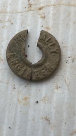
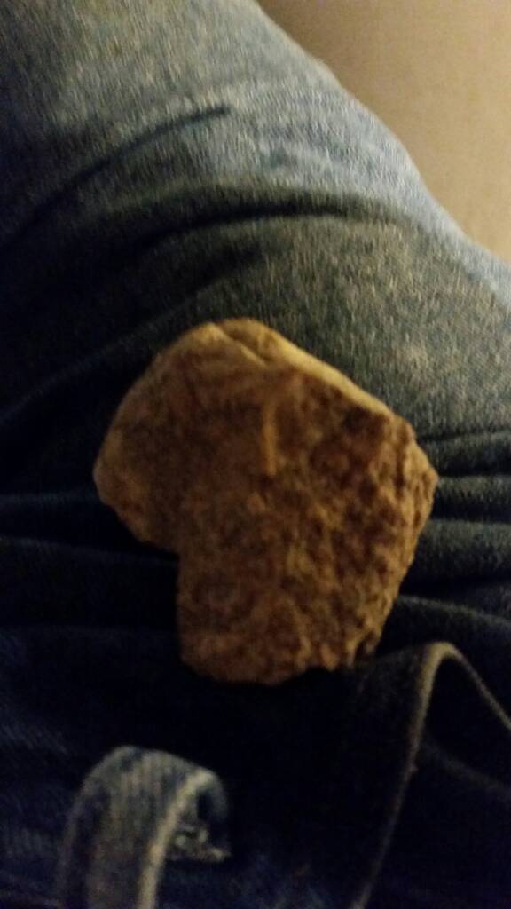
Celestial navigation is the use of angular measurements (sights) between celestial bodies and the visible horizon to locate one's position on the globe, on land as well as at sea. At a given time, any celestial body is located directly over one point on the Earth's surface. The latitude and longitude of that point is known as the celestial body’s geographic position (GP), the location of which can be determined from tables in the Nautical or Air Almanac for that year.

However you do pose a very intriguing question?

The North Ecliptic Pole is in Draco. Due to precession, the celestial pole moves in a circle around the ecliptic poles once every 25,800 years.

The ecliptic poles are (as of epoch 1 January 2000) at: (North) right ascension 18h 0m 0.0s (exact), declination +66° 33′ 38.55″

The orientation of the Earth's axis and equator are not fixed in space, but rotate about the poles of the ecliptic with a period of about 25,800 years, a process known as lunisolar precession, as it is due mostly to the gravitational effect of the Moon and Sun on the Earth's equatorial bulge. Likewise, the ecliptic itself is not fixed. The gravitational perturbations of the other bodies of the Solar System cause a much smaller motion of the plane of the Earth's orbit, and hence of the ecliptic, known as planetary precession. The combined action of these two motions is called general precession, and changes the position of the equinoxes by about 50 arc seconds (about 0°.014) per year.

I do have an old book of tables some quite well worn if I can find it on the "Drumbeat"

Here is rough table not as precise as a nautical almanac which constantly needs to be updated.


No. Name Mag. S.H.A. Dec. No. Name Mag. S.H.A. Dec.

1 Alpheratz 2.2* 358 N.29 31 Gacrux 1.6 172# S. 57
2 Ankaa 2.4 354 S.42 32 Alioth 1.7 167 N. 56
3 Schedar 2.5* 350 N.56 33 Spica 1.2* 159# S. 11
4 Diphda 2.2 349# S.18 34 Alkaid 1.9 153 N. 49
5 Achernar 0.6 336# S.57 35 Hadar 0.9 149# S. 60

6 Hamal 2.2* 328 N.23 36 Menkent 2.3 149 S. 36
7 Acamar 3.1 316 S.40 37 Arcturus 0.2* 146# N. 19
8 Menkar 2.8 315 N. 4 38 Rigel Kentaurus 0.1 140# S. 61
9 Mirfac 1.9* 309 N.50 39 Zubenelgenubi 2.9* 138# S. 16
10 Aldebaran 1.1* 291# N.16 40 Kochab 2.2 137 N. 74

11 Rigel 0.3* 282# S. 8 41 Alpheca 2.3* 127 N. 27
12 Capella 0.2* 281 N.46 42 Antares 1.2* 113# S. 26
13 Bellatrix 1.7* 279# N. 6 43 Atria 1.9 108# S. 69
14 Elnath 1.8 279 N.29 44 Sabic 2.6 103 S. 16
15 Alnilam 1.8* 276# S. 1 45 Shaula 1.7 97# S. 37

16 Betelgeuse var.* 271# N. 7 46 Rasalhague 2.1 96 N. 13
17 Canopus -0.9 264# S.53 47 Eltanin 2.4 91 N. 51
18 Sirius -1.6* 259# S.17 48 Kaus Australis 2.0 84# S. 34
19 Adhara 1.6 256# S.29 49 Vega 0.1* 81 N. 39
20 Procyon 0.5* 245# N. 5 50 Nunki 2.1* 76# S. 26

21 Pollux 1.2* 244 N.28 51 Altair 0.9* 63# N. 9
22 Avior 1.7 234# S.59 52 Peacock 2.1 54# S. 57
23 Suhail 2.2 223 S.43 53 Deneb 1.3* 50 N. 45
24 Miaplacidus1.8 222# S.70 54 Enif 2.5 34 N. 10
25 Alphard 2.2 218# S. 9 55 Al Na'ir 2.2 28# S. 47

26 Regulus 1.3* 208# N.12 56 Fomalhaut 1.3 16# S. 30
27 Dubhe 2.0 194 N.62 57 Markab 2.6 14 N. 15
28 Denebola 2.2* 183# N.15
29 Gienah 2.8 176 S.17
30 Acrux 1.1 174# S.63

* = Stars that are prominent for observers in the Northern hemisphere.
# = Stars that are prominent for observers in the Southern hemisphere.
Var. = Variable star, mag. = 0.1 to 1.2
- Note that many stars are visible North and South of the equator.

Anyway I hope it is of some help? It late and Drumbeat sails at day break.

Oh if you are looking for magnetic compass bearing taken back in time you have to consult magnetic variation tables going back to that time frame especially in the extreme north and south regions. If your hunting down the exact position today of a past celestial observation with a marine Chronometer taken from certain star in polar sky. You would have hunt down old tables of the that time and compare present table.

Browns Nautical Almanac is now in its 138th year of publication. Any almanac before 1883 is rare as hens teeth.

Kanacki
 

Last edited:

Azquester

Bronze Member
Dec 15, 2006
1,736
2,596
Primary Interest:
All Treasure Hunting
Strange but funny. His name was "Tio" the Uncle as in "El Tio" the Satan that guards all miners underground!

I wonder who the Gentleman from Tucson was? The maps and stories I have tell a story about two Brothers finding the mine with the iron door in 1847 in the Santa Catalina range not the Tumacacori mountains. Legends have a way of playing off each other don't they?

We do know that just a few years later Lucky Lully found a Jesuit Gold mine which started the now ghost town of Alta and pulled millions of dollars in gold out of the ground. That was just east of the Tumacacori Mission in the Santa Rita mountains. I wonder if it had an iron door?


Hola there amigos.

A fair wind blows before I set sail, so I just post you a article that might be of interested dated around December 1884. Was not quite sure where to post this as it touches two subjects. But anyway enjoy.


View attachment 1227845


Kanacki
 

Last edited:
OP
OP
KANACKI

KANACKI

Bronze Member
Mar 1, 2015
1,445
5,931
Primary Interest:
All Treasure Hunting
Hola Bill

That is one of the interest mysteries of such legends stories. It hard to know for sure. I too had some thing on Santa Rita but I have to check my data base.

Is that Alta mine and the ghost town of Hershaw? Living in western Pacific I am not familiar with the area.

Harshaw,_AZ_1880s.jpg

Kanacki
 

OP
OP
KANACKI

KANACKI

Bronze Member
Mar 1, 2015
1,445
5,931
Primary Interest:
All Treasure Hunting
Hola bill my eyes are tired. been up on watch and have not slept well. I have my departure delayed. been nodding off in chart room.

Here is 1901 newspaper story about the San Rita

Los Angeles Herald, Number 224, 12 May 1901 — OLD MINING DISTRICT WILL BE REOPENED [ARTICL.jpg

Los Angeles Herald, Number 224, 12 May 1901 — OLD MINING DISTRICT WILL BE REOPENED [ARTICL.jpg

Los Angeles Herald, Number 224, 12 May 1901 — OLD MINING DISTRICT WILL BE REOPENED [ARTICL.jpg

Kanacki
 

OP
OP
KANACKI

KANACKI

Bronze Member
Mar 1, 2015
1,445
5,931
Primary Interest:
All Treasure Hunting
Classic, classic example of a coded message relating to a treasure site (or valuable informational source) located in that particular region of AZ. A well-worn protocol. Thanks for the post.

Way, way OT: do you have any practical knowledge of celestial navigation using stars in the ecliptic polar regions?

My apologies on the your other comment about coded messages ie limited information you and bill are most likely correct in regards to the name. As looking through old Arizona records I have available there is no one recorded by that name. Which possibly an alias? However I did find a name of laborer with the last name, However we at the risk of wrongly identifying that person without further evidence.

Kanacki
 

OP
OP
KANACKI

KANACKI

Bronze Member
Mar 1, 2015
1,445
5,931
Primary Interest:
All Treasure Hunting
Hola amigos Another hour I have my port clearance. New kid on Job these days..hes slow....

Here is another you guys might enjoy...

1909 story. in New Mexico. It seems many old Spanish or Mexican workings was reopened with more modern operation over time. Makes you wonder how many was missed. Not all of course was connected to the Jesuits either.

Any have fun you in great part of the world. Cheers....


Los Angeles Herald, Volume 37, Number 3, 4 October 1909 — CAMPS ADVANCE WITHOUT NOISE [ART.jpg

Los Angeles Herald, Volume 37, Number 3, 4 October 1909 — CAMPS ADVANCE WITHOUT NOISE [ART.jpg

Kanacki
 

sdcfia

Silver Member
Sep 28, 2014
3,660
8,888
Primary Interest:
Other
<cut>
However you do pose a very intriguing question?

The North Ecliptic Pole is in Draco. Due to precession, the celestial pole moves in a circle around the ecliptic poles once every 25,800 years.

The ecliptic poles are (as of epoch 1 January 2000) at: (North) right ascension 18h 0m 0.0s (exact), declination +66° 33′ 38.55″

The orientation of the Earth's axis and equator are not fixed in space, but rotate about the poles of the ecliptic with a period of about 25,800 years, a process known as lunisolar precession, as it is due mostly to the gravitational effect of the Moon and Sun on the Earth's equatorial bulge. Likewise, the ecliptic itself is not fixed.
<cut>
Kanacki

Thanks for the response. I don't wish to derail your thread, so I'll discontinue this discussion here. I knew that you were an experienced navigator - hence my question. I've been long perplexed about the Vikings' apparent navigational feats in the higher North American latitudes - specifically their skill in determining accurate longitudes. I happened upon Crichton Miller's book, The Golden Thread of Time, which I recommend to anyone interested in the subject of ancient navigation, and which contains very intriguing interpretations of mythological/religious text.

Please continue with the newspaper article discussion. As stated earlier, I believe this article was, for lack of a better label, a KGC coded message.
 

Last edited:

Shortfinger

Hero Member
Apr 7, 2015
569
2,475
Valley Center, CA/Yuma, AZ
Primary Interest:
All Treasure Hunting
Hola sdcfia

My main stomping ground is the Pacific. Generally Southern Cross pointers in South pacific and Big dipper and pole star in Northern Pacific. That and old Polynesian navigation methods wind and waves and birds. Trouble is in higher polar or lower arctic regions is bad weather for sighting stars at night at sea.

Kanacki

Somehow, I'm not surprised that you are familiar with the old Polynesian navigation methods. I looked into those pretty extensively a while back, along with studying celestial navigation. I was never very good at celestial navigation, i suspect because it was hard for me to identify exactly which star I was looking at. I have to agree with you that GPS makes us lazy, but it is a fantastic tool, as long as it works. At the risk of igniting a controversy here, i'm going to say that, IMHO that the ancient Polynesians were the greatest navigators and seafarers of any in the ancient world. Hopefully you will see this when you get back in touch, and will comment on it. Bon Voyage. It seems that (again,not surprisingly, with your years of experience and knowledge) you have chosen a good time for your trip, as it is unlikely that you will experience any tropical cyclones in the near future.

JB
 

Nov 8, 2004
14,582
11,942
Alamos,Sonora,Mexico
Primary Interest:
All Treasure Hunting
Loke, you-n-Oro just about have it pinpointd - next time for sure Kanacki is among the trade winds already.

"Down where the trade winds blow, that's where I long to go '' Pretty song about the atolls, not
the Japanese infested islands where most of us ended.

No lovely maidens such as Kanacki's crew.
 

Oroblanco

Gold Member
Jan 21, 2005
7,838
9,830
DAKOTA TERRITORY
Detector(s) used
Tesoro Lobo Supertraq, (95%) Garrett Scorpion (5%)
Loke, you-n-Oro just about have it pinpointd - next time for sure Kanacki is among the trade winds already.

"Down where the trade winds blow, that's where I long to go '' Pretty song about the atolls, not
the Japanese infested islands where most of us ended.

No lovely maidens such as Kanacki's crew.

Hmm well that depends on how many thousand acres the point of that pin will cover.....:BangHead:
 

Top Member Reactions

Users who are viewing this thread

Top