Two peaks

OP
OP
UncleMatt

UncleMatt

Bronze Member
Jul 14, 2012
2,389
2,530
Albuqerque, NM / Durango, CO
Detector(s) used
Garrett Infinium & Gold Bug II, Bazooka Super Prospector Sluice
Primary Interest:
All Treasure Hunting
Okay, I need some help on something else I am working on LAD wise: defining the criteria for the canyons we should be looking for. I have a GIS specialist with $40K of software waiting to get this from me so he can take an elevation map from USGS and then use his software to highlight only those canyons that meet LAD specs. For example, many of the stories mention very high canyon walls, and specific canyon widths. How high should the criteria be for those walls and widths if we want them indicated on such a map?

Please guys, think on this, and post your input. I'm trying to create a map where only the canyons that might be suitable candidates show up, so we can ignore the rest. Or any other geographic information we could use to narrow down the LAD search area.
 

Springfield

Silver Member
Apr 19, 2003
2,850
1,383
New Mexico
Detector(s) used
BS
Okay, I need some help on something else I am working on LAD wise: defining the criteria for the canyons we should be looking for. I have a GIS specialist with $40K of software waiting to get this from me so he can take an elevation map from USGS and then use his software to highlight only those canyons that meet LAD specs. For example, many of the stories mention very high canyon walls, and specific canyon widths. How high should the criteria be for those walls and widths if we want them indicated on such a map?

Please guys, think on this, and post your input. I'm trying to create a map where only the canyons that might be suitable candidates show up, so we can ignore the rest. Or any other geographic information we could use to narrow down the LAD search area.

I wouldn't know what to recommend myself, because so many LAD versions differ. One man's 'deep, steep, rough zigzag canyon' may look get an entirely different description from you or me. Remember that all the published LAD versions are at best third hand and, people tend to mis-interpret or embellish things, often to make the story more readable. I'm not trying to make your job harder Matt, but this is exactly the reason practically every canyon in eastern AZ/western NM has been looked at since Adams' alleged 1864 escapade - with no cigar.
 

OP
OP
UncleMatt

UncleMatt

Bronze Member
Jul 14, 2012
2,389
2,530
Albuqerque, NM / Durango, CO
Detector(s) used
Garrett Infinium & Gold Bug II, Bazooka Super Prospector Sluice
Primary Interest:
All Treasure Hunting
lol, I wasn't taking you seriously about those coords.

I will be re-reading the stories this weekend while hunkering down in the desert winter, and trying to come up with list of canyon criteria to operate from. I don't have it here with me to quote from, but I recall "towering canyon walls" and "the canyon was 300 yards wide". So lets say for grins that a "towering canyon wall is 150' at least. I can tell my GIS specialist to illustrate any geographical canyon areas where the elevation map shows at least 150' depth for depressions from their bottom to the top edge, and between 250 and 350 yards of width. Then he will generate a Google Earth map that shows the areas that meet the criteria in an overlaid color.

Note: if anyone disagrees with my approximations, please speak up, and be ready to justify your objections. I'm always open to other sets of eyes. Also feel free to correct any errors I may post about what is in the tales we are using. Also throw out criteria you believe are relevant for consideration.

Once I get the target canyons figured out from the map, I will use other methods to look into them further. Only Dusted knows what I'm up to, and can't really go into that yet. But I plan on posting the kmz or kml files here for these maps, and would appreciate other contributors as well. I believe a collaborative effort will win the day here, and nothing else will.
 

OP
OP
UncleMatt

UncleMatt

Bronze Member
Jul 14, 2012
2,389
2,530
Albuqerque, NM / Durango, CO
Detector(s) used
Garrett Infinium & Gold Bug II, Bazooka Super Prospector Sluice
Primary Interest:
All Treasure Hunting
I wouldn't know what to recommend myself, because so many LAD versions differ. One man's 'deep, steep, rough zigzag canyon' may look get an entirely different description from you or me. Remember that all the published LAD versions are at best third hand and, people tend to mis-interpret or embellish things, often to make the story more readable. I'm not trying to make your job harder Matt, but this is exactly the reason practically every canyon in eastern AZ/western NM has been looked at since Adams' alleged 1864 escapade - with no cigar.

Lets just keep it simple then and reduce our parameters to canyon depth and width. His software couldn't tell a zig-zag from a zag-zig anyway!We can get more specific than that if the situation requires. Even those 2 simple criteria may be enough to narrow down the search into manageable chunks of territory, but who knows.

Once we have this map done, we could then start looking at the length of the canyons, and comparing that to the various stories. In the end we could have a specific map for each version of the story, and then try to find commons leads they all share. This will become very obvious when I post my landmark and distance map soon.

I honestly wish Jack Purcell were still posting here, I would love to have his input and participation. Especially since he doesn't even live 20 miles from my place in Albuquerque.
 

Last edited:

markmar

Silver Member
Oct 17, 2012
4,117
6,259
Primary Interest:
All Treasure Hunting
UncleMatt

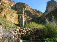
How many LAD clues you believe fit in this picture ?

canyon.jpg
 

OP
OP
UncleMatt

UncleMatt

Bronze Member
Jul 14, 2012
2,389
2,530
Albuqerque, NM / Durango, CO
Detector(s) used
Garrett Infinium & Gold Bug II, Bazooka Super Prospector Sluice
Primary Interest:
All Treasure Hunting
Well, no trees suitable for cabin building are visible on the pediments below the canyon walls, and no stone walls or constructions were mentioned in any of the tales, so I would say this canyon does not match the LAD. But this photo is not high enough in resolution to make out much more than what is obvious, and you would need to be more specific about the part of the LAD story it supposedly represents. Is it the site of the LAD, or is it in one of the canyons leading to it? Since I am focusing on mapping, what are its GPS coordinates?
 

Last edited:
OP
OP
UncleMatt

UncleMatt

Bronze Member
Jul 14, 2012
2,389
2,530
Albuqerque, NM / Durango, CO
Detector(s) used
Garrett Infinium & Gold Bug II, Bazooka Super Prospector Sluice
Primary Interest:
All Treasure Hunting
I was hoping we could avoid bs in this thread
 

OP
OP
UncleMatt

UncleMatt

Bronze Member
Jul 14, 2012
2,389
2,530
Albuqerque, NM / Durango, CO
Detector(s) used
Garrett Infinium & Gold Bug II, Bazooka Super Prospector Sluice
Primary Interest:
All Treasure Hunting
Look more carefully to the coordinates and try again . The snowflake is degree .

lol, yes, I know what the asterisk represents. I cut and pasted them right into Google Maps from your post and it went right to cancun, mexico. That format is accepted by Google Maps and Google Earth. Did you mean to post other coords perhaps? Try posting them in digital format.
 

OP
OP
UncleMatt

UncleMatt

Bronze Member
Jul 14, 2012
2,389
2,530
Albuqerque, NM / Durango, CO
Detector(s) used
Garrett Infinium & Gold Bug II, Bazooka Super Prospector Sluice
Primary Interest:
All Treasure Hunting
markmar, I converted to decimal GPS, and was able to see the location you intended me too. To verify it is correct, I am sending them to you PM. You can decide if you want to post them here or not, I didn't want to assume anything on that front. After you verify that is the correct location, we can go from there. Sorry for any misunderstanding.
 

Last edited:

Oroblanco

Gold Member
Jan 21, 2005
7,838
9,830
DAKOTA TERRITORY
Detector(s) used
Tesoro Lobo Supertraq, (95%) Garrett Scorpion (5%)
UncleMatt - I have to agree with our mutual amigo Springfield, I don't think we can define the size of the canyon walls or even what was meant by a zig-zag canyon exactly. What one person calls "vertical" or steep, another would not. We don't even know how wide the canyon was - was it as wide as a football field, or something so narrow that you could touch both walls while standing in the middle?
Oroblanco
 

Top Member Reactions

Users who are viewing this thread

Top