Maps

EarnieP

Hero Member
Jul 20, 2015
526
1,062
Primary Interest:
All Treasure Hunting
"Dear Mr. Croves,

I am sorry to report that we have little post-graduate information on CP Stone, and there is no map in his file.

Manuscript Currator
West Point Library."

��Ug, the search continues. I am wondering if it was considered classified?


Mr Croves,
Have you tried contacting (if he's still living) Blaine Lamb, the author of;

'The Extraordinary Life of Charles Pomeroy Stone: Soldier, Surveyor, Pasha, Engineer'


From Amazon;
"BLAINE LAMB received his PhD in history from Arizona State University. An archivist for the state of California, he directed the completion of the Golden State Museum, now the California Museum, in Sacramento. At the time of his retirement, he was the Chief of the Archaeology, History and Museums Division of California State Parks. His publications include articles in California History,Western Historical Quarterly, and Journal of America’s Military Past."
------------

If anyone has what you're looking for, maybe it's Lamb or his estate.
------------

[Edit: Lamb also wrote;

'The Corps and the Colorado: American Engineers on the American Nile'.

and;

'Jews in early Phoenix 1870-1920'

Those might be interesting reads.]
 

Last edited:

EDN

Jr. Member
Apr 17, 2016
46
110
Gilbert, Arizona
Detector(s) used
Minelab Eureka Gold
Primary Interest:
All Treasure Hunting
BlackLine,

Here are some other ruins near by.

Old Ruins 33.579695° -111.126814°

Old Ruins 33.552443° -111.139971°

Old Ruins 33.549148° -111.142047°

Old Ruins 33.501356° -111.185413°

EDN
 

BlackLine

Full Member
Feb 7, 2016
184
401
NRW, Germany
Detector(s) used
Fisher Gold Bug 2
Primary Interest:
Other
BlackLine,

Here are some other ruins near by.

Old Ruins 33.579695° -111.126814°

Old Ruins 33.552443° -111.139971°

Old Ruins 33.549148° -111.142047°

Old Ruins 33.501356° -111.185413°

EDN

Nice. The third i didnt know before. I have also more ruins but most of them in the eastern range.
 

BlackLine

Full Member
Feb 7, 2016
184
401
NRW, Germany
Detector(s) used
Fisher Gold Bug 2
Primary Interest:
Other
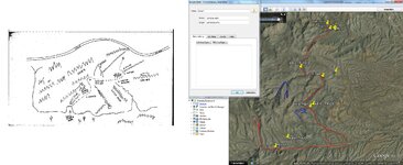
"on my trail to san carlos"

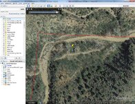
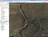
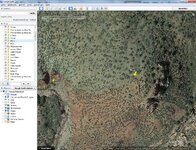
map.jpg map-1.jpg map-2.jpg map-3.jpg map-4.jpg map-5.jpg

i dont believe that this map leads to the ldm. maybe anyone can check it!?
i think that on the last pic was once a house.
 

Last edited:

Hal Croves

Silver Member
Sep 25, 2010
2,659
2,695
Minas del oro Map.
Looking for old threads or conversations about this map.
Anyone familiar with it?


Thanks,
Hal
 

BlackLine

Full Member
Feb 7, 2016
184
401
NRW, Germany
Detector(s) used
Fisher Gold Bug 2
Primary Interest:
Other
hal i can recognize it. have no photoshop at home. will send you the answer tomorrow. for you late in the evening ;)
 

BlackLine

Full Member
Feb 7, 2016
184
401
NRW, Germany
Detector(s) used
Fisher Gold Bug 2
Primary Interest:
Other
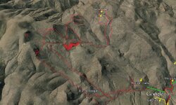
im really sorry about the quality. the problem is the 3d effect but i think you can see what i mean with this pic.

minas del oro.jpg
 

Hal Croves

Silver Member
Sep 25, 2010
2,659
2,695
im really sorry about the quality. the problem is the 3d effect but i think you can see what i mean with this pic.

View attachment 1342753

There are several "traced" drawings of the photograph of the original Minas del oro Map.
All of the examples, that I have seen, are inaccurate when compared to the photo.
Thou, my reprint of that photo is small and not very detailed.

Which one are you working with?


Hal
 

BlackLine

Full Member
Feb 7, 2016
184
401
NRW, Germany
Detector(s) used
Fisher Gold Bug 2
Primary Interest:
Other
There are several "traced" drawings of the photograph of the original Minas del oro Map.
All of the examples, that I have seen, are inaccurate when compared to the photo.
Thou, my reprint of that photo is small and not very detailed.

Which one are you working with?


Hal
that one on my thread. had anyone an original map?
 

Azquester

Bronze Member
Dec 15, 2006
1,736
2,596
Primary Interest:
All Treasure Hunting
im really sorry about the quality. the problem is the 3d effect but i think you can see what i mean with this pic.

View attachment 1342753

Blackline, Go into "Options" on GE and place the elevation exaggeration to "0". That will lay the map flat for a transparency overlay. Then show it from straight above the area with the transparency on top.

Great photo!
 

BlackLine

Full Member
Feb 7, 2016
184
401
NRW, Germany
Detector(s) used
Fisher Gold Bug 2
Primary Interest:
Other
Blackline, Go into "Options" on GE and place the elevation exaggeration to "0". That will lay the map flat for a transparency overlay. Then show it from straight above the area with the transparency on top.

Great photo!

impossible. cant show an aerial view of a 3d map. the question is... why the peraltas should made 2 maps for the same mines? one is an aeriel view and one is a 3d view.
 

markmar

Silver Member
Oct 17, 2012
4,117
6,259
Primary Interest:
All Treasure Hunting
And the Perfil mapa , is a Peralta's 3D map and shows the same region of the Cross beside of the words " por encima al roca mula " from the skin map .
 

Hal Croves

Silver Member
Sep 25, 2010
2,659
2,695
Looking for the GPS# for the symbols on Blacktop Mesa, both sets.
Any help would be appreciated.
 

Hal Croves

Silver Member
Sep 25, 2010
2,659
2,695
hal..if you mean the symbols on the south end they are on a topo map

Thanks azdave,
Yes, the southwestern facing set is marked on GE as well but, not the exact coordinates.
There should also be a second set thou, I am having a difficult time finding it.

It may sound like "pie-in-the sky" dreaming but I think that I now understand their purpose.
I need GPS# to confirm the idea.
 

Top Member Reactions

Users who are viewing this thread

Top