Video 4 - The Peralta Stone Maps with Frank Augustine

Scar

Full Member
Dec 25, 2010
193
114
Ryan great job. I must say that when you posted the first video I started to watch from the computer in my office that I generally work from but the sound was so low from the monitor speakers I couldn't hear very good so I turned it off. I am glad I did because today after reading all the good comments you have received I started looking around the office for a solution to the sound. I took the stock headphones from my E-TRAC metal detector but they have a big jack plug that wouldn't fit my sound card. I had forgotten about the high end sound card in my newest computer that my son uses for our work. The jack fit and the sound was excellent and I watched all 4 videos back to back. I had to turn the sound down on the last one. You and Frank make a good team. With all the BS you see on TV these days, it is so good to have treasure,net where you can see and read the real deal. I look forward to watching your next video.
.
 

releventchair

Gold Member
May 9, 2012
22,395
70,710
Primary Interest:
Other
Firstly RG1976 thank you for the desert travel in regards to the Sups and surrounds.. Man, that's an opportunity for me that ain't been coming any other way..

Your style of filming and narrating is for you to manage, and should always be so, but right now your unbiased approach makes it much easier to follow the perspective of someone open to all angles with an emphasis on what is tangible. Works well for both casual observers and those with their own opinions already established.Or so it seems to me anyway.It is very well done.
A question about Weavers needle view from Tumlinson's dig site popped up- wondering if a gap in the Mt. range might allow a spyglass to catch the top of the needle.
(Yaa, one of them kind of thoughts.)

The third hole dug at Tumlinson's is bowl /funnel shaped so much compared to first two...I'll spare you the rest of that thought,l.o.l..

Superb video. Way to go Gent's and congrats on teaming up in a collaborative effort.

Hat's off to ya Frank for your involvement. That is an asset to the vids forthcoming, but to RG's curiosity outside of the vids too which is great.
Too an example of someone showing someone (and an audience) things that don't have to be shared, by choice, for good reason; in a pleasant way.
And I get to eye ore with you interpreting! What a deal...
 

Last edited:

Las Vegas Bob

Sr. Member
Aug 25, 2005
351
267
Detector(s) used
Fisher Gold Bug
Primary Interest:
All Treasure Hunting
Nice video, great narration by both you and Frank. Really enjoyed it, your getting better each time.
 

Las Vegas Bob

Sr. Member
Aug 25, 2005
351
267
Detector(s) used
Fisher Gold Bug
Primary Interest:
All Treasure Hunting
It's a very good video. Maybe I like to dip my hand in the water to test the temperature before I jump in.

Jump in the waters fine, if you want to know something spit it out, stuff could mean anything, this is a treasure hunting form so if that's what ya be asking about let us know.
 

Old

Hero Member
Feb 25, 2015
656
1,409
Virginia
Detector(s) used
Whites
Primary Interest:
All Treasure Hunting
Ryan, My comment wasn't finding fault with the lack of back story. Its perfect for "us" at TNET. We have plenty of back story. Version 1.0, 2.1, 2.3....10.157. Depends on how wide an audience you might want. But its perfect for us.

Can't help you with the DB 40 cactus. Don't have a clue on that one. The TK on the other side I could venture a guess. `Spec we all could <g>.
 

i am the horse

Jr. Member
Apr 17, 2014
99
109
Primary Interest:
All Treasure Hunting
i am going to have to side with gollums theory that the stones were found in an old mission/building somewhere. not necessarily azripe like he stated but possibly another building. i find it hard to believe that all those locations of the stones were that spread out and he found them.. very odd. but hey i am just as lost as everyone else here.
 

deducer

Bronze Member
Jan 7, 2014
2,281
4,360
Primary Interest:
Other
Thanks Deducer!! I really appreciate that compliment and I'm sure Frank does as well! Making the video was a lot of fun! If you have any sites that you think would be interesting, within the SWA, please shoot me a PM and I'd be happy to research them.

As far as commercial use - you're right, commercial use is ambiguous - which is why I shoot with my iPhone instead of all my expensive camera equipment. Arizona law doesn't include cell phone images / video to be considered as "professional" or "commercial use". The downside to using a phone is all of the wind noise you heard in this video - ugh! Of course, this law could change at any time - especially with how quickly technology is advancing.

Thanks for looking out for me on this one though - I had the same concern when my first video turned into many many more.

Edit - I want to clarify "commercial use laws". I consulted an entertainment lawyer about this and that is the answer I was given. If anyone else wants to go shoot with their phone, you should contact a lawyer and clarify for yourself. I am no way trying to interpret laws on public forums!

My bet is that law was passed in an era when cellphones weren't what they are today, smartphones with HD quality video rivaling those of high end video cameras, so expect that law to be overhauled sooner than later, and even applied retroactively.

I think the safe bet here is for you to be ready to show that none of your video make money (hence leaving the monetization option unchecked on your YT account).

As far as sound- you can invest in a quality lav mic that plugs into the iphone, plenty of options online.

Will send PM.
 

Hal Croves

Silver Member
Sep 25, 2010
2,659
2,695
RG1976, sgtfda,

Good work, both of you.

Just a word of caution concerning Gary's excellent research. Be sure not to draw any quick conclusions based on the font comparisons. If the treasure chest stone was completed at any point after the discovery of the Stone Maps, it only means that Tumlinson had an example from which to work. The "A" is a directional symbol (font). They should look like that.

Find out the creation date of the Treasure Chest stone. If it predates the discovery of the stone maps, then there is a better than average chance that Tumlinson carved the stone maps. If post-1948, the idea is all but dead.

Monkey see, monkey do.

Research, research, research.
 

Garry

Sr. Member
Apr 19, 2009
256
496
Great video Ryan and Frank. I appreciate the balance I in presenting both sides of the argument in regards to the PSM. The holes do look old in that the spoils or dirt has eroded around the holes exposing the bigger stones. IMHO if Frank is correct in the locations of these holes then Tumlinson worked very hard on his hoax. Or he was telling truth. Or someone else dug these holes from Tumlinson's descriptions. Something that I found interesting was the carving on the chimney of the face or head. Seems similar to the priest character on the PSM.
Gratz on the new video. Well done.

P.S. I thought Tumlinson found the PSM's off old hwy 60 north of the area in your video.

Has anyone researched the history of the area near the Tumlinson Stone Maps’ burial site?

When was the present day bridge built across Queen Creek?

Where was it located in relation to the old Highway 60 bridge that was replaced?

Are there any remains of the old Highway 60 bridge that have survived to the present or were all signs of that bridge removed? If any of the old abutments, etc. survived it would at least give a ballpark area of where Travis searched. Maybe the north half of the present day bridge is actually the site of the old Highway 60 bridge?

It would seem to me that building the present day bridge would have impacted a fairly large area and if the two bridges were near each other the map burial area was probably bulldozed which might date our three holes to well after the Tumlinson era?.

I suspect someone like Somehiker, who I think has spent considerable time in that area, may have some excellent insights.

The piece of sandstone that Frank found interested me because Doc Rosecrans told a similar story in a letter to Bernice McGee December 21, 1966. Doc is talking about some heart shape up near Windy Pass as being the source. I also don’t know how he knew what material the heart stone was made out of or if he was simply speaking about the trail maps in general. I'm just not sure Doc ever physically saw the stone maps although he was involved with the Davis brothers and aware of the existence of the maps early on.

Red stones, at map burial site.jpg

Garry
 

Hal Croves

Silver Member
Sep 25, 2010
2,659
2,695
Garry! I was hoping you'd come and be a part of this thread. Thanks again for allowing me to use your work as part of my video - I really enjoyed the analysis you did on the handwriting.

Let's see if I can answer some of your questions.

First - let's take a look at this map from google earth. When you and I spoke, I told you about an old "rest stop / restaurant" not too far away from the Tumlinson site where frank and I stopped to shoot our video. The building is now abandoned - as it was on the "old" US-60. As you can see from this map - the new 60 and the old 60 converge not too far away from where we parked. I am told that the area where the bridge is, is the same as before. Perhaps the bridge was retrofitted - but I haven't seen any evidence of an entirely new bridge built at a new location. Like I mentioned to you on the phone, I did see what looked like pieces of old road - broken in chunks - around the bridge area. It's possible that the bridge was resurfaced - but the "frame" of the bridge stayed. Does anyone have anything contrary to this? I am not able to find anything online about that particular bridge. Where it gets confusing is there is a fairly large bridge that also covers queen creek, but much further away - headed towards Globe / Miami - that is also on the US 60

View attachment 1166856

Concerning the history of the area, outside of Tumlinson, I am told by an "old timer" that this area was excavated within the past 20-ish(?) years - and quite a bit of artifacts were present - that made the researchers believe that exact area was perhaps a trading post dating back quite a long time ago. I will see if I can get more information on that.

My impression - I've been there 2x now - and collectively, 3-4 hours - is this:

When I first saw the holes in the ground - I thought they were excavated graves. Even so much so that I laid down in one of them to see if I would fit - in which I did - until frank started kicking rocks on me and pretending to bury me alive! (jerk). Frank even mentions the words "grave sized holes" in our video. I talked to some folks about this, showed them my footage, all before editing what you guys saw on YouTube. Everyone I talked to said - there is no way those are graves - no one would dig in that dirt - its way too hard, like digging in cement to bury someone. So I said - well clearly the holes are there, so someone thought they were looking for "something". We can all agree on that.

Concerning the area where Tumlinson claims to found these - there are not a bunch of pot holes all over the ground - or areas where it looks like people were digging, at least recently. The 3 areas that you see on the video, those stand out like a sore thumb. To be honest, Im pretty shocked no one has ever posted those "holes" - or even talked about them. It's a big part of the Tumlinson story!

Also - I really take issue with Tumlinson saying he "tripped on a rock" out there, and that rock happened to be one of the stone maps. That entire area, just like everywhere else in the superstitions is littered with rocks....big / small and house sized. In my opinion - that is a complete lie out of Tomlinson's mouth. If he was tripping over rocks, he wouldn't have made it more than 5 feet from his car without landing face first. There are rocks EVERYWHERE out there.

2nd - Weaver's needle. I mentioned this 2x in my video. Weaver's needle, according to GE, is roughly 12 miles away from that site. Its hidden by the Superstition Range. Also, the human eye will start to be tricked by the curvature in the earth past 3.5 miles. Then you take into account dust / pollution / power lines / heat waves / etc - there is no way Tumlinson was at that site to get a "better view" of weaver's needle....its too far away and hidden. Frank is telling me that on our next trip, he believes that you may be able to see the very tip-top peak of Weaver's needle from that site - I have scoured over all my images and I cannot see it, but will report back.

Garry - when was the "treasure chest" map carved by Tumlinson? Any idea? I believe you are the only one, outside of family, that has seen it in person and talked to the folks behind it. Also, to clarify, isn't it also true that Tumlinson's own family says Tumlinson carved the Stone Maps?

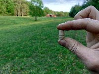
Here are more photos, for anyone interested, in the rock that Frank found at the Tumlinson Site.


Sorry this post is so long - whew!

RG1976,

Just a word about the "Red Stone". Do you have any idea just how long it would take to round off the cleaved facing on that stone? Its about as beveled as the other sides which means a very, very, long time (obviously, unless it was pulled from the creek bed). Do yourself a favor and compare it to the cleaved ore sample in your video. Will you post a side by side for the gang?

IMO, and with respect, what you have there is a great paper weight. However, to be on the safe side, I would ask someone more familiar with local weathering, erosion, and deposition.
 

azdave35

Silver Member
Dec 19, 2008
3,606
8,104
Has anyone researched the history of the area near the Tumlinson Stone Maps’ burial site?

When was the present day bridge built across Queen Creek?

Where was it located in relation to the old Highway 60 bridge that was replaced?

Are there any remains of the old Highway 60 bridge that have survived to the present or were all signs of that bridge removed? If any of the old abutments, etc. survived it would at least give a ballpark area of where Travis searched. Maybe the north half of the present day bridge is actually the site of the old Highway 60 bridge?

It would seem to me that building the present day bridge would have impacted a fairly large area and if the two bridges were near each other the map burial area was probably bulldozed which might date our three holes to well after the Tumlinson era?.

I suspect someone like Somehiker, who I think has spent considerable time in that area, may have some excellent insights.

The piece of sandstone that Frank found interested me because Doc Rosecrans told a similar story in a letter to Bernice McGee December 21, 1966. Doc is talking about some heart shape up near Windy Pass as being the source. I also don’t know how he knew what material the heart stone was made out of or if he was simply speaking about the trail maps in general. I'm just not sure Doc ever physically saw the stone maps although he was involved with the Davis brothers and aware of the existence of the maps early on.

View attachment 1166834

Garry
there is an old bridge on the old el camino viejo road about 2.5 miles n.w. of florence junction that is still in use...30 years ago thats the bridge where everyone thought the stone maps were found
 

OP
OP
RG1976

RG1976

Sr. Member
Mar 30, 2015
336
440
Scottsdale, Arizona
Detector(s) used
Tesoro Lobo SuperTraq & Vaquero

Leupold BX-3 Mojave & RX1200i Rangefinder
Primary Interest:
Other
Yes. I've heard that as well Dave! For the intention of the video, frank and I followed the "map" that Tumlinson drew. But with everything Dutchman - you never know! It's my intention to go to the site you mentioned - perhaps you can come with :)
 

azdave35

Silver Member
Dec 19, 2008
3,606
8,104
RG1976 wrote:
First - let's take a look at this map from google earth. When you and I spoke, I told you about an old "rest stop / restaurant" not too far away from the Tumlinson site where frank and I stopped to shoot our video. The building is now abandoned - as it was on the "old" US-60. As you can see from this map - the new 60 and the old 60 converge not too far away from where we parked. I am told that the area where the bridge is, is the same as before. Perhaps the bridge was retrofitted - but I haven't seen any evidence of an entirely new bridge built at a new location. Like I mentioned to you on the phone, I did see what looked like pieces of old road - broken in chunks - around the bridge area. It's possible that the bridge was resurfaced - but the "frame" of the bridge stayed. Does anyone have anything contrary to this? I am not able to find anything online about that particular bridge. Where it gets confusing is there is a fairly large bridge that also covers queen creek, but much further away - headed towards Globe / Miami - that is also on the US 60

ryan...that old rest stop used to be a gas station / restaurant and it was located on the old highway 60..the owner of the station was approached by the state dept. as they needed the land to build the new highway...he kept holding out for more money and the state got tired of messing with him and just put the new highway around him...so the new highway bypassed him and there was no access to his store and the greedy fella's business went broke...there was also a turquoise business located there also...hardy's turquoise i believe ..if i remember correctly he was the first guy to figure out how to stabilize turquoise...he made a fortune but the gas staion owner went broke,,,lol
 

OP
OP
RG1976

RG1976

Sr. Member
Mar 30, 2015
336
440
Scottsdale, Arizona
Detector(s) used
Tesoro Lobo SuperTraq & Vaquero

Leupold BX-3 Mojave & RX1200i Rangefinder
Primary Interest:
Other
And this is why I just admire Dave so much. Full of information! Thanks for clarifying that!

To play "anti stone maps" for a second - why would tumlinson stop to relieve himself, as legend says, when he just drove by a restaurant / rest stop! They're pretty close by!
 

Last edited:

azdave35

Silver Member
Dec 19, 2008
3,606
8,104
And this is why I just admire Dave so much. Full of information! Thanks for clarifying that!

To play "anti stone maps" for a second - why would tumlinson stop to relieve himself, as legend says, when he just drove by a restaurant / rest stop! They're pretty close by!
yes ryan...the old highway 60 ran a slightly different route than the new 60
 

azdave35

Silver Member
Dec 19, 2008
3,606
8,104
RG1976,

Just a word about the "Red Stone". Do you have any idea just how long it would take to round off the cleaved facing on that stone? Its about as beveled as the other sides which means a very, very, long time (obviously, unless it was pulled from the creek bed). Do yourself a favor and compare it to the cleaved ore sample in your video. Will you post a side by side for the gang?

IMO, and with respect, what you have there is a great paper weight. However, to be on the safe side, I would ask someone more familiar with local weathering, erosion, and deposition.

do i sense a little jealously here hal?...,,ryan is a friend of mine and he tells me he has a major metal detector company sponsoring him now....i dont see anyone offering to sponsor you
 

Oso

Jr. Member
May 26, 2015
25
64
Foothills of Supes
Primary Interest:
Relic Hunting
Ryan, I joined Tnet just to tell you how much I enjoy your videos. I’ve been lurking here since the TV show more or less to read how others felt about it and I got sucked into the whole LDM topic. My brother runs a 10” dredge off a 40’ pontoon in Nome; he isn’t part of the show but is very familiar with it so I am pretty well up to speed on the reality of reality TV.

I live in the foothills of the Superstitions very close to the Mining Camp restaurant which is about as close as I’ll ever get to the Bat Cave or some of your other locations.

Back to the point… as far as I’m concerned, your videos and the conversations they start are very informative and entertaining; now, with Frank involved, even more so. I hope the two of you and others keep working together and keep sharing your work.

Oso
 

Hal Croves

Silver Member
Sep 25, 2010
2,659
2,695
do i sense a little jealously here hal?...,,ryan is a friend of mine and he tells me he has a major metal detector company sponsoring him now....i dont see anyone offering to sponsor you

Wow, that is one sad post indeed, almost pathetic. Do you always use your friends to coverup your shortcomings? Hmmm.

Anyway, I take it you find that Red Rock to be a significant discovery? If so, why not explain how? What does it all mean Dave? Please tell us, in strictly scientific terms.

Whatever success or sponsorship Ryan receives is his own personal business. He certainly has earned it, putting in the time and his own resources to tell his stories. Dave, are you trying to hitch your tired old sideboard to his rising star? Because that's how you are presenting yourself. Or, are you now serving as a mouthpiece for Ryan? Not sure why he would need you.
Very curious this.

Dave, in this game, things are not always as they seem.
You however, just may be the exception to the rule.

...and the Red Rock, it's importance seems to have been Frank's idea. Perhaps you weren't paying attention.

PS. Why on earth would I need a sponsor and what the heck would they be sponsoring? Your so silly sometimes.

-------------------

Congratulations on your sponsorship Ryan! You have certainly earned it.
One last thought. Thinking back, I now feel that your initial instincts about those we spoke of were correct.

Lets leave it at that and focus on legends.
 

Last edited:

Garry

Sr. Member
Apr 19, 2009
256
496
there is an old bridge on the old el camino viejo road about 2.5 miles n.w. of florence junction that is still in use...30 years ago thats the bridge where everyone thought the stone maps were found

azdave35,

Thanks for the input. I want to make sure I understand.

The dual bridge that is shown on Ryan's Google earth picture was not in existence 30 years ago? It was created after 1985?

The bridge where Tumlinson is alleged to have stopped was the only Queen Creek crossing in use until 1985? I suspect the 1985 date may be earlier?

Can you still cros/s Queen Creek on the old Highway 60 bridge?

The map that Frank had was not credited but I believe it is a copy of the same map in Dr. Glover's book on page on page 338. the caption reads;

Copy of Travis Tumlinson's map marked by Travis where he said he dug-up the Stone Maps. "X" marks the spot. Original map give by Travis Tumlinson to Robert Tumlinson, then by Robert to Dr. Gene Davis. it was photocopied for Dr. Davis's original by the author.

I get confused when I look at the alleged map marked by Travis and compare it to Ryan's Google earth map, It looks like it is right on where Ryan filmed. Is there something wrong with the map they were using?

Can you see Weaver's Needle from the location 2 1/2 miles NW?

I realize I'm probably one of the few who care, :laughing7: but I hope you can sort through this and get me a little closer. After I chew on your answer I may have some additional questions.:laughing7:

You usually don't get many answers on TNET.

Thanks again,

Garry
 

Last edited:

Top Member Reactions

Users who are viewing this thread

Top