vamelungeon
Jr. Member
Re: Indians of the Swift era... (Trails & Great Shawnee Cave)
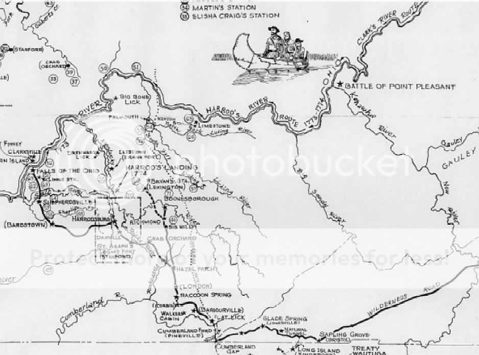
Thank you for your maps, they are great! I particularly like the last one showing the gaps (passes). I've never seen one like it before.
Thank you for your maps, they are great! I particularly like the last one showing the gaps (passes). I've never seen one like it before.