Good explanation of Jonathan Swift

KY Hiker

Bronze Member
Oct 28, 2014
1,537
3,220
North Central Kentucky
Detector(s) used
Whites
Primary Interest:
All Treasure Hunting
Last edited:

KY Hiker

Bronze Member
Oct 28, 2014
1,537
3,220
North Central Kentucky
Detector(s) used
Whites
Primary Interest:
All Treasure Hunting
do not have much faith in prathers book if swift did own the land as he says then i think this land would contain the supposed great cave and would be reason for ownership of this land i believe the great cave is a deception to lead people off and is actually an unknown that has yet to be discovered and is much smaller than swift describes

If the cave exists, it is/was pigeon water cave. The kegs of coin Bill Gibson found there have no other explanation currently. There are other caves, and I think the word 'great' was added, if not, Mammoth and several others in the state fit the bill. Prather's book has years of research and I would not quickly discount it, his theory about R.L. Stevenson has yet to be proven. Could Swift's land ownership in KY have been done to distract those who he feared would find his mine(s)? All we can do is guess at any of it at this point. If Prather is correct about dates of Swift, that discounts ALL the 1760s carvings all over 5 different states, especially KY.

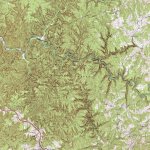
Turkey tracks are common in Cherokee country, less so in Shawnee country, yet in KY the turkey tracks are all over. Seem to be often found on exposed rock ledges with overlooks. This has made me ponder the connection to the mine locations and the description of where 3 streams come together, thus making a turkey track. The Cherokee had Gold in VA, NC, SC, and GA. They used to claim much of KY as their own...I have posted this before and got little response, I am not one to hold back information that others could use. Does anyone see a turkey track on this map? Take it or leave it...I just want to put it out there for everyone to digest. I wonder if the Cherokee were the original miners, and later the Shawnee after running them further South. The major turkey track on this map is off the beaten path and is not as frequented as most places within the Red River Gorge.
TurkeyTrackTopo.jpg
 

Last edited:

rgb1

Sr. Member
Nov 24, 2013
295
769
s.w. Ohio
Detector(s) used
2 whites 1 garett
Primary Interest:
All Treasure Hunting
my friend it has taken me many years to come to my conclusions with alot of research yo back up what i believe if you new things i have found and authenticated i thinkyou would agree with some of my thoughts down the road i will explain most of what prather has written is speculation i have facts i will only say things that i can prove however you and others will have to wait till time comes andi am able to show everthing as i have found them.
 

KY Hiker

Bronze Member
Oct 28, 2014
1,537
3,220
North Central Kentucky
Detector(s) used
Whites
Primary Interest:
All Treasure Hunting
I try to keep an open mind to all the possibilities. There is no reason to not believe what you have found as well. There are very few facts, so far, surrounding the legend. Sharing information will help everyone involved. And it seems to me that as things are found, they are quickly hidden by the those that have found it. Their motivation is to protect what they have found, understandable but that is part of the reason I think the trail has been lost over the years. So when a notion comes to me, or a bit of information, I try to share it. I don't expect you to divulge anything until your interest is secure. These forums are for discussion and sharing of information, and that is all I am trying to do.
 

Ken S.

Hero Member
Oct 1, 2018
577
1,615
Paintsville,Ky.
Primary Interest:
Other
I like Prathers theory, But it is just that Theory, until boots on the ground turns it to fact. His theory is like most and has some interjection in it that wont pan out. But it has some valuable information that no one else has produced. He has done some great investigative research in writing his book for sure. I say this based on the video alone, haven't read the book yet.
 

franklin

Gold Member
Jun 1, 2012
5,036
7,168
Detector(s) used
Garrett ADS-7X, Fisher Two Box M-Scope, Mother Lode Locator, Dowsing Model 20 Electroscope, White's TM808, White's TM900, Inground Scanners
Primary Interest:
All Treasure Hunting
I like Prathers theory, But it is just that Theory, until boots on the ground turns it to fact. His theory is like most and has some interjection in it that wont pan out. But it has some valuable information that no one else has produced. He has done some great investigative research in writing his book for sure. I say this based on the video alone, haven't read the book yet.

I have the book and I for one do not think it is worth a read. But others may see things differently.
 

Ken S.

Hero Member
Oct 1, 2018
577
1,615
Paintsville,Ky.
Primary Interest:
Other
The research on the land ownership to me is the part that I find most interesting. It took a lot of research to put all that together. Land title documents take time to search out especially back that far.
 

KY Hiker

Bronze Member
Oct 28, 2014
1,537
3,220
North Central Kentucky
Detector(s) used
Whites
Primary Interest:
All Treasure Hunting
I like Prathers theory, But it is just that Theory, until boots on the ground turns it to fact. His theory is like most and has some interjection in it that wont pan out. But it has some valuable information that no one else has produced. He has done some great investigative research in writing his book for sure. I say this based on the video alone, haven't read the book yet.

Very little of what he covered in the presentation in the video is actually covered in the book. His focus is toward purchased land South and Southwest of Louisville. I find it quite interesting that many of the land title transfers are in thousands of acres but for 1-5 shillings priced. It is as if the land was transferred for pennies on the dollar value to cover up another transfer (or it was to settle some other debt?). Something lies beneath the land swaps.
 

Ken S.

Hero Member
Oct 1, 2018
577
1,615
Paintsville,Ky.
Primary Interest:
Other
Very little of what he covered in the presentation in the video is actually covered in the book. His focus is toward purchased land South and Southwest of Louisville. I find it quite interesting that many of the land title transfers are in thousands of acres but for 1-5 shillings priced. It is as if the land was transferred for pennies on the dollar value to cover up another transfer (or it was to settle some other debt?). Something lies beneath the land swaps.

MAYBE !! The land was transferred for silver to start a treasury for the New Country of the U S ?? according to Prather Swift had connections with G W and the newly formed government.
 

KY Hiker

Bronze Member
Oct 28, 2014
1,537
3,220
North Central Kentucky
Detector(s) used
Whites
Primary Interest:
All Treasure Hunting
Unfortunately deed books don't record motivations, yes Washington and Swift were masons as well. Washington gave Swift a portrait of himself too.
 

Ken S.

Hero Member
Oct 1, 2018
577
1,615
Paintsville,Ky.
Primary Interest:
Other
The land may have been sold at the price for patriotic services rendered through the revolution. We'll probably never know.
 

Brushy Bandit

Full Member
Jan 11, 2017
195
560
Carter County, KY
Primary Interest:
All Treasure Hunting
If the cave exists, it is/was pigeon water cave. The kegs of coin Bill Gibson found there have no other explanation currently. There are other caves, and I think the word 'great' was added, if not, Mammoth and several others in the state fit the bill. Prather's book has years of research and I would not quickly discount it, his theory about R.L. Stevenson has yet to be proven. Could Swift's land ownership in KY have been done to distract those who he feared would find his mine(s)? All we can do is guess at any of it at this point. If Prather is correct about dates of Swift, that discounts ALL the 1760s carvings all over 5 different states, especially KY.

Turkey tracks are common in Cherokee country, less so in Shawnee country, yet in KY the turkey tracks are all over. Seem to be often found on exposed rock ledges with overlooks. This has made me ponder the connection to the mine locations and the description of where 3 streams come together, thus making a turkey track. The Cherokee had Gold in VA, NC, SC, and GA. They used to claim much of KY as their own...I have posted this before and got little response, I am not one to hold back information that others could use. Does anyone see a turkey track on this map? Take it or leave it...I just want to put it out there for everyone to digest. I wonder if the Cherokee were the original miners, and later the Shawnee after running them further South. The major turkey track on this map is off the beaten path and is not as frequented as most places within the Red River Gorge.
View attachment 1672246


Can look at any map and pick out a turkey track, especially if you're lookin for em.
 

KY Hiker

Bronze Member
Oct 28, 2014
1,537
3,220
North Central Kentucky
Detector(s) used
Whites
Primary Interest:
All Treasure Hunting
Yep, steep topography creates turkey tracks naturally. Obviously, the water has to travel between the ridges... The Swift journals explain monument rock(s) being where three streams come together. I wonder and ponder if the turkey track has more meaning to it than what is at the surface or what is more common knowledge. I was told years ago the symbol was an expression of a hunting party's direction of travel. In other words, 'the way towards the good hunt' think of it as a turkey/game trail... looking back at the map I included, the first turkey track marks the entrance into the cliff country from the East. A second one occurs where Swift Camp Creek and Copperas Creek meet the Red River. At these junctions (turkey tracks) several large cabin size boulders may be found in and along the stream. If you were traveling through this area and standing on an outcropping of rock with a turkey track carved at your feet, the streams coming together could be seen as a turkey track from 200ft above. The Red River Gorge is a unique geological area. Things live and grow there and no where else in the world. The stone in Manchester, KY has many turkey tracks on it too. They are very common within old Cherokee country, not so much in Shawnee lands (Ohio for instance), and the Cherokee have always been connected to the Gold of the SE USA. I think the turkey track is either a Cherokee symbol, not a generic Indian symbol, or its a Coelbren letter 'y'.

CoelbrenAlphabet.gif
 

Last edited:

Ken S.

Hero Member
Oct 1, 2018
577
1,615
Paintsville,Ky.
Primary Interest:
Other
Yep, steep topography creates turkey tracks naturally. Obviously, the water has to travel between the ridges... The Swift journals explain monument rock(s) being where three streams come together. I wonder and ponder if the turkey track has more meaning to it than what is at the surface or what is more common knowledge. I was told years ago the symbol was an expression of a hunting party's direction of travel. In other words, 'the way towards the good hunt' think of it as a turkey/game trail... looking back at the map I included, the first turkey track marks the entrance into the cliff country from the East. A second one occurs where Swift Camp Creek and Copperas Creek meet the Red River. At these junctions (turkey tracks) several large cabin size boulders may be found in and along the stream. If you were traveling through this area and standing on an outcropping of rock with a turkey track carved at your feet, the streams coming together could be seen as a turkey track from 200ft above. The Red River Gorge is a unique geological area. Things live and grow there and no where else in the world. The stone in Manchester, KY has many turkey tracks on it too. They are very common within old Cherokee country, not so much in Shawnee lands (Ohio for instance), and the Cherokee have always been connected to the Gold of the SE USA. I think the turkey track is either a Cherokee symbol, not a generic Indian symbol, or its a Coelbren letter 'y'.

View attachment 1673023

I have wondered for some time if there may have been a connection between the turkey track and the Coelbren letter Y . Or maybe that it was related to a topographical feature of the land, Like three ridges that come into one. Or who knows what for sure ?? Common knowledge of years ago tells one that the easiest travel was along ridges unlike todays travel of through the valley and cutting the gaps in the ridges lower.
 

Last edited:

KY Hiker

Bronze Member
Oct 28, 2014
1,537
3,220
North Central Kentucky
Detector(s) used
Whites
Primary Interest:
All Treasure Hunting
Coelbren relates back to possible Welsh visitation to the area. This could have been as early as 570-580AD after a comet strike hit both Northern UK/Scandinavia area and South America, to as late as 1100s AD which is related to the Maddoc (Madox) traditions. Either of these time frames may also have to do with Indian legends of Red Haired tribes and some were giant in stature. Also, of pioneers reporting of Christian-like Welsh speaking tribes, and mounds that were built similar to those of old Wales.
 

Last edited:

Ken S.

Hero Member
Oct 1, 2018
577
1,615
Paintsville,Ky.
Primary Interest:
Other
There is history of Mound Builders in the area here. Particularly in the Johns Creek area before Dewey lake was made. My most concerning thought would be Why did they only use the letter Y in a carving ??? Unless it meant the end by it being the last letter of their alphabet .
 

Last edited:

KY Hiker

Bronze Member
Oct 28, 2014
1,537
3,220
North Central Kentucky
Detector(s) used
Whites
Primary Interest:
All Treasure Hunting
We would have to know old Welsh to know what it stood for. Maybe the first letter of the name of God? Maybe it had another meaning? I could not suppose to know... even some of the other letters combined could form the /\/\/\ or \/\/\/ carved in some areas.


Full video is here


Last edited:

heveemetal

Greenie
Sep 10, 2011
11
12
Primary Interest:
All Treasure Hunting
A good website for colonial era symbols and history is peopleofonefire.com It has some excellent research about petroglyph and symbols as well as native American history.
 

Curtis

Hero Member
Sep 3, 2008
899
1,009
Cincinnati
Primary Interest:
All Treasure Hunting
I have posted this too many times. It not the same Swift, and its not logical to carry the stuff into KY all that way with a good chance of it being taken by Indians or French, even Spanish. Again they could melt down the booty on a deserted island, or even on board a ship, many had a forge on board to repair iron items...I respect Prather's research and his ideas since the book ...but I also think he is mistaken about the pirate/hiding loot idea.
 

Top Member Reactions

Users who are viewing this thread

Top