1600s spanish maps

RELICDUDE07

Bronze Member
Oct 2, 2007
2,128
54
Pascagoula Ms.
Detector(s) used
minelab exp.
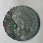
I found this old map and was looking pretty good at it ,are the old buildings on these type maps indian villages or spanish missions /forts... This would almost have to be im thinking indian village,but im not a 100% sure....Its early 1600s,and no spanish forts known to be in the area of these in this timeframe.Thanks for any ,and all help....I take that back.saint augustine would be..
 

Shortstack

Silver Member
Jan 22, 2007
4,305
416
Detector(s) used
Tesoro Bandido II and DeLeon. also a Detector Pro Headhunter Diver, and a Garrett BFO called The Hunter & a Garrett Ace 250.
Primary Interest:
All Treasure Hunting
RD, I think that map was mainly used to record the locations of the main riverways and major bays and inlets that had deep water for their sailing ships. A large town / settlement could be shown on it, but the more detailed maps of just sections of coastlines would have the forts, settlements, and Indian villages.
 

Top Member Reactions

Users who are viewing this thread

Latest Discussions

Top