RGINN
Gold Member
- Oct 16, 2007
- 8,613
- 10,764
- 🏆 Honorable Mentions:
- 1
- Detector(s) used
- White's DFX, White's Classic 1 Coinmaster, Nokta Pointer
- Primary Interest:
- All Treasure Hunting
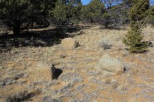
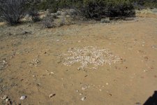
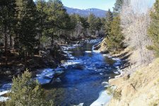
Went down here today and over into the Fourmile Rec area where I camp quite a bit through the winter. Saw where somebody with a lot of free time made a rock circle out of quartz chips. Checked out these three rocks again that are a puzzle to me. They might mean somethin, but no tellin. The nearest rocks of that size are a quarter mile away. The two rocks on the left are about 10ft. apart and on a north-south line. The other rock at 4 o'clock points south east. No tellin if they mean anything at all, but fun to ponder.