Highmountain
Hero Member
I'm starting a new thread on this so I'll have the ability to add key words, which I'm not able to do on the other ghost town thread because I didn't begin it. Seems silly to go to all the trouble of putting this online if it can't be found on search engines. Needs key words for that.
Cross Reference to other Ghost Towns in New Mexico thread:
A few ghost town locations around your state
http://forum.treasurenet.com/index.php/topic,158264.0.html
http://snipurl.com/2aepd [forum_treasurenet_com]
La Parda wild and wooly ghost town link:
http://forum.treasurenet.com/index.php/topic,159240.0.html
http://snipurl.com/2afji [forum_treasurenet_com]
_________________________________________________
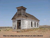
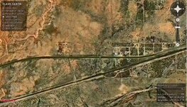
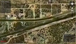
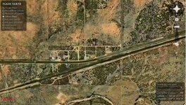
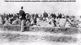
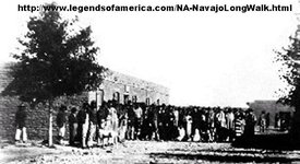
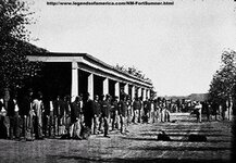
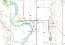
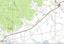
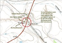
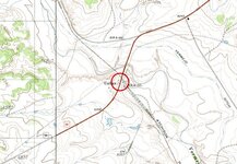
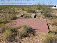
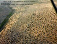
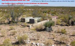
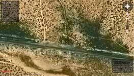
[size=12pt]Taiban - Virgin territory for metal detectorists and relic seekers[/size]
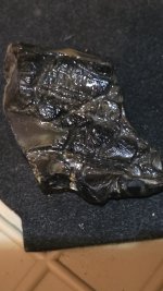
February 1944 the town was obliterated when a munitions train on a siding exploded. As a kid in the 1950s I used to pester the folks every time we passed through there to stop and let me pick around in the debris.
Today nobody much knows about what happened there. Just another dusty place along the highway. Probably there's never been a metal detector passed over it.
http://en.wikipedia.org/wiki/Taiban,_New_Mexico
http://snipurl.com/2a4ec [en_wikipedia_org]
http://www.roadsidethoughts.com/nm/taiban.htm
http://snipurl.com/2a4eg [www_roadsidethoughts_com]
http://www.aviationarchaeology.com/src/AARmonthly/Feb1944S.htm
http://snipurl.com/2a4ei [www_aviationarchaeology_com]
440205 AT-17C 42-13821 1148TEFTS Ft Sumner AAF, Ft Sumner, NM TACGC 3 Borron, Lee E USA NM Taiban Aux Field, NM
Cross Reference to other Ghost Towns in New Mexico thread:
A few ghost town locations around your state
http://forum.treasurenet.com/index.php/topic,158264.0.html
http://snipurl.com/2aepd [forum_treasurenet_com]
La Parda wild and wooly ghost town link:
http://forum.treasurenet.com/index.php/topic,159240.0.html
http://snipurl.com/2afji [forum_treasurenet_com]
_________________________________________________
[size=12pt]Taiban - Virgin territory for metal detectorists and relic seekers[/size]
February 1944 the town was obliterated when a munitions train on a siding exploded. As a kid in the 1950s I used to pester the folks every time we passed through there to stop and let me pick around in the debris.
Today nobody much knows about what happened there. Just another dusty place along the highway. Probably there's never been a metal detector passed over it.
http://en.wikipedia.org/wiki/Taiban,_New_Mexico
http://snipurl.com/2a4ec [en_wikipedia_org]
http://www.roadsidethoughts.com/nm/taiban.htm
http://snipurl.com/2a4eg [www_roadsidethoughts_com]
http://www.aviationarchaeology.com/src/AARmonthly/Feb1944S.htm
http://snipurl.com/2a4ei [www_aviationarchaeology_com]
440205 AT-17C 42-13821 1148TEFTS Ft Sumner AAF, Ft Sumner, NM TACGC 3 Borron, Lee E USA NM Taiban Aux Field, NM


Attachments
-
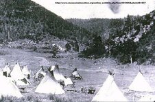
 Taiban Church.jpg33.4 KB · Views: 1,672
 -
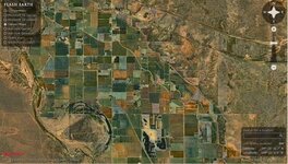
 Taiban FE 3.jpg268 KB · Views: 1,486
 -
 Taiban FE 2.jpg66.5 KB · Views: 1,527
 -
 Taiban FE 1.jpg87.3 KB · Views: 1,455
 -
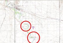
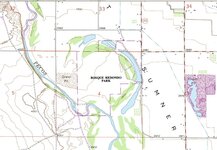
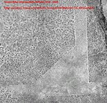
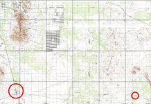
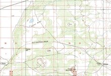
 Taiban topo3.jpg79.4 KB · Views: 1,461
 -
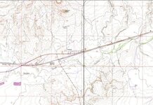 Taiban topo2.jpg77.7 KB · Views: 1,493
 -
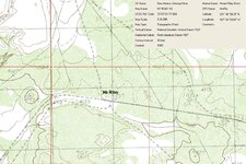
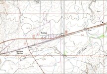 Taiban topo1.jpg76.4 KB · Views: 1,548
 -
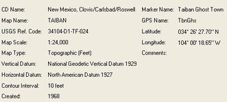 Taiban Longitude Latitude.jpg19.6 KB · Views: 1,450


 Either way its cool to drive through and see!