Welcome guest, is this your first visit?
Member
Discoveries
 
Results 1 to 3 of 3
  1. #1
    us
    Feb 2008
    ROSWELL, NEW MEXICO
    Whites MXT-Fisher 2 box & others
    12
    Prospecting

    Massacre Peak near Akela exit off I-10

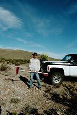
    I have made an interesting find near the old Butterfield stage road in the area of Massacre Peak off I-10 near
    the Akela exit. Does anyone know why they call this Massacre Peak or have any knowledge about a buried
    cache near the Butterfield stage road? I have not been able to find any information about this area from my
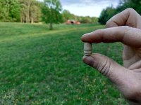
    own research. I am now willing to share ( by written contract) my site with anyone who can contribute some real info or documentation. I don't need a partner, but I will share find with anyone who has some information that will help in this recovery. I need to know where the graves from the massacre are located? I have found some already...I need more.
    Does anyone have information? Please don't POST anything...just give me your contact information.
    Thanks
    Attached Thumbnails Attached Thumbnails Massacre Peak near Akela exit off I-10-06194_14.jpg  

  2. #2
    pw
    Apr 2003
    New Mexico
    BS
    1,668
    2 times

    Re: Massacre Peak near Akela exit off I-10

    The entire Butterfield Trail route from Mesilla through to Doubtful Canyon at the AZ line was prime ambush country by the Apache when the stage route was in operation. Your Massacre Peak, just like the Massacre Peak 20 miles further west, was presumably named in remembrance of a such an ambush. There are scores of graves along the way - usually marked by piles of rocks alongside the trail, some prominent, most vague and obscure. The survivors buried the victims where they fell and moved on. The short stretch between Fort Cummins and Pony Hill, called Cookes Canyon (including the west MP), is riddled with ambush sites and graves - a total 400 reported deaths in there. I'm not sure which incident resulted in the naming of your MP - might be diffcult/impossible to document. There could be, probably are, additional graves in the area that are not associated with your MP incident and are unknown to history. Interesting country there in the Good Sight and Uvas ranges, including a number of good petroglyph sites. Try talking to some of the local ranchers in the area - if their families have been there long enough, they may know something. Good luck.
    Those are my principles, and if you don't like them... well, I have others.
    Marx

  3. #3

    Apr 2005
    Southern N.M.
    30

    Re: Massacre Peak near Akela exit off I-10

    It was named after an incident when a group of soldiers who had been sent out to rescue a stage was run up the hill and held up there until they either chose to starve, or tried to fight their way out. They held out as long as they could but eventually decided to try and make a break for it by dark. They were ambushed coming down, picked off like flies and left where they dropped. There is a record of the graves that are in the area but the graves are all protected by law. The soldiers were taken back for burial.
    No way,,, more twisted wire?


Sponsors

Posting Permissions

  • You may not post new threads
  • You may not post replies
  • You may not post attachments
  • You may not edit your posts
  •  

Search tags for this page

apahe flats massacre peak petroglyphs
,

massacre peak new mexico

Click on a term to search for related topics.
Powered by vBadvanced CMPS v4.1.3