Is Oak Island the location of the third Temple of Solomon?

Rebel - KGC

Gold Member
Jun 15, 2007
21,680
14,739
Okay, I see the misunderstanding, the fault lies in the reference to the "Temple of Solomon". Actually it was what was in the Temple of Solomon and was also the Tabernacle of Moses. It ead a perfect cubed room called the Holy of Holies. This is where the Ark of the Covenant was kept and was believed that the new Holies of Holy would be built to the distant west. Correct me if I'm wrong and I know you will Rebel, the Temple of Solomon was suposidly built by the Masons.
There was one more thing that I read and I'm still working on this is the tribe of Levi, the keepers of the Ark asigned by God later became the "Catholic Church". Weather it's true or not i'm still looking. Reb, i'm steping off the path a minute, have you looked at the map in Harold Wilkins book, "captain kidd and his skeleton Island"?

Harold T. Wilkins is/was a good Brit writer; I have his books on Flying Saucers, South American "Mysteries"; NOT the book on Capt. Kidd (WILL look for it, tho...).
 

Last edited:
O

Old Silver

Guest
There was one more thing that I read and I'm still working on this is the tribe of Levi, the keepers of the Ark asigned by God later became the "Catholic Church". Weather it's true or not i'm still looking.

No sir, that was a group of individuals who split off from the early church (the real church), and ended up forming the first denomination. It had nothing to do with any of the tribes of Israel.
 

Smithbrown

Bronze Member
May 22, 2006
1,002
834
I don't think that Harold Wilkins is the most reliable of authors. I would worry if he is your main source.
 

Rebel - KGC

Gold Member
Jun 15, 2007
21,680
14,739
I don't think that Harold Wilkins is the most reliable of authors. I would worry if he is your main source.

LOL! ANYWAY, here is the map, I was alluding to; just "google" Oak Island Money Pit Mysteries: unexplainedmysteries.com HH!
 

Last edited:
OP
OP
T

treasure1822

Hero Member
Dec 9, 2010
521
238
It's not his writing that I am concerned with. It's only the map, see when asked by Gilbert Hedden, Wilkens first said he made it up. But when asked about the text, writen on the map he had told Gilbert that he had seen it in a private collection of Captain kidd artifacts in Britain.Gilbert check and the map matched non of the artifacts the collector had. Wilkins finally said he must had seen the map in the British museum.
 

Smithbrown

Bronze Member
May 22, 2006
1,002
834
There is no real evidence the map ever existed. No other person ever saw it, no photograph was ever taken. Wilkins changed his story so often, how can you be sure any of them were true?
 

OP
OP
T

treasure1822

Hero Member
Dec 9, 2010
521
238
I have contacted the British museum, who in turn had differed me to the British liabrary. They told me that I would have to hire one ofe their reserchers to go through their collections and I just have the resorces for that.
Granted Wilkins had changed his story but it may have been to protect his credibility even though if gives more questioning to it.
I also understand that no one had seen the orignal map, but no has seen the encypted stone found in the pit at 90 feet or the gold chain.
When people look at the map they see the details within the island and the referrence to the west indies and asure themselves that this is not a map of Oak Island.
When I see the map, I see a copy of a map where the perimeter shape resembles Oak Island and has writen text that coralates to known man made feature of Oak Island. I also see features added to sell a book about Captain Kidd. Look at the text, it is upside down to the referrence to the compass. Think about that, if you orient the map so north is up the dirrectional text is up side down. But even more then that it backwards.
 

OP
OP
T

treasure1822

Hero Member
Dec 9, 2010
521
238
I have said this many time and will keep saying it, to retrace someones steps you need to go backwards. Read the text backwards, start with "7 by 8 by 4". Have you ever heard the phrase to er is human. Well we need to forgive Wilkins for a less than acurate redition of the map that he copied from. The things set in stone are the things that don't change. Look at the "Boat Stone", that was found in Westford Mass. The number on that stone is "184", and that is in referrence to "Leagues".
 

Dave Rishar

Silver Member
Mar 6, 2008
3,212
3,256
WA
Detector(s) used
Tesoro Vaquero, XP Deus, Vallon Gizmo
Here's a question: would 14th century Europeans be using Indo-Arabic numerals or Roman numerals?

Just something to kick around.
 

OP
OP
T

treasure1822

Hero Member
Dec 9, 2010
521
238
Well let's see if I can explain it right. European were still using the roman numeral system after the fall of the Roman Empire. The Hindu Arabic numeral system was introduced to the Europeans at about 1000 AD. It was actually used by scholars by 1100 AD so I will say it was a standard in education by the 14th century. One of the writen anomolies at that time was the open top "8". Actually from what I understand the proper term for the Hindu Arabic numerals that we use is "European Numerals".
 

Dave Rishar

Silver Member
Mar 6, 2008
3,212
3,256
WA
Detector(s) used
Tesoro Vaquero, XP Deus, Vallon Gizmo
Well let's see if I can explain it right. European were still using the roman numeral system after the fall of the Roman Empire. The Hindu Arabic numeral system was introduced to the Europeans at about 1000 AD. It was actually used by scholars by 1100 AD so I will say it was a standard in education by the 14th century. One of the writen anomolies at that time was the open top "8". Actually from what I understand the proper term for the Hindu Arabic numerals that we use is "European Numerals".

1. Correct.
2. Correct.
3. Essentially correct, although we're only talking about a few scholars, not many. Incorrect on the second part unless one were studying in North Africa.
4. I'm not aware of an open-topped 8.
5. We're now getting into semantics, but as this numbering system originated in India and was brought to Europe by the Arabs, I would have to say that this is incorrect.

To return to the introduction and adoption of Arabic numbers, it wasn't an easy transition. Note that over one thousand years later, we still use Roman numerals for certain things, even though it's an inferior system.

However, the main question is whether or not some former Templars or Templar affiliates in the late 14th century knew this. The answer is maybe. It's plausible. However, remember that the prime advantage of the Indo-Arabic number system is in mathematics; for anyone besides a mathematician or an astronomer (later on), there would be little if any advantage to switching. This is probably why it took so long to gain acceptance in Europe, and why the Arabic world eagerly adopted it. I suspect that this is also why we still use Roman numerals for the things that we do - no math required.

If they did know it, which numerals would they use for an inscription on a stone?
 

OP
OP
T

treasure1822

Hero Member
Dec 9, 2010
521
238
In the authentification of the "Boat Stone", one of the identifiers was the open ended "8" that was said to be used in late 14th- early 15th. As for which number they would use, I don't know if that's a loaded question but the logical answer would be the one or more numbers needed to convey their thought. In the case of the "Boat Stone" it was "184" and the unit of measure was "leagues". A "leaque" in itself is the distance a person could travel in an hour. The range for distance is 2.4 to 4.6 miles per league. So if you were to walked north along the east coast from Westford Mass. to the shores off Oak Island Nova Scotia, keeping the shore to your right, it would be about a 3 week walk providing everything went well.
Anyways as I was saying, 1 8 4 were used on the stone and the other signafier was on the map but do to a error on Wilkins part he had misread the
original map so instead of a "1" he wrote a "7". 7 by 8 by 4 was on the copy of the map. It should have been 1 by 8 by 4. Those two way of writing that number was the way to link them together.
 

OP
OP
T

treasure1822

Hero Member
Dec 9, 2010
521
238
In Westford Mass. not to far from the carving of the "Westford Knight", a stone was unearthed durring a road construction. One of the workers was so intrigued by it he had taken it home and had it in his garage. I believe for like 30 plus years. It now sits in a little museum in Westford. On the stone there is a ship, some believe it to represent a late 14th century ship. I believe it to represent a costal location(undefined). There is also a arrow (Native American) at what I would consider pointing down or south if I had to orient myself north as in a map. And last thing, the numbers 184 but the 8 is open at the top. The believe the stone to be carved the later part of the 14th century to the early part of the 15th century.
 

Dave Rishar

Silver Member
Mar 6, 2008
3,212
3,256
WA
Detector(s) used
Tesoro Vaquero, XP Deus, Vallon Gizmo
In the authentification of the "Boat Stone", one of the identifiers was the open ended "8" that was said to be used in late 14th- early 15th. As for which number they would use, I don't know if that's a loaded question but the logical answer would be the one or more numbers needed to convey their thought. In the case of the "Boat Stone" it was "184" and the unit of measure was "leagues". A "leaque" in itself is the distance a person could travel in an hour. The range for distance is 2.4 to 4.6 miles per league. So if you were to walked north along the east coast from Westford Mass. to the shores off Oak Island Nova Scotia, keeping the shore to your right, it would be about a 3 week walk providing everything went well.

The "8" on the stone looked fine to me, but the number also looked like 1184. I haven't seen it in person, so I can't really judge it. I can find no reference stating that 8 was open-ended during the 14th-15th century. If you have a solid reference discussing this, I would be obliged if you could direct me to it. As much as I hate mathematics, I enjoy reading about where numbering systems come from.

I'm not sure that Westford would have been a good place for a marker. How would anyone have found it?

westford.jpg

That's about 60 miles from the ocean, and a mile or two from the nearest river. If someone had to find this in order to find that in order to find the other thing, why stick it out in the middle of nowhere where it couldn't be found? Why not put it on the coast where there was at least a chance of it not being missed? It's important that the right people find this, right?

What were the people who supposedly made those markings even doing out there?
 

Eldo

Banned
Jul 7, 2014
1,890
698
Vermont
Detector(s) used
Brain, Pointing Finger, occasionally the Pinky Finger
Primary Interest:
All Treasure Hunting
There is no real evidence the map ever existed. No other person ever saw it, no photograph was ever taken. Wilkins changed his story so often, how can you be sure any of them were true?

Not the only map
View attachment 1033136
View attachment 1033137

Aspotogan is the location of the second Acadia location of caches.....just located the entire outline of the pirate skull map on the skull stone and matched every point perfectly.....

this one is spooky........like an apparition of a ghost that appears when you line the stone engraving over the terrain....they were some of the most skilled map makers without any overhead images....look how closely they line up

View attachment 1033138
 

Eldo

Banned
Jul 7, 2014
1,890
698
Vermont
Detector(s) used
Brain, Pointing Finger, occasionally the Pinky Finger
Primary Interest:
All Treasure Hunting
View attachment 1033149

Thats an X cut into something, visible from the ridge. and is planted there as a marker for either the treasure trove location, or the starting point from the movements deciphered from the stone.
 

Eldo

Banned
Jul 7, 2014
1,890
698
Vermont
Detector(s) used
Brain, Pointing Finger, occasionally the Pinky Finger
Primary Interest:
All Treasure Hunting
View attachment 1033152

This Skull is outlined in the terrain as is the mouth and the ridge lines......there is a cave on the other side of the hill from the deep cove......this x is unmistakeable as is the shape of the "cut" through the valley there, and the fact that is appears to be stating he cut an " X " out of the thicket in the drawing.....shows up on the map is very strange....

if you superimpose the carving over the terrain you get an amazing likeness that actually looks like a ghost speaking as you rotate the picture off its alignment slightly//////

its that accurate....

its either in this cave on the hill dug in and buried in.....or its to the east in the field somewhere.....prolly have the same cross that is on the oak island laid out here somewhere.....

In fact.....the cross on Oak Island is the map to get you to the heartstone, I think.......but it is used to measure this distance first......then to travel to the peninsula to open the final tomb of the Beloved by following the clues they left in the works of shakespeare.
 

Justintime

Bronze Member
Dec 15, 2011
1,164
345
Central, Alabama
Detector(s) used
AT Pro,Pro pointer, TRX,Whites Spectrum XLT, Whites Beachhunter ID, whites bullseye ll pinpointer
Primary Interest:
Other
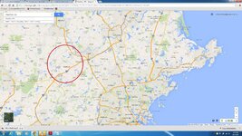
Screenshot_2014-08-13-22-27-26_1.jpg .I think the Third Temple will be in America. I believe Oak Island area was the holding area when treasure was being brought over. The treasure was not safe all together, so it was separated, 144 different caches, everything needed for New Atlantis, New Jerusalem. Somehow, Bacon got the scrolls, to the cache locations. Just my opinion, thanks Justintime
 

Top Member Reactions

Users who are viewing this thread

Top