diginforthepast221
Newbie
- Dec 24, 2008
- 4
- 0
here are some things i found intresting, im new to the hobby just recently obtained my dads metal dector god rest his soul, i know its not really a good dectector but ive been told its good to start with, its a pr200dr pros[ector, but here is some great info about my town
Eighteenth century
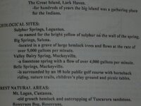
In the early 18th century, the Six Nations of the Iroquois, headquartered in New York, ruled the Indian tribes of Pennsylvania, including those who lived near what would become Lock Haven. Indian settlements in the area included three Munsee villages on a 325 acre (1.32 km²) island, known as the Great Island, in the West Branch Susquehanna River at the mouth of Bald Eagle Creek. During the French and Indian War (1754–63), colonial militiamen on a military expedition to an Indian stronghold in the village of Kittanning, 44 miles (71 km) northeast of Pittsburgh, destroyed Indian property on the Great Island and along the West Branch. By 1763, the Indians had abandoned the Great Island and other villages in the area.n 1768, the British bought lands south of the West Branch from the Iroquois through the Treaty of Fort Stanwix. However, white settlers continued to appropriate land, including land in and near the future site of Lock Haven, that was not covered by the treaty. In 1769, Cleary Campbell, the first white settler in the area built a log cabin near the present site of Lock Haven University of Pennsylvania, and by 1773, William Reed had built a cabin surrounded by a stockade and called it Reed's Fort.[6] It was the westernmost of 11 mostly primitive forts along the West Branch; Fort Augusta, at what is now Sunbury, was the easternmost and most defensible. In response to settler incursions, and encouraged by the British after the start of the American Revolution (1775–1783), Indians attacked colonists and their settlements along the West Branch. In 1778, Fort Reed and the other white settlements in the area were abandoned during a general evacuation known as the Big Runaway. Hundreds of people fled along the river to Fort Augusta, about 50 miles (80 km) from Fort Reed. Some did not return for five years.[7] In 1784, the United States and the Iroquois signed a separate Treaty of Fort Stanwix transferring all remaining Indian territory in Pennsylvania to the state.
Nineteenth century
Lock Haven prospered during much of the 19th century largely because of timber and transportation. The forests of Clinton County and other counties upriver held a huge supply of white pine and hemlock as well as oak, ash, maple, poplar, cherry, beech, and magnolia. The wood was used locally for such things as frame houses, shingles, canal boats, and wooden bridges, and whole logs were floated to Chesapeake Bay and on to Baltimore to make spars for ships. Log driving and log rafting, competing forms of transporting logs to sawmills, began along the West Branch around 1800. By 1830, "the lumber industry was in full swing".[8]
Canal monument incorporating old lock in downtown Lock Haven
Authorized by the Pennsylvania General Assembly, the West Branch Canal opened in 1834 and soon ran 73 miles (117 km) from Northumberland to Farrandsville, about 5 miles (8 km) upstream from Lock Haven. A state-funded extension called the Bald Eagle Cut ran from the West Branch through Lock Haven and Flemington to Bald Eagle Creek. A privately-funded extension, the Bald Eagle and Spring Creek Navigation, eventually reached Bellefonte, 24 miles (39 km) upstream. Lock Haven's founder, Jeremiah Church, and his brother, Willard, chose the town site in 1833 partly because of the river, the creek, and the canal. Church named the new town Lock Haven because it had a canal lock and because it was a resting place for loggers, boatmen, and other travelers. Over the next quarter century, canal boats 12 feet (4 m) wide and 80 feet (24 m) long carried passengers and mail as well as cargo such as coal, ashes for lye and soap, firewood, food, furniture, dry goods, and clothing. A rapid increase in Lock Haven's business and population followed the opening of the canal.[9]
A Lock Haven log boom, smaller than but otherwise similar to the Susquehanna Boom at Williamsport, was constructed in 1849. Large cribs of timbers weighted with tons of stone were arranged in the pool behind the Dunnstown Dam, named for a settlement on the opposite shore. The piers, about 150 feet (46 m) from one another, stretched in a line from the dam to a point 3 miles (5 km) upriver. Connected by timbers shackled together with iron yokes and rings, the piers anchored an enclosure into which the river current forced floating logs. Workers called boom rats sorted the captured logs, branded like cattle, for delivery to sawmills and other owners. Lock Haven became the lumber center of Clinton County and the site of many businesses related to forest products.[10]
The Sunbury and Erie Railroad, re-named the Philadelphia and Erie Railroad in 1861, reached Lock Haven in 1859, and with it came a building boom. Hoping that the area's coal, iron ore, white pine, and high-quality clay would produce significant future wealth, railroad investors led by Christopher and John Fallon, financed a line to Lock Haven. On the strength of the railroad's potential value to the city, local residents invested heavily in housing, building the largest homes in Lock Haven between 1854 and 1856. Though the Fallons' coal and iron ventures failed, Gothic Revival, Greek Revival, and Italianate mansions and commercial buildings such as the Fallon House, a large hotel, remained, and the railroad provided a new mode of transport for the ongoing timber era. A second rail line, the Bald Eagle Valley Railroad, originally organized as the Tyrone and Lock Haven Railroad and completed in the 1860s, linked Lock Haven to Tyrone, 56 miles (90 km) to the southwest. The two rail lines soon became part of the network controlled by the Pennsylvania Railroad.[11]
During the era of log floating, logjams sometimes occurred when logs struck an obstacle. Log rafts floating down the West Branch had to pass through chutes in canal dams. The rafts were commonly 28 feet (9 m) wide—narrow enough to pass through the chutes—and 150 feet (46 m) to 200 feet (61 m) long.[12] In 1874, a large raft got wedged in the chute of the Dunnstown Dam at Lock Haven and caused a jam that blocked the channel from bank to bank with a pile of logs 16 feet (5 m) high and trapped, in addition to loose logs, another 200 log rafts, and two canal boats, The Mammoth of Newport and The Sarah Dunbar.[13]
In terms of board feet, the peak of the lumber era in Pennsylvania arrived in about 1885, when about 1.9 million logs went through the boom at Williamsport. These logs produced a total of about 226 million board feet (533,000 m³) of sawed lumber. After that, production steadily declined throughout the state, including Lock Haven.[12]
The Central State Normal School, established to train teachers for central Pennsylvania, held its first classes in 1877 at a site overlooking the West Branch Susquehanna River. The small school, with enrollments below 150 until the 1940s, eventually became Lock Haven University of Pennsylvania.[14] In the early 1880s, the New York and Pennsylvania Paper Mill in Castanea Township near Flemington and Lock Haven began paper production on the site of a former sawmill; the paper mill remained a large employer until the end of the 20th century.
Twentieth century
Bird's-eye view from a postcard sent in 1911
As older forms of transportation such as the canal boat disappeared, new forms arose. One of these, the electric trolley, began operation in Lock Haven in 1894. The Lock Haven Electric Railway, managed by the Lock Haven Traction Company and, after 1900, the Susquehanna Traction Company, ran passenger trolleys between Lock Haven and Mill Hall, about 3 miles (5 km) to the west. The trolley line extended from the Philadelphia and Erie Railroad station in Lock Haven to a station of the Central Railroad of Pennsylvania, which served Mill Hall. The route went through Lock Haven's downtown, close to the Normal School, across town to the trolley car barn on the southwest edge of the city, through Flemington, over the Bald Eagle Canal and Bald Eagle Creek, and on to Mill Hall via what was then known as the Lock Haven, Bellefonte, and Nittany Valley Turnpike. Plans to extend the line from Mill Hall to Salona, 3 miles (5 km) miles south of Mill Hall, and to Avis 10 miles (16 km) northeast of Lock Haven, were never carried out, and the line remained unconnected to other trolley lines. The system, always financially marginal, declined after World War I. Losing business to automobiles and buses, it ceased operations around 1930.[15]
In 1937, William T. Piper, Sr., built the Piper Aircraft Corporation factory in Lock Haven after the company's Taylor Aircraft manufacturing plant in Bradford, Pennsylvania, was destroyed by fire. The Piper plant in Lock Haven began operations in a building that once housed a silk mill.[16] As the company grew, the original factory expanded to include several additions, an engineering building, and an office building. In 1984, the company, then owned by Lear-Siegler, ceased operations in Lock Haven and moved to Vero Beach, Florida. A non-profit corporation bought the former Piper engineering building in 1995 to create the Piper Aviation Museum.[17]
The Central State Normal School was acquired by the state of Pennsylvania in 1915 and was renamed Lock Haven State Teachers College in 1927. Between 1942 and 1970, the student population grew from 146 to more than 2,300, the number of teaching faculty rose from 25 to 170, and the college carried out a large building program. In 1960, the school's name was changed to Lock Haven State College, and its emphasis shifted to include the humanities, fine arts, mathematics, and social sciences, as well as teacher education. In 1983, the school's name was changed again to Lock Haven University of Pennsylvania. The school opened a branch campus in Clearfield, 48 miles (77 km) west of Lock Haven, in 1989.[14]
[edit] Floods
The streams of Pennsylvania have frequently flooded since at least the advent of written records. According to William H. Shank, the Indians of Pennsylvania warned white settlers that great floods occurred on the Delaware and Susquehanna rivers every 14 years. Shank tested this idea by tabulating the highest floods of record at key points throughout the state over a 200-year period and found that a major flood had occurred, on average, once every 25 years between 1784 and 1972. Major floods recorded at Harrisburg, on the main stem of the Susquehanna about 120 miles (193 km) miles downstream from Lock Haven, occurred in 1784, 1865, 1889, 1894, 1902, 1936, and 1972. Readings from the Williamsport gage station, 24 miles (39 km) miles below Lock Haven on the West Branch of the Susquehanna, showed major flooding between 1889 and 1972 in the same years as the Harrisburg station; in addition, a major flood occurred on the West Branch at Williamsport in 1946.[18]
One of the biggest floods in Lock Haven occurred in 1889 and coincided with the Johnstown Flood. On June 1, the flooding Susquehanna demolished Lock Haven's log boom, and millions of feet of stored timber were swept away.[19] The flood damaged the canals, which were subsequently abandoned, and destroyed the last of the canal boats based in the city.[20]
The most damaging Lock Haven flood was caused by the remnants of Hurricane Agnes in 1972. The storm, just below hurricane strength, made landfall on June 22 near New York City. The storm merged with a non-tropical low on June 23, and the combined system affected the northeastern United States until June 25. The combination produced widespread rains of 6 inches (15 cm) to 12 inches (30 cm) with local amounts up to 19 inches (48 cm) inches in western Schuylkill County, about 75 miles (121 km) southeast of Lock Haven.[21] At Lock Haven, the flood greatly damaged the local paper mill (formerly the New York and Pennsylvania Paper Mill, bought by the Hammermill Paper Company, and later acquired by International Paper) and the factory and airplanes of Piper Aircraft. Piper permanently ended production of the Comanche and Twin Comanche because of the destruction of tooling.
In 1992, Federal, state, and local governments began construction of barriers to protect the city. The project included a levee of 36,000 feet (10,973 m) and a floodwall of 1,000 feet (305 m) along the Susquehanna River and Bald Eagle Creek, closure structures, ponding areas, a pumping station, and some relocation of roads and buildings. Completed in 1995, it protected the city from high water in 1996 and again 2004, when rainfall from the remnants of Hurricane Ivan threatened the city.[22]
Eighteenth century
In the early 18th century, the Six Nations of the Iroquois, headquartered in New York, ruled the Indian tribes of Pennsylvania, including those who lived near what would become Lock Haven. Indian settlements in the area included three Munsee villages on a 325 acre (1.32 km²) island, known as the Great Island, in the West Branch Susquehanna River at the mouth of Bald Eagle Creek. During the French and Indian War (1754–63), colonial militiamen on a military expedition to an Indian stronghold in the village of Kittanning, 44 miles (71 km) northeast of Pittsburgh, destroyed Indian property on the Great Island and along the West Branch. By 1763, the Indians had abandoned the Great Island and other villages in the area.n 1768, the British bought lands south of the West Branch from the Iroquois through the Treaty of Fort Stanwix. However, white settlers continued to appropriate land, including land in and near the future site of Lock Haven, that was not covered by the treaty. In 1769, Cleary Campbell, the first white settler in the area built a log cabin near the present site of Lock Haven University of Pennsylvania, and by 1773, William Reed had built a cabin surrounded by a stockade and called it Reed's Fort.[6] It was the westernmost of 11 mostly primitive forts along the West Branch; Fort Augusta, at what is now Sunbury, was the easternmost and most defensible. In response to settler incursions, and encouraged by the British after the start of the American Revolution (1775–1783), Indians attacked colonists and their settlements along the West Branch. In 1778, Fort Reed and the other white settlements in the area were abandoned during a general evacuation known as the Big Runaway. Hundreds of people fled along the river to Fort Augusta, about 50 miles (80 km) from Fort Reed. Some did not return for five years.[7] In 1784, the United States and the Iroquois signed a separate Treaty of Fort Stanwix transferring all remaining Indian territory in Pennsylvania to the state.
Nineteenth century
Lock Haven prospered during much of the 19th century largely because of timber and transportation. The forests of Clinton County and other counties upriver held a huge supply of white pine and hemlock as well as oak, ash, maple, poplar, cherry, beech, and magnolia. The wood was used locally for such things as frame houses, shingles, canal boats, and wooden bridges, and whole logs were floated to Chesapeake Bay and on to Baltimore to make spars for ships. Log driving and log rafting, competing forms of transporting logs to sawmills, began along the West Branch around 1800. By 1830, "the lumber industry was in full swing".[8]
Canal monument incorporating old lock in downtown Lock Haven
Authorized by the Pennsylvania General Assembly, the West Branch Canal opened in 1834 and soon ran 73 miles (117 km) from Northumberland to Farrandsville, about 5 miles (8 km) upstream from Lock Haven. A state-funded extension called the Bald Eagle Cut ran from the West Branch through Lock Haven and Flemington to Bald Eagle Creek. A privately-funded extension, the Bald Eagle and Spring Creek Navigation, eventually reached Bellefonte, 24 miles (39 km) upstream. Lock Haven's founder, Jeremiah Church, and his brother, Willard, chose the town site in 1833 partly because of the river, the creek, and the canal. Church named the new town Lock Haven because it had a canal lock and because it was a resting place for loggers, boatmen, and other travelers. Over the next quarter century, canal boats 12 feet (4 m) wide and 80 feet (24 m) long carried passengers and mail as well as cargo such as coal, ashes for lye and soap, firewood, food, furniture, dry goods, and clothing. A rapid increase in Lock Haven's business and population followed the opening of the canal.[9]
A Lock Haven log boom, smaller than but otherwise similar to the Susquehanna Boom at Williamsport, was constructed in 1849. Large cribs of timbers weighted with tons of stone were arranged in the pool behind the Dunnstown Dam, named for a settlement on the opposite shore. The piers, about 150 feet (46 m) from one another, stretched in a line from the dam to a point 3 miles (5 km) upriver. Connected by timbers shackled together with iron yokes and rings, the piers anchored an enclosure into which the river current forced floating logs. Workers called boom rats sorted the captured logs, branded like cattle, for delivery to sawmills and other owners. Lock Haven became the lumber center of Clinton County and the site of many businesses related to forest products.[10]
The Sunbury and Erie Railroad, re-named the Philadelphia and Erie Railroad in 1861, reached Lock Haven in 1859, and with it came a building boom. Hoping that the area's coal, iron ore, white pine, and high-quality clay would produce significant future wealth, railroad investors led by Christopher and John Fallon, financed a line to Lock Haven. On the strength of the railroad's potential value to the city, local residents invested heavily in housing, building the largest homes in Lock Haven between 1854 and 1856. Though the Fallons' coal and iron ventures failed, Gothic Revival, Greek Revival, and Italianate mansions and commercial buildings such as the Fallon House, a large hotel, remained, and the railroad provided a new mode of transport for the ongoing timber era. A second rail line, the Bald Eagle Valley Railroad, originally organized as the Tyrone and Lock Haven Railroad and completed in the 1860s, linked Lock Haven to Tyrone, 56 miles (90 km) to the southwest. The two rail lines soon became part of the network controlled by the Pennsylvania Railroad.[11]
During the era of log floating, logjams sometimes occurred when logs struck an obstacle. Log rafts floating down the West Branch had to pass through chutes in canal dams. The rafts were commonly 28 feet (9 m) wide—narrow enough to pass through the chutes—and 150 feet (46 m) to 200 feet (61 m) long.[12] In 1874, a large raft got wedged in the chute of the Dunnstown Dam at Lock Haven and caused a jam that blocked the channel from bank to bank with a pile of logs 16 feet (5 m) high and trapped, in addition to loose logs, another 200 log rafts, and two canal boats, The Mammoth of Newport and The Sarah Dunbar.[13]
In terms of board feet, the peak of the lumber era in Pennsylvania arrived in about 1885, when about 1.9 million logs went through the boom at Williamsport. These logs produced a total of about 226 million board feet (533,000 m³) of sawed lumber. After that, production steadily declined throughout the state, including Lock Haven.[12]
The Central State Normal School, established to train teachers for central Pennsylvania, held its first classes in 1877 at a site overlooking the West Branch Susquehanna River. The small school, with enrollments below 150 until the 1940s, eventually became Lock Haven University of Pennsylvania.[14] In the early 1880s, the New York and Pennsylvania Paper Mill in Castanea Township near Flemington and Lock Haven began paper production on the site of a former sawmill; the paper mill remained a large employer until the end of the 20th century.
Twentieth century
Bird's-eye view from a postcard sent in 1911
As older forms of transportation such as the canal boat disappeared, new forms arose. One of these, the electric trolley, began operation in Lock Haven in 1894. The Lock Haven Electric Railway, managed by the Lock Haven Traction Company and, after 1900, the Susquehanna Traction Company, ran passenger trolleys between Lock Haven and Mill Hall, about 3 miles (5 km) to the west. The trolley line extended from the Philadelphia and Erie Railroad station in Lock Haven to a station of the Central Railroad of Pennsylvania, which served Mill Hall. The route went through Lock Haven's downtown, close to the Normal School, across town to the trolley car barn on the southwest edge of the city, through Flemington, over the Bald Eagle Canal and Bald Eagle Creek, and on to Mill Hall via what was then known as the Lock Haven, Bellefonte, and Nittany Valley Turnpike. Plans to extend the line from Mill Hall to Salona, 3 miles (5 km) miles south of Mill Hall, and to Avis 10 miles (16 km) northeast of Lock Haven, were never carried out, and the line remained unconnected to other trolley lines. The system, always financially marginal, declined after World War I. Losing business to automobiles and buses, it ceased operations around 1930.[15]
In 1937, William T. Piper, Sr., built the Piper Aircraft Corporation factory in Lock Haven after the company's Taylor Aircraft manufacturing plant in Bradford, Pennsylvania, was destroyed by fire. The Piper plant in Lock Haven began operations in a building that once housed a silk mill.[16] As the company grew, the original factory expanded to include several additions, an engineering building, and an office building. In 1984, the company, then owned by Lear-Siegler, ceased operations in Lock Haven and moved to Vero Beach, Florida. A non-profit corporation bought the former Piper engineering building in 1995 to create the Piper Aviation Museum.[17]
The Central State Normal School was acquired by the state of Pennsylvania in 1915 and was renamed Lock Haven State Teachers College in 1927. Between 1942 and 1970, the student population grew from 146 to more than 2,300, the number of teaching faculty rose from 25 to 170, and the college carried out a large building program. In 1960, the school's name was changed to Lock Haven State College, and its emphasis shifted to include the humanities, fine arts, mathematics, and social sciences, as well as teacher education. In 1983, the school's name was changed again to Lock Haven University of Pennsylvania. The school opened a branch campus in Clearfield, 48 miles (77 km) west of Lock Haven, in 1989.[14]
[edit] Floods
The streams of Pennsylvania have frequently flooded since at least the advent of written records. According to William H. Shank, the Indians of Pennsylvania warned white settlers that great floods occurred on the Delaware and Susquehanna rivers every 14 years. Shank tested this idea by tabulating the highest floods of record at key points throughout the state over a 200-year period and found that a major flood had occurred, on average, once every 25 years between 1784 and 1972. Major floods recorded at Harrisburg, on the main stem of the Susquehanna about 120 miles (193 km) miles downstream from Lock Haven, occurred in 1784, 1865, 1889, 1894, 1902, 1936, and 1972. Readings from the Williamsport gage station, 24 miles (39 km) miles below Lock Haven on the West Branch of the Susquehanna, showed major flooding between 1889 and 1972 in the same years as the Harrisburg station; in addition, a major flood occurred on the West Branch at Williamsport in 1946.[18]
One of the biggest floods in Lock Haven occurred in 1889 and coincided with the Johnstown Flood. On June 1, the flooding Susquehanna demolished Lock Haven's log boom, and millions of feet of stored timber were swept away.[19] The flood damaged the canals, which were subsequently abandoned, and destroyed the last of the canal boats based in the city.[20]
The most damaging Lock Haven flood was caused by the remnants of Hurricane Agnes in 1972. The storm, just below hurricane strength, made landfall on June 22 near New York City. The storm merged with a non-tropical low on June 23, and the combined system affected the northeastern United States until June 25. The combination produced widespread rains of 6 inches (15 cm) to 12 inches (30 cm) with local amounts up to 19 inches (48 cm) inches in western Schuylkill County, about 75 miles (121 km) southeast of Lock Haven.[21] At Lock Haven, the flood greatly damaged the local paper mill (formerly the New York and Pennsylvania Paper Mill, bought by the Hammermill Paper Company, and later acquired by International Paper) and the factory and airplanes of Piper Aircraft. Piper permanently ended production of the Comanche and Twin Comanche because of the destruction of tooling.
In 1992, Federal, state, and local governments began construction of barriers to protect the city. The project included a levee of 36,000 feet (10,973 m) and a floodwall of 1,000 feet (305 m) along the Susquehanna River and Bald Eagle Creek, closure structures, ponding areas, a pumping station, and some relocation of roads and buildings. Completed in 1995, it protected the city from high water in 1996 and again 2004, when rainfall from the remnants of Hurricane Ivan threatened the city.[22]