triple d
Sr. Member
- Nov 17, 2013
- 488
- 414
- Detector(s) used
- 36" BGT Prospector, 30" BGT Sniper, And related gold prospecting equipment
- Primary Interest:
- Prospecting
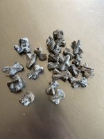
Most of the best mines I have read about. There where chasing the lead and silver deposits.And small amounts of gold. But the same is true. For some reason they stopped mining. I think these veins contain several minerals together. Silver lead and gold. So the cost of prosessing it could be too much. But thats what samples are for. The area I find most of my ore is in the Rangley formation. Even thou its in N.H. I think testing could give you a good idea of what you have. And maybe how much it would be to process it. I thought galena was a cube also. If I knew how to post a picture. Id show you the rock I found in Maine. It has quite a bit of Lead and silver I think. Keep on searching.