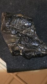
What is it??

Oct 16, 2010
15
7
I have found some of the old spanish trails. Wasnt able to follow it time constraints. Did a google earth on it and see it leads to a rectangular site. No visable buildings, but the site is not normal compared to local vegitation. I've found several of these on google earth, old trails leading to this type site, also have found circular sites. Near one of them I've found arrowheads, pottery shards and stuff. This is located in colorado. Have a whites dfx and would like to take it near them, realizing its on blm and cant take anything older than 50 years. Any thoughts??
 

OP
OP
L
Oct 16, 2010
15
7
Not at this time. Plan on going back next week if the weather gets better. Will take photos and post. Because gold was found in this canyon suspect it was a spanish gold mining operation.
 

Old Dog

Gold Member
May 22, 2007
5,860
397
Western Colorado
Groups of circular marks from Google earth have been used to locate the Native American camps and places where they lived. The circular places are commonly referred to as tepee rings. As to the origins of the square locations they could be a number of things. Only investigation and research on your part will shed light.

Thom
 

OP
OP
L
Oct 16, 2010
15
7
Thanks old dog. I'll take some pic's and post when I return. Tepee rings, never thought of that. Explains it. Wish the outland areas had better resolution on google earth. But, then I'd never have to walk out there. Later.
 

desertmoons

Bronze Member
Apr 16, 2008
1,067
168
If it is out east of the mountains,,could be several things. Settlement, pueblo escapees. A fair amount of traffic twixt NM and that area. Additionally...ah..well let us know what you find :) Like... circles within those rectangles.
Depending on the area..the circles might also be remnants of "kivas." Take some compass readings. Not all kiva structures were part of a village and they are not necessarily near water either.
 

Top Member Reactions

Users who are viewing this thread

Top