Home
Forums
New posts
Top Treasure Finds
Search forums
Members
Current visitors
New profile posts
Search profile posts
What's new
New posts
New threads
New Banner Finds
New media
New media comments
New profile posts
Latest activity
Gallery
New media
New comments
Search media
Top Finds
Charter Member
Upgrade!
Charter Member Stats
Log in
Register
What's new
Search
Search
Everywhere
Threads
This forum
Search titles only
By:
New posts
Top Treasure Finds
Search forums
Members
Current visitors
New profile posts
Search profile posts
Menu
Log in
Register
Navigation
Install the app
Install
More options
Contact us
Close Menu
Home
Forums
Our Discoveries
JavaScript is disabled. For a better experience, please enable JavaScript in your browser before proceeding.
You are using an out of date browser. It may not display this or other websites correctly.
You should upgrade or use an
alternative browser
.
What Is It? 🕵️
Have you found something and need help ID'ing it? Ask here.
Top threads
1
2
3
…
Go to page
Go
3176
Next
1 of 3176
Go to page
Go
Next
Last
Latest updates
Popular
Newest
Unanswered
Unsolved
Filters
Show only:
Loading…
Locked
Sticky
Solved
✅ SOLVED
How to mark your "What Is It" SOLVED -- PHOTO TUTORIAL.
River Rat
Aug 12, 2013
Answers
1
Views
50K
May 8, 2022
Treasure_Hunter
Locked
Sticky
PLEASE READ BEFORE POSTING ITEMS IN "WHAT IS IT?"
PBK
Jul 20, 2009
Answers
1
Views
63K
Jun 28, 2013
River Rat
🔎 UNIDENTIFIED
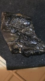
Petrified wood? Why's it got a green opal sheen?
Mazzalani11
Today at 7:56 AM
Answers
2
Views
127
42 minutes ago
Bernitup
B
L
Glass bottle makers mark..?!
LSTROP5190
Today at 6:06 AM
Answers
2
Views
109
Today at 2:00 PM
MuckyBottles
C
Smelting by the river ?
Clonloum123
Today at 8:51 AM
Answers
1
Views
118
Today at 1:33 PM
vpnavy
✅ SOLVED
Military Medal any info appreciated.
HAUNTEDHOUSE
Today at 10:51 AM
Answers
1
Views
119
Today at 11:06 AM
Jack873
J
🔎 UNIDENTIFIED
What is it? Magnifying glass?
Williamsce24
Today at 10:52 AM
Answers
1
Views
112
Today at 11:03 AM
Fentonian
🔎 UNIDENTIFIED
Another unknown found today. Help needed, TIA
Merf
Tuesday at 4:23 PM
Answers
7
Views
415
Today at 10:04 AM
Merf
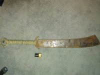
An Interesting Sword
EnvoyToTheMolePeople
Dec 29, 2020
Answers
12
Views
1K
Yesterday at 12:14 PM
Joecoins
🔎 UNIDENTIFIED
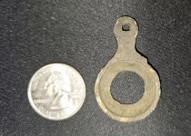
Little help figuring out what these are.....?
Martyo
Tuesday at 3:15 PM
Answers
11
Views
531
Yesterday at 12:11 PM
Martyo
🔎 UNIDENTIFIED
What is this? It’s ornate and flower shaped, maybe pewter or silver plated? Also looks old to me?
DarthYoda333
Yesterday at 8:07 AM
Answers
6
Views
240
Yesterday at 11:01 AM
cudamark
🔎 UNIDENTIFIED
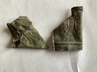
Another whatsit from an early 1900s cavalry camp.
VTSwinger
Monday at 8:16 AM
Answers
4
Views
309
Yesterday at 7:26 AM
VTSwinger
V
✅ SOLVED
Found this while detecting; Not metal
bartholomewroberts
Apr 19, 2024
Answers
10
Views
554
Wednesday at 9:21 PM
bartholomewroberts
🔎 UNIDENTIFIED
Broke Tree Mystery - What Did This ?
Cariboo5
Saturday at 9:20 PM
2
Answers
24
Views
827
Wednesday at 5:47 PM
Almy
🔎 UNIDENTIFIED
Stone artifact?
Maybmeteor
Monday at 9:28 AM
Answers
7
Views
422
Wednesday at 5:41 PM
Almy
🔎 UNIDENTIFIED
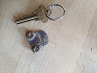
Cap gun handle?
Nathan W
Monday at 5:19 PM
Answers
5
Views
255
Wednesday at 5:11 PM
Nathan W
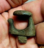
🔎 UNIDENTIFIED
Type of a rein guide?
pepperj
Tuesday at 7:54 PM
Answers
2
Views
240
Wednesday at 5:04 PM
Gare
🔎 UNIDENTIFIED
I keep finding these all over my parent's yard. Ring up as steelish...
PluGGLife
Sunday at 12:14 PM
Answers
6
Views
388
Wednesday at 4:48 PM
Gare
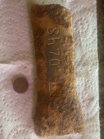
🔎 UNIDENTIFIED
Cast iron piece stamped "Sh 70"
robertk
Wednesday at 4:09 AM
Answers
2
Views
162
Wednesday at 5:26 AM
pepperj
T
What is this??
Travi
Monday at 10:18 PM
Answers
1
Views
213
Tuesday at 3:57 AM
vpnavy
✅ SOLVED
1860 hawksley powder flask , thanks to Deftone
Merf
Monday at 5:05 PM
Answers
3
Views
322
Monday at 9:58 PM
Deftone
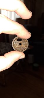
🔎 UNIDENTIFIED
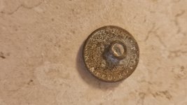
Old Button? I dont know.
Itzzjustwill
Monday at 6:22 PM
Answers
3
Views
168
Monday at 7:39 PM
fyrffytr1
1
2
3
…
Go to page
Go
3176
Next
1 of 3176
Go to page
Go
Next
Last
You must log in or register to post here.
Users who are viewing this forum
Merf
4 minutes ago
Latest Discussions
M
LUE MAP THEORY, MAYBE SOME CONTEXT
Latest: sdcfia
2 minutes ago
Treasure Legends
D
Coins from france
Latest: Mackaydon
7 minutes ago
Coins
THE Random Chat Thread - AKA "The RCT" - No shirt or shoes required - Open 24 / 7
Latest: Oregon Viking
8 minutes ago
General Discussion
I found some... stuff! 🤔
Latest: Bucket Lister
16 minutes ago
Today's Finds! 📅
New and improved "roasterruler" retrieving apparatus.
Latest: Bernitup
26 minutes ago
CoinStar Finds
What language is this?
Latest: Marino13
33 minutes ago
My Daily Snapshot
Home
Forums
Our Discoveries
Top