mofugly13
Full Member
- Joined
- Jan 30, 2015
- Messages
- 198
- Reaction score
- 184
- Golden Thread
- 0
- Location
- San Francisco, Ca
- Primary Interest:
- Prospecting
Hi all. I have been very interested in staking my own gold claim for a long time. Lately, I've really begun to research what it takes, and at this point I have a pretty good idea of what I need to do. I have been using Geocommunicator, LR2000, and the Land Matters mapping tool to get the ball rolling. I have an area that I'm interested in, primarily because a friend married into a family with a claim in this same area, and I have been there. But I am having a hard time deciphering the plat for the area to figure out if it's open to mineral discovery. I found a 'how to read a MTP' on some gov't website, but it isn't entirely clear to me. The areas I am looking at have USFS 'tracts' in them, and these are shown on the MTP with the notation 'MS' which I understand to mean 'Mineral Survey'. But that's all I got. How do I tell if a section is open to discovery?
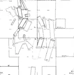
Attached is a clip I captured from the MTP I am looking at. The NW and SW quarters of section 12 is what I'm interested in:

Attached is a clip I captured from the MTP I am looking at. The NW and SW quarters of section 12 is what I'm interested in:

Upvote
0


