- Joined
- Apr 24, 2010
- Messages
- 12,923
- Reaction score
- 27,656
- Golden Thread
- 1
- Location
- Upper Canada 🇨🇦
- 🥇 Banner finds
- 1
- 🏆 Honorable Mentions:
- 3
- Detector(s) used
- XP Deus, Lesche Piranha 35 Shovel & 'Garrett Carrot'
- Primary Interest:
- Relic Hunting
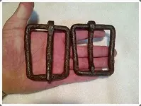
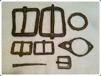
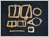
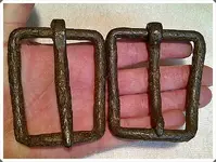
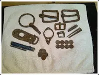
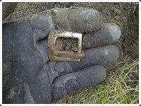
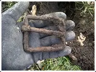
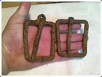
It was a 'buckle' kinda day!
*Update* Before & After pics of cleaned finds at the end of this post!
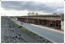
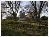
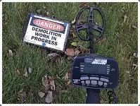
This is a farm that was expropriated by our provincial government for the extension of a toll highway north of Toronto. I last checked the property in September, at that time there were still chickens running around the yard and the house was still occupied. Unfortunately, when I finally went back yesterday the house had already been demolished, it looked fairly recent too. I feel pretty lucky to have found what I did considering the ground had been pretty much leveled by the excavator!
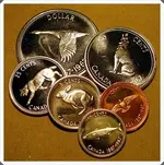
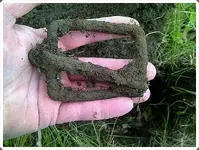
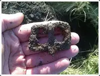
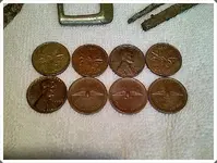
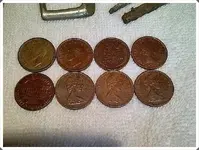
I found all of the older pennies dating from 1940 - 1967 in the same hole, obviously some kids 'life savings'! The older buckles were a nice find, sure wish there would've been some silver here though.
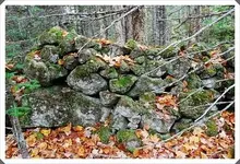
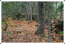
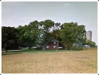
The first shot is up the driveway looking at the barns, the house stood to the right. The second pic is looking through the trees in the front yard to where the house once stood. The third pic is a 'screen shot' from Google Maps of what the house originally looked like.
Thanks for looking and best of luck to all,
Dave
*Update* Before & After pics of cleaned finds at the end of this post!
This is a farm that was expropriated by our provincial government for the extension of a toll highway north of Toronto. I last checked the property in September, at that time there were still chickens running around the yard and the house was still occupied. Unfortunately, when I finally went back yesterday the house had already been demolished, it looked fairly recent too. I feel pretty lucky to have found what I did considering the ground had been pretty much leveled by the excavator!
I found all of the older pennies dating from 1940 - 1967 in the same hole, obviously some kids 'life savings'!
The older buckles were a nice find, sure wish there would've been some silver here though. The first shot is up the driveway looking at the barns, the house stood to the right. The second pic is looking through the trees in the front yard to where the house once stood. The third pic is a 'screen shot' from Google Maps of what the house originally looked like.
Thanks for looking and best of luck to all,
Dave
Attachments
-
 IMG-20131119-03378.webp112.5 KB · Views: 109
 -
 IMG-20131119-03379.webp122.4 KB · Views: 104
 -
 IMG-20131122-03396.webp66 KB · Views: 109
 -
 IMG-20131121-03382.webp81.7 KB · Views: 105
 -
 IMG-20131120-03381.webp68.4 KB · Views: 105
 -
 IMG-20131122-03392.webp62.6 KB · Views: 118
 -
 IMG-20131122-03391.webp77.2 KB · Views: 112
 -
 IMG-20131121-03384.webp121.4 KB · Views: 107
 -
 IMG-20131122-03389.webp102.8 KB · Views: 106
 -
 IMG-20131121-03383.webp104.1 KB · Views: 114
 -
 IMG-20131122-03394.webp71.6 KB · Views: 92
 -
 IMG-20131122-03393.webp73.8 KB · Views: 117
Last edited:
Upvote
4

 I was amazed at the size of these barns as well. I took a walk around the entire structure and saw that it used to be a dairy farm at one point. As far as the buckles go, they're blacksmith made and likely date to the mid-1800's.
 I think a lot of kids collected the 1967 Canadian Centennial year commemorative coins when they first came out, I know I did!