Railroad Stops - I don't have personal knowledged of several of these but they came up in various websearches and the descriptions include coordinates for those difficult to locate:
Altair
Bowen
Pelea
Hachita
Mastodon
Old Hachita
Noria
Minero
Potrillo
Playas
Mount
Riley
Rodeo
Monument
Malpais
Ghosts of the Southline
http://home.swbell.net/lwsumner/ghosts.htm
Ghosts of the Southline Artifacts
http://home.swbell.net/lwsumner/artifacts.htm
Detailed List of Towns and Landmarks along the El Paso and Southwestern Railroad
between El Paso, Texas and Douglas, Arizona
--------------------------------------------------------------------------------
Listed below are all towns and significant landmarks that were located on the portion of the "Southline" between El Paso, TX and Douglas, AZ. Most of this information was obtained from either U.S. Geological Survey maps (mostly from the older 15 minute series) and from other old maps. Mileage and elevation figures were obtained from USGS topographic maps.
--------------------------------------------------------------------------------
Topographic Maps and
Aerial Photographs by
El Paso, Texas - El Paso County - Elev. 3,710
(SeeTopographic Map) (See Aerial Photograph)
USGS: El Paso TX - 7.5 min. series 1955
31°46'01.52"N 106°28'42.78"W
4.2 miles east of Rio Grande Bridge
Bridge over the Rio Grande River - Elev. 3,736
(SeeTopographic Map) (See Aerial Photograph)
USGS: Smeltertown TX/NM - 7.5 min. series 1955 - T29S-R4E-Section15
31°47'13.53"N 106°31'35.93"W
New Mexico / Texas State Line in center of River
0.9 miles east of Bowen Tunnel (mileage from center of river)
4.2 miles west of El Paso, Texas
Bowen Tunnel - Dona Ana County - Elev. 3,860
USGS: Smeltertown TX/NM - 7.5 min. series 1955 - T29S-R4E-Section9 & 16
31°47'34.15"N 106°32'26.01"W
The tunnel was later opened up to form the Bowen Cut. 0.2 mileseast of Bowen (mileage from center of tunnel)
0.9 miles west of Rio GrandeRiver
5.1 miles west of El Paso, Texas
Bowen ,New Mexico - Dona Ana County - Elev. 3,858
(SeeTopographic Map) (See Aerial Photograph)
USGS: Smeltertown TX/NM - 7.5 min. series 1955 - T29S-R4E-Section9
31°47'39.61"N 106°32'40.12"W
On north side of Sierra De Cristo Rey (former Rodadero Peak)
1.9 miles east of Pelea
0.2 miles west of Bowen Tunnel
5.3 miles west of El Paso, Texas
Pelea (Anapra),New Mexico - Dona Ana County - Elev. 3,848
(SeeTopographic map) (See Aerial Photograph)
USGS: Smeltertown TX/NM - 7.5 min. series 1955 - T29S-R4E-Section18
31°47'01.99"N 106°34'00.08"W
Right of way meets the Mexican border at this point. Track is adjacent to SP tracks at this point, crossovers exist. Track starts climbing outof the Rio Grande Valley.
8.7 miles east of Mastodon
1.9 miles west of Bowen
7.5 miles west of El Paso, Texas
Western rim of Rio Grande Valley - Elev. 4,100
(SeeTopographic Map) (See Aerial Photograph)
31°49'35.06"N 106°39'10.06"W
Eastbound trains begin their decent into the Rio Grande Valleyat this point.
3.0 miles east of Mastodon
5.7 miles west of Pelea
Santa Theresa Port of Entry Highway crosses grade
31°49'23.84"N 106°41'03.33"W
0.5 miles east of Mastodon
8.2 miles west of Pelea
Mastodon ,New Mexico - Dona Ana County - Elev. 4,112
(SeeTopographic Map) (See Aerial Photograph)
USGS: Strauss, NM - 7.5 min. series 1955 - T28S-R2E-Section 36
31°49'20.92"N 106°41'31.05"W
10.2 miles east of Noria
8.7 miles west of Pelea
15.9 miles west of El Paso, Texas
Noria ,New Mexico - Dona Ana County - Elev. 4,127
(SeeTopographic Map) (See Aerial Photograph)
USGS: Noria, NM - 7.5 min. series 1985 - T29S-R1E-Section 8
31°48'15.94"N 106°51'42.42"W
Old Borderland Highway is north of tracks. East from this pointit drifts to the north, heading to Strauss, NM on SP Mainline.
8.4 miles east of Potrillo
10.2 miles west of Mastodon
26.1 miles west of El Paso, Texas
Potrillo ,New Mexico - Dona Ana County - Elev. 4,247
(SeeTopographic Map) (See Aerial Photograph)
USGS: Potrillo, NM - 7.5 min. series 1985 - T29S-R2W-Section 12
31°48'03.44"N 106°59'51.86"W
Post Office from 1908 to 1914 Old Borderland Highway is north oftracks. Southern tip of the East Potrillo Mountains are approx. 1 mileto the north.
5.1 miles east of Mount Riley
8.4 miles west of Noria
34.7 miles west of El Paso, Texas
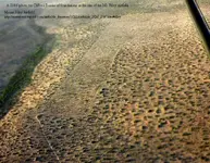
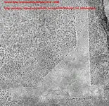
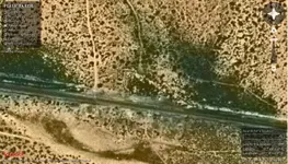
Phoenix/El Paso Airway Emergency Landing Field
Approximatly 3 miles sotheast of Mount Riley townsite
(SeeTopographic Map) (See Aerial Photograph)
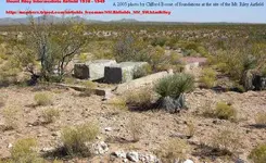
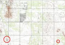
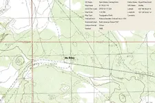
Mount Riley ,New Mexico - Dona Ana County - Elev. 4,109
(SeeTopographic Map) (See Aerial Photograph)
USGS: Mount Riley SE, NM - 7.5 min. series 1985 - T29S-R2W-Section 6
31°48'58.75"N 107°04'53.61"W
Road to the north goes to the Mt. Riley Ranch & to Mt. Riley, Kilborne Hole. Road to the south goes to Riley Airfield & Mexican border.
7.3 miles east of Monument
5.1 miles west of Potrillo
39.6 mles west of El Paso, Texas
Dry Lake Beds - Elev. 4,041
(SeeTopographic Map) (See Aerial Photograph)
USGS: Mount Riley SE, NM - 7.5 min. series 1985 - T29S-R3W-Section12
31°48'21.30"N 107°06'07.61"W
Old Borderland Highway is south of tracks.
5.7 miles east of Monument
1.6 miles west of Mount Riley
Monument ,New Mexico - Dona Ana County - Elev. 4,111
(SeeTopographic Map) (See Aerial Photograph)
USGS: MT. Riley, NM - 15 min. series 1917 - T29S-R3W-Section 18
31°47'20.65"N 107°11'22.35"W
Old Borderland Highway is to south of tracks
3.8 miles east of Malpais
7.3 miles west of Mount Riley
46.9 miles west of El Paso, Texas
Malpais ,New Mexico - Dona Ana County - Elev. 4,128
(SeeTopographic Map) (See Aerial Photograph)
USGS: Camel Mountain, NM - 7.5 min. series 1965 - T29S-R4W-Section98
31°47'57.95"N 107°15'08.88"W
Road to the northeast goes to Guzman's Lookout Mountain Road tothe southwest goes to Birchfield Tank, Camel Mountain & Mexican border.Old Borderland Highway crossed the tracks here. To the east it is southof the tracks, to the west, it is north of the tracks.
11.1 miles east of Arena
3.8 miles west of Monument
50.7 miles west of El Paso, Texas
Dona Ana / Luna County Line
7.9 miles east of Arena
3.2 miles west of Malpais
Indian Basin Road
Goes about 3 miles to the northwest to Indian Basin
6.7 miles east of Arena
4.4 miles west of Malpais
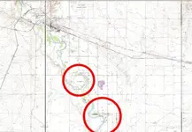
Altair ,New Mexico - Luna County (Exact location unknown)
(SeeTopographic Map) (See Aerial Photograph)
18 (approx.) miles east of Columbus
Arena Stock Tank & Windmill
Just south of tracks
0.7 miles east of Arena
10.4 miles west of Malpais
Arena, New Mexico - Luna County - Elev. 3,959
(SeeTopographic Map) (See Aerial Photograph)
USGS: Coyote Hill, NM - 7.5 min. series 1966 - T29S-R6W-Section12
31°48'06.05"N 107°24'54.07"W
Old Border Highway is on the south side of the tracks
13.5 miles east of Columbus
11.1 miles west of Malpais
61.8 miles west of El Paso, Texas
Mirian, New Mexico - Luna County NM (exact location unknown)
7 (approx.) miles east of Columbus
Columbus, New Mexico - Luna County - Elev. 4,064
(SeeTopographic Map) (See Aerial Photograph)
USGS: Columbus, NM - 7.5 min. series 1965 - T28S-R8W-Section 34
31°49'41.50"N 107°38'23.04"W
Post Office from 1891 to present Old Border Highway is south oftracks, Primitive dirt to the east, paved NM Highway 9 to the west.
7.2 miles east of Mimbres
13.5 miles west of Arena
75.3 miles west of El Paso, Texas
Mimbres, New Mexico - Luna County - Elev. 4,348
(SeeTopographic Map) (See Aerial Photograph)
USGS: Malpais Hill, NM - 7.5 min. series 1965 - T28S-R9W-Section10
31°48'04.30"N 107°45'13.78"W
12.8 miles east of Hermanas
7.2 miles west of Columbus
82.5 miles west of El Paso, Texas
Ford, New Mexico - Luna County (exact location unknown)
Hermanas, New Mexico - Luna County - Elev. 4,453
(SeeTopographic Map) (See Aerial Photograph)
USGS: Hermanas, NM - 7.5 min. series 1964 - T28S-R11W-Section 22
31°51'04.87"N 107°57'10.49"W
Branch Line to Deming connects here. Old Water tank still standingand used by ranchers Post Office from 1903 to 1925
5.1 miles east of Savoya
12.8 miles west of Mimbres
95.3 miles west of El Paso, Texas
Savoya, New Mexico - Luna County Elev. 4,585
(SeeTopographic Map)
USGS: Victorio Ranch SE, NM - 7.5 min. series 1965 - T29S-R12W-Section 1
31°49'09.16"N 108°00'58.83"W
7.6 miles east of Victorio
5.1 miles west of Hermanas
100.4 miles west of El Paso
Victorio, New Mexico - Luna County - Elev. 4,576
(SeeTopographic Map) (See Aerial Photograph)
USGS: Victorio Ranch, NM - 7.5 min. series 1965 - T28S-R13W-Section23
31°51'03.61"N 108°08'09.26"W
5.9 miles east of Continental
7.6 miles west of Savoya
108.0 miles west of El Paso, Texas
Grant / Luna county line
0.5 miles east of Continental
5.4 miles west of Victorio
Continental, New Mexico - Grant County - Elev. 4,707
(SeeTopographic Map) (See Aerial Photograph)
USGS: Hat Top Mountain, NM - 7.5 min. series 1982 - T28S-R14W-Section 12
31°53'11.65"N 108°13'21.73"W
6.4 miles east of Hachita
5.9 miles west of Victorio
113.9 miles west of El Paso, Texas
Hachita ,New Mexico - Grant County - Elev. 4,514
(SeeTopographic Map) (See Aerial Photograph)
USGS: Hachita, NM - 7.5 min. series 1982 - T27S-R15W-Section 36
31°55'08.54"N 108°19'19.52"W
Present town site established in 1902. Post Office from 1882 to 1892, then town moved, Post Office 1902 to present. Junction of Arizona & New Mexico RR to Lordsburg
3.2 miles east of Minero
6.4 miles west of Victorio
120.3 miles west of El Paso, Texas
Minero, New Mexico - Grant County - Elev. 4,519
(SeeTopographic Map) (See Aerial Photograph)
USGS: Hachita, NM - 15 min. series 1918 - T27S-R15W-Section 28
31°55'57.38"N 108°22'27.87"W
4.6 miles east of Vista
3.2 miles west of Hachita
123.5 miles west of El Paso, Texas
(Old)Hachita , New Mexico - Grant County - Elev. 4,850
(SeeTopographic Map) (See Aerial Photograph)
Continental Divide - Elev. 4,648
1.5 miles east of Vista
3.1 miles west of Minero
Vista, New Mexico - Grant County - Elev. 4,679
(SeeTopographic Map) (See Aerial photograph)
USGS: Hachita, NM - 15 min. series 1918 - T27S-R16W-Section 12
31°57'56.77"N 108°25'55.88"W
3.7 miles east of Pothook
4.6 miles west of Minero
128.1 miles west of El Paso, Texas
Continental Divide - Elev. 4,694
3.1 miles east of Pothook
0.6 miles west of Vista
Pothook, New Mexico - Grant County - Elev. 4,553
(SeeTopographic Map) (See Aerial Photograph)
USGS: Hachita, NM - 15 min. series 1918 - T27S-R16W-Section 8
31°58'26.50"N 108°29'32.17"W
5.8 miles east of Playas
3.7 miles west of Vista
131.8 miles west of El Paso, Texas
Hidalgo / Grant County Line
4.0 miles east of Playas
1.8 miles west of Pothook
Playas ,New Mexico - Hidalgo County - Elev. 4,311
(SeeTopographic Map) (See Aerial Photograph)
USGS: Playas Lake North, NM - 7.5 min. series 1982 - T27S-R17W-Section 7
31°58'14.75"N 108°36'31.80"W
Post Office from 1913 to 1918
12.0 miles east of Animas
5.8 miles west of Pothook
137.6 miles west of El Paso, Texas
Continental Divide - Elev. 4,510
1.0 miles east of Antelope
5.4 miles west of Playas
Antelope, New Mexico - Hidalgo County - Elev. 4,496
(SeeTopographic Map) (See Aerial Photograph)
USGS: Beacon Hill, NM - 7.5 min. series 1982 - T27S-R18W-Section18
31°57'22.52"N 108°42'52.45"W
5.6 miles east of Animas
6.4 miles west of Playas
144.0 miles west of El Paso, Texas
Animas, New Mexico - Hidalgo County - Elev. 4,404
(SeeTopographic Map) (See Aerial Photograph)
USGS: Animas, NM - 7.5 min. series 1982 - T27S-R19W-Section 20
31°56'55.67"N 108°48'20.53"W
Established in 1843. Post Office from 1909 to Present
5.4 miles east of Pratt
5.6 miles west of Antelope
149.6 miles west of El Paso, Texas
Pratt, New Mexico - Hidalgo County - Elev. 4,425
(SeeTopographic Map) (See Aerial Photograph)
USGS: Antelope Pass, NM - 7.5 min. series 1982 - T27S-R20W-Section21
31°56'34.46"N 108°53'40.10"W
Post Office from 1905 to 1913.
12.7 miles east of Rodeo
5.4 miles west of Animas
155.0 miles west of El Paso, Texas
Antelope Pass - Elev. 4,410
(SeeTopographic Map) (See Aerial Photograph)
Pass through the Peloncillo Mountains
11.1 miles east of Rodeo
1.6 miles west of Pratt
Apan, New Mexico - Hidalgo County (Exact location unknown)
(SeeTopographic Map) (See Aerial Photograph)
Rodeo ,New Mexico - Hidalgo County - Elev. 4,128
(SeeTopographic Map) (See Aerial Photograph)
USGS: Antelope Pass, NM - 7.5 min. series 1982 - T28S-R21W-Section30
31°50'08.56"N 109°01'54.21"W
Post Office from 1903 to Present
12.7 miles east of Apache
12.7 miles west of Pratt
167.7 miles west of El Paso, Texas
Arizona / New Mexico State Line
10.7 miles east of Apache
2.0 miles west of Rodeo


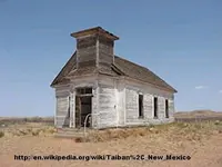 Taiban Church.webp22.1 KB · Views: 1,694
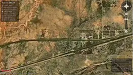 Taiban FE 3.webp261.8 KB · Views: 1,509
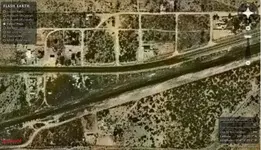 Taiban FE 2.webp58.2 KB · Views: 1,549
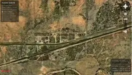 Taiban FE 1.webp84.6 KB · Views: 1,478
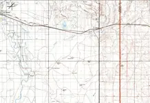 Taiban topo3.webp64 KB · Views: 1,484
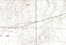 Taiban topo2.webp65.4 KB · Views: 1,515
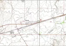 Taiban topo1.webp59.8 KB · Views: 1,567
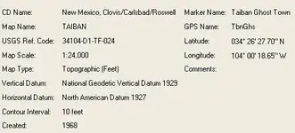 Taiban Longitude Latitude.webp14.7 KB · Views: 1,469
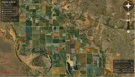


 Either way its cool to drive through and see!