deepskyal
Bronze Member
- Joined
- Aug 17, 2007
- Messages
- 1,925
- Reaction score
- 63
- Golden Thread
- 0
- Location
- Natrona Heights, Pa.
- Detector(s) used
- White's Coinmaster 6000 Di Series 3, Minelab Eq 600
- Primary Interest:
- Metal Detecting
- #1
Thread Owner
Here are some pics you guys may want to explore.
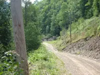
The first pic, where I'm showing a foundation down the road, to the left of the phone pole is a stone chimney and fireplace standing alone. For some reason, I took a pic and it never made it into the camera.
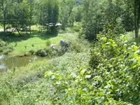
This road is the park road leading down to the base of the dam itself.
Also, there are numerious foot trails made by people along the road.
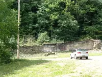
In the old panorama that I'm posting, there were a couple houses in the area unaffected by the flood but are long gone.
If you figure how badly the area was stripped of lumber by the so called "lumber hicks", there had to have been lumber camps somewhere nearby.
Use you imagination...a couple flat areas ....maybe once a house sat? A good place for a camp when they built the dam?
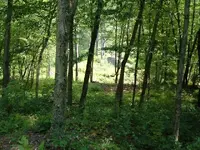
Also...above the large concrete dam, there was a smaller earthen dam which I got pics of.
The first pic, where I'm showing a foundation down the road, to the left of the phone pole is a stone chimney and fireplace standing alone. For some reason, I took a pic and it never made it into the camera.
This road is the park road leading down to the base of the dam itself.
Also, there are numerious foot trails made by people along the road.
In the old panorama that I'm posting, there were a couple houses in the area unaffected by the flood but are long gone.
If you figure how badly the area was stripped of lumber by the so called "lumber hicks", there had to have been lumber camps somewhere nearby.
Use you imagination...a couple flat areas ....maybe once a house sat? A good place for a camp when they built the dam?
Also...above the large concrete dam, there was a smaller earthen dam which I got pics of.