sharing some old files i found

cw0909

Silver Member
Joined
Dec 24, 2006
Messages
4,378
Reaction score
3,238
Golden Thread
0
Primary Interest:
Other
found an old cd, labeled beale most seem corrupted cant open them,heres some maps
that opened,if you want to see them bigger than the enlarge link does,you will have to
get this browser plugin Downloads by Category | LizardTechLizardTech

beale.webpbeale 2.webp

beale
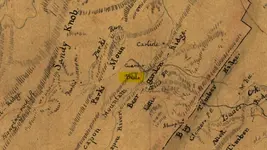
Map of the location of part of the North-Western Turnpike Road
Date:1831 This copy made by Fr. Koch, Richmond, Va. Jan. 27th 1862.
enlarge link
Map of the location of part of the North-Western Turnpike Road /
View catalog record
Library of Congress LCCN Permalink 2005625122
looked at where beale land is now, i think im close
ACME Mapper 2.0

----------------
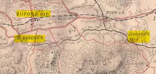
buford to buford.webp

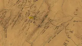
Map of Bedford Co.
Created Published [S.l.] : Chief Engineer's Office, D.N.V., [1864].
Map of Bedford Co.
Map of Bedford Co.

----------------
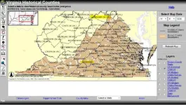
hampshire beale 1830.webpold and new conty line.webp

" + theTitle + "
 

FIRST map is today's Rt. 50, from Winchester, Va. (Frederick County), into West Virginia (ALL part of Virginia prior to CONFEDERATE WAR, as shown in bottom 2 maps.
 

im going to take the cd to a freinds, that still has a puter running XP,to see if i can open the files
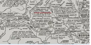
i think sort of remember one of the files, is a search we did back in the late 80s, near the zion church
in the far right of this map,above and to the left of the far right bufords


Mt. Zion Church is a "rumored" location of "BT"...
 

On the North side of Rt. 460 WEST (towards Montvale) on a hill, the church grave yard was a "site of interest"; V & T Rail Road came through and portions of the graveyard was moved/shifted. NO "BT" was found; hope this "triggers" YOUR memory...
 

On the North side of Rt. 460 WEST (towards Montvale) on a hill, the church grave yard was a "site of interest"; V & T Rail Road came through and portions of the graveyard was moved/shifted. NO "BT" was found; hope this "triggers" YOUR memory...

couldnt open files,found out some of the files are win office 2000, maybe i can fnd a copy
i think we looked about a 3rd mile E maybe W of here...... http://goo.gl/maps/s1QPt
seems less trees E...... http://goo.gl/maps/yS1iI
same W, i remember trying to remap creek....... http://goo.gl/maps/jSnWU
 

Last edited:
Last edited:
Last edited:
i think img will load now,and a link to the area today
ACME Mapper 2.1

Screenshot.webp
 

my friend opened another file, it reads....
-----------------------------

Deed, John Mays to William B. Lynch, 1819 Lynchburg Deed Book E, page 378
William B. Lynch bought property near Morriss @ link

http://files.usgwarchives.net/va/lynchburg/deeds/m200l520.txt
-----------------------------
and i looked around and i must have found it through this search engine

Virginia USGenWeb Archives Project Search

long txt @link here is some of it
---------------------------------------
the said William B. Lynch his heirs andassigns forever a certain piece ofground lying and being within the Corporation of Lynchburg and bounded asfollows Viz beginning onfifth alley one hundred feet from its juncture with eleventh street atRobert (Moris, Mariss?) Moris's cornerand running with Morriss's line south 38 east eighty two and a half feetthen at right angles north 52degrees east thirty two feet thence at right angles north 38 degrees westthirty-two and a half feet to fifthalley and then with fifth alley north fifty two degrees west thirty-two feetto the beginning being the lotbought by said Mays of William B. Lynch and the one bought by William B.Lynch of James W. (Dibell,
--------------------------
link to the txt file
http://files.usgwarchives.net/va/lynchburg/deeds/m200l520.txt
 

Last edited:
my friend opened another file, it reads....
-----------------------------

Deed, John Mays to William B. Lynch, 1819 Lynchburg Deed Book E, page 378
William B. Lynch bought property near Morriss @ link

http://files.usgwarchives.net/va/lynchburg/deeds/m200l520.txt
-----------------------------
and i looked around and i must have found it through this search engine

Virginia USGenWeb Archives Project Search

long txt @link here is some of it
---------------------------------------
the said William B. Lynch his heirs andassigns forever a certain piece ofground lying and being within the Corporation of Lynchburg and bounded asfollows Viz beginning onfifth alley one hundred feet from its juncture with eleventh street atRobert (Moris, Mariss?) Moris's cornerand running with Morriss's line south 38 east eighty two and a half feetthen at right angles north 52degrees east thirty two feet thence at right angles north 38 degrees westthirty-two and a half feet to fifthalley and then with fifth alley north fifty two degrees west thirty-two feetto the beginning being the lotbought by said Mays of William B. Lynch and the one bought by William B.Lynch of James W. (Dibell,
--------------------------
link to the txt file
http://files.usgwarchives.net/va/lynchburg/deeds/m200l520.txt

That is about correct; OLD maps of Lynchburg, Va. indicate the OLD Streets like that; it is factual in that Robert MORRIS (Mayor of Lynchburg, Va. - 1813) DID buy land in that area; built a HUGE house, used "extra" rooms to "BOARD" ppl (like TJB); He was VERY active in local "events"... AND! He & his wife DID "entertain" ppl, being well-loved. etc. THANKS for sharing!
 

Last edited:
my friend opened another file, it reads....
-----------------------------

Deed, John Mays to William B. Lynch, 1819 Lynchburg Deed Book E, page 378
William B. Lynch bought property near Morriss @ link

http://files.usgwarchives.net/va/lynchburg/deeds/m200l520.txt
-----------------------------
and i looked around and i must have found it through this search engine

Virginia USGenWeb Archives Project Search

long txt @link here is some of it
---------------------------------------
the said William B. Lynch his heirs andassigns forever a certain piece ofground lying and being within the Corporation of Lynchburg and bounded asfollows Viz beginning onfifth alley one hundred feet from its juncture with eleventh street atRobert (Moris, Mariss?) Moris's cornerand running with Morriss's line south 38 east eighty two and a half feetthen at right angles north 52degrees east thirty two feet thence at right angles north 38 degrees westthirty-two and a half feet to fifthalley and then with fifth alley north fifty two degrees west thirty-two feetto the beginning being the lotbought by said Mays of William B. Lynch and the one bought by William B.Lynch of James W. (Dibell,
--------------------------
link to the txt file
http://files.usgwarchives.net/va/lynchburg/deeds/m200l520.txt

Will review my map of OLD Lynchburg, Va. John Lynch once owned ALL that land (he was founder of Lynchburg); it IS neat to be able to walk ALL over this area & "feel" the HISTORY!
 

Went to Lynchburg, Va. Library this past hour to review maps of OLD Lynchburg, Va. & books on OLD Lynchburg, Va.; something of "interest" is Robert MORRIS... becomes Robert MORRIS'S place. It then becomes MORRISS! HA!
 

Last edited:
A simple apostrophe ('... "possessive case"), makes a difference; w/o it... MORRISS!
 

i think img will load now,and a link to the area today
ACME Mapper 2.1

View attachment 1117422

THIS is definitely Albemarle County, Va. (@ 1899); Garth Mill in on Rt. 29, NORTH of Charlottesville, Col. R.T.W. Duke DID have a place called SUNNYSIDE; "Early" is now Earlysville... been there! I will do R & I on "Beale", Va. in Albemarle County.
THANKS, again... "cw"!
 

Last edited:
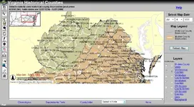
Rebel check this map, made by the historical society in 73, wow i think prob
the 1st map made to mention the beal treasure, i have another file but not
on this wireless chromebook, later when i get to other puter

cool map
http://spec.lib.vt.edu/imagebase/08MAPS/screen/HM200701241556.jpg
source
Browsing Maps -> Historical Maps -> Virginia Maps

cool map popup info
Viewing Full Record for HM200701241556

Can't say it is about "BT"; keep us informed. MAY be home-place of a family with last name of "Beale"... will do R & I on Beale Families of Albemarle County, Virginia.

DANG! LOTS of Beales in Albemarle County, Va.! SOME families connected to UVA (Mr. Jefferson's University)!

AND! CSA Sentinel W.T. Wright is stated to be buried in Charlottesville, Va.; Cemetery on 5th Street. He was "watching over" the "BT" in Upper Goose Creek Valley, Bedford County, Va.
 

Last edited:

Top Member Reactions

Users who are viewing this thread

Back
Top Bottom