Barton
Sr. Member
- Joined
- Apr 21, 2005
- Messages
- 449
- Reaction score
- 322
- Golden Thread
- 0
- Location
- Abiquiu, NM
- Detector(s) used
- What ever is needed for the project I am working on--I am a cache hunter
- Primary Interest:
- Cache Hunting
- #1
Thread Owner
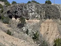
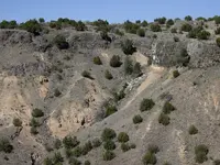
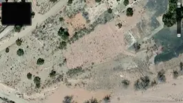
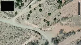
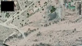
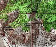
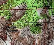
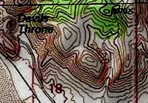
Is this possibly a Spanish Cache site?
Thank you for your help and any insight.
Barton
Thank you for your help and any insight.
Barton