SultansOfSwing
Hero Member
- #1
Thread Owner
Besides doing research reading town history books and browsing old maps, sometimes you just have to get out there and see some spots for yourself.
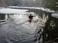
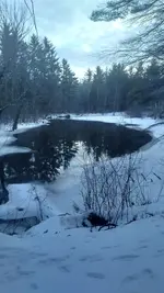
Sunday my friends and I went to a hidden swimming hole that we want to try doing some water detecting this year.
We've detected the land near it and all have pulled silvers, mainly mercs but there was one barber dime. We know this swimming spot had been used for a long time but we werent sure about the depth. We 4x4'd out the the spot and grabbed a kayak we had stashed in the woods. I volunteered to hop in and paddle around getting depth measurements. Straight ahead upstream, its nice and shallow, no more than 2.5ft deep. Back towards shore where the bend is, there an 9ft deep hole, then it levels back out to 2-4ft deep going down stream.
Were planning to hit it hard this spring but in the mean time were going to put on waders and do some detecting in the shallow areas because this snow cover is stopping us from doing any land detecting, and weve got the ITCH!


