KGC clues found with John Murrell, put on your thinking caps!!!!!

point hunter

Full Member
Feb 1, 2007
148
82
West Monroe, Louisiana
Detector(s) used
Ace 250, GTI 2500
Hi. I find these latest posts interesting. I have found the name Murrell carved in at least one beech tree close to the Dixie Overland Hwy. (Hwy. 80) in north Louisiana. I have been chasing bent tree clues and carving sites off and on for a few years now. Hwy. 80 was the first east/west highway from the east coast to the west coast. I thought I was chasing KGC or JJ, but the sites do seem to have been used over a number of years based on the different age of the carvings. I have a pretty good understanding of the lay of the land from central to north Louisiana having grown up about 60 miles from Natchez. I will help you Alec identify some landmarks if you want me to. I don't want to see your maps unless you want to share them, I have plenty sites located already to try and figure out.
I also have a question about Natchez and the neutral zone. I thought the neutral zone was along the Louisiana/Texas border. Natchez is located at the Louisiana/Mississippi border. Natchez is however located on the Camino Real which runs across central Louisiana to Texas passing right though the neutral zone. The Camino Real is now known as Hwy. 84.
 

alec

Sr. Member
Mar 21, 2003
373
132
Hawaii
Detector(s) used
garrett, minelab, tesoro, whites
Thanks for the offer Point Hunter but I don't get to Louisiana much so I doubt I will be hunting any of Murrel's stuff for quite a while. Several of the maps I have have some landmarks named on them such as rivers and creeks. When I get time I will try to post a few more of the maps on here for you and anyone else that may be interested.

Maybe Hoss will jump in with some info. He said he was going to but must have got busy.
 

Attachments

  • 01-2.jpg
    01-2.jpg
    73.4 KB · Views: 3,038

alec

Sr. Member
Mar 21, 2003
373
132
Hawaii
Detector(s) used
garrett, minelab, tesoro, whites
Here are a couple of more.
 

Attachments

  • 03-2.jpg
    03-2.jpg
    65.2 KB · Views: 2,472
  • 11-2.jpg
    11-2.jpg
    78.9 KB · Views: 2,880

point hunter

Full Member
Feb 1, 2007
148
82
West Monroe, Louisiana
Detector(s) used
Ace 250, GTI 2500
Very cool maps!!! I recognized a couple of place names right off. The first is Black Lake. Here a brief history I found interesting and the link:
http://lakebistineau.com/history/DATES 1.html

1818- In August 1818, John Murrell, after leaving his home in Tennessee and traveling down the Mississippi and up the Red River into Loggy Bayou and Dorcheat with his wife, six children, a pack horse, his rifle and a dog or two found a cooling spring and settled his family near Isaac Alden's home in the "flat Lick" (small creek) area just east of today's Minden. At the time his only neighbors were Isaac Alden and a half-indian named Fields. But that winter brought Mr. Allen for whom the settlement was later named(Allen's Settlement), Daniel Moore, Wm. Gryder, and Newton Drew who established the community of Overton on the east banks of Bayou Dorcheat.
These first settlers found the country beautiful, pleasant and healthy. Game was plentiful and astonishingly tame. The black bear, deer, turkey,waterfowl fish and quail were used as food. The panther, black wolf, wildcats and foxes were troublesome. Otters and some beaver provided fur.
While John Murrell was not the first settler in the area, preceded by Isaac Alden in 1811, the burial of his son in the fall of 1818 marked the first burial among the civilized in this area. Also, the birth of his son in 1819 marked the first birth in the area. The oldest graveyard in the area was located on the John Murrell plantation in 1822.

Black lake is located roughly 30 miles from Red River and Shreveport. South of Hwy. 80 on Hwy. 9 near Campti, Louisiana.
 

point hunter

Full Member
Feb 1, 2007
148
82
West Monroe, Louisiana
Detector(s) used
Ace 250, GTI 2500
The next is Grand Encore, here is the link: http://www.townofchatham.org/home/history.shtml

Although most of early transportation in North Louisiana was by water there were some well used trails at an early date. “The Old Natchitoches Road” was one that ran from Lake Providence to Natchitoches. The geographer William Darby published what many believe to be the first known trails on it. He described the trail, later known as the “Old Natchitoches Road,” when he spoke of an Indian trail at Grand Encore, located north of Natchitoches, on the new bed of the Red River as being: ...joined by another which was known as the Ouachita trail, and which led directly to the Licks, and thence through the hills, directly northeast to a Choctaw Village on the banks of Bayou Cheniere au Tondre, and thence to cross the Ouachita at the site of Monroe and to continue on up the Ouachita and into southeast Arkansas and to the Mississippi.

This trail was used extensively by the Indians to transport salt from Louisiana salt works to the many Indian villages along the route. It was also a part of Sieur de Bienville’s route to Natchitoches by way of Chatham in 1700 on his trip from Lake Providence to Natchitoches.

I know almost exactly where the Chowtaw village on Bayou Cheniere is located. What I find very interesting is the tree carving site I refered to with Murrell's name is only 3 or 4 miles away. It seems I should be looking much closer at Murrell. Thanks!!!
 

Kisatchie

Jr. Member
Feb 20, 2007
24
1
Winnfield, Louisiana
Detector(s) used
Garrett ACE 250
Point Hunter,

Glad to see this post, I havent been here in some while and not sure you remember me. I am located in Winnfield, La. My main intrest is in the West/Kimbrell Clan and John Murrell, and seeing these maps is a real boost for me. I am in the process of reading a book about Murrell, "Reverend Devil". I plan to go to this area and start looking for some clues. I am not far at all from Atlanta and Montgomery which was home for the West/Kimbrell Clan, and also my family is from the area known as the neutral strip. My ancestors settled land in the Natchitoches/Sabine Parishes during the late 1800's, and is still in the family.

Alec,

I would really be intrested in see any of these maps if your willing to share that info.
 

alec

Sr. Member
Mar 21, 2003
373
132
Hawaii
Detector(s) used
garrett, minelab, tesoro, whites
I will try to get some more maps scanned and posted. I recently moved to a new house and I have stuff boxed up everywhere so I have to first, find the box they are in and then get them scanned.

Here's a couple more that I already had scanned.
 

Attachments

  • 07-2.jpg
    07-2.jpg
    72.7 KB · Views: 2,767
  • 10-2.jpg
    10-2.jpg
    59.9 KB · Views: 2,231

point hunter

Full Member
Feb 1, 2007
148
82
West Monroe, Louisiana
Detector(s) used
Ace 250, GTI 2500
Kisatchie,

Hi. It's good to hear from you. I haven't been here much myself. We'll have to chat some when you get time. I hope these maps and research get you pointed in the right direction. Don't forget us, when you find the big one!! Ha Ha

Alec,

Thanks so much for posting more maps. I keep hoping I'll see one that matches up with a site closer to me. That would be fun to chase. Your generosity in sharing info shows what a great person you are. Thanks again.

I have been looking closer at Murrell the outlaw these past few days. I have discovered there were two John Murrell's in the west Louisiana area. My earlier post is actually about John Murrell, the gentleman farmer. Sorry that I posted info that wasn't true. What are the odds: Two men living in the same area, at the same time, with the same name. Both of them having a good bit of info available online.
Here is some info found on Murrell the outlaw and the link. I couldn't get it to copy properly, but it's pages 302-309:


http://books.google.com/books?id=qm...a#v=onepage&q=murrell gold louisiana&f=false
 

alec

Sr. Member
Mar 21, 2003
373
132
Hawaii
Detector(s) used
garrett, minelab, tesoro, whites
point hunter, thank you for the compliment but don't go making me out to be too nice of a guy, you'll get people laughing! :laughing9:
 

Attachments

  • 02-2.jpg
    02-2.jpg
    68.9 KB · Views: 3,033
  • 12-2.jpg
    12-2.jpg
    72.9 KB · Views: 2,252

flintk

Newbie
Aug 30, 2010
1
0
I was reading your messages and remembered something mentioned in a book"Shadow of the Sentenial" an overturned strong box was used to throw off unknowing diggers. it meant dig deeper. be sure to check out that hole real good before leaving it. Good luck.
 

lastleg

Silver Member
Feb 3, 2008
2,876
658
Didn't Murrell/Murel go to prison in 1834 for a ten year stretch and come out
with TB and died shortly after 1844/45? That would mean he was active in the
KGC from 1820's to 1834??? 
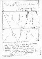
Oh, I know, Jay, he faked his death in 1844 and
rode with Bloody Bill and Quantrell serving as Sgt-at-Arms in the Knights of the
Golden Circle. Then after the Surrender he floated his treasure down the Missi-
ssippi to the Devil's Punchbowl at Natchez. That skull the gravediggers got
really belonged to Jonathan Swift and the fingers tattooed with HT(Horse Theif)
really belonged to a guy named Bigalow. After burying half his loot at the
Punchbowl he went overland to the nuetral strip by the Sabine to bury the rest.
In order to support his gang of 2500 Mystic Clanners he robbed the New Orleans mint and started the Mardis Gras using Melangeon and Redbone actors
to throw fake necklaces to the huge crowds on Bourbon Street. At his 100th
birthday party in 1904 his invitees included both James's, Frank Dalton, Roy
Acuff, John Dillenger and Pretty Boy Floyd.

THE END
 

GrayCloud

Bronze Member
Jan 24, 2008
1,797
120
Louisiana
Detector(s) used
Explorer II & Garrett 2500 w/Treasure Hound
You boys poking around those hill right out of Natchez Louisiana, which is right dab in the middle of the no law zone? Be careful out there, some of those local can get a little rowdy. Point Hunter, we will get together in a couple of years if my body hold out and do a little hunting. Till then I am stuck in Tulsa Oklahoma on a Job. Dang this work thing. :(
 

Scar

Full Member
Dec 25, 2010
193
114
I am a Petroleum Landman and have worked many of the Parishes of Louisiana that were included in "No Mans Land". While working Red River Parish a few years back I found land patents for John Murrell and Iaasic Murrell. If I remember correctly the lands were located around the area where Hwy 84 crosses the Red River and the western boundary line was Bayou Pierre, I think John was granted the section adjoining the bayou and Issac got the section just to the East.
 

goverton

Sr. Member
Oct 9, 2010
407
45
Primary Interest:
All Treasure Hunting
Side Note: Has anyone here used a Digital Golf Range Distance Finder Scope to measure distances in the field of treasure hunting?

These are much cheaper than a laser transit if they will work.

Thanks in advance for your input.
 

alec

Sr. Member
Mar 21, 2003
373
132
Hawaii
Detector(s) used
garrett, minelab, tesoro, whites
Never used a golf scope but I routinely used laser range finders (the hunting kind) in the field and they work great. Beats stretching a tape 200-300 yards.
 

Hoss KGC

Full Member
May 30, 2003
220
84
USA
alec said:
Never used a golf scope but I routinely used laser range finders (the hunting kind) in the field and they work great. Beats stretching a tape 200-300 yards.

Wow, you actually have to measure distances of 200 and 300 yards??!!
 

goverton

Sr. Member
Oct 9, 2010
407
45
Primary Interest:
All Treasure Hunting
Dang, Tulsa?!......you could be lookin in Okie land....if you are not already! :wink: :wink:


GrayCloud said:
You boys poking around those hill right out of Natchez Louisiana, which is right dab in the middle of the no law zone? Be careful out there, some of those local can get a little rowdy. Point Hunter, we will get together in a couple of years if my body hold out and do a little hunting. Till then I am stuck in Tulsa Oklahoma on a Job. Dang this work thing. :(
 

alec

Sr. Member
Mar 21, 2003
373
132
Hawaii
Detector(s) used
garrett, minelab, tesoro, whites
Hoss KGC said:
alec said:
Never used a golf scope but I routinely used laser range finders (the hunting kind) in the field and they work great. Beats stretching a tape 200-300 yards.

Wow, you actually have to measure distances of 200 and 300 yards??!!

Just on certain occasions and usually only when I'm hunting Spanish stuff. Does that ruin your day Hoss? :laughing9:
 

goverton

Sr. Member
Oct 9, 2010
407
45
Primary Interest:
All Treasure Hunting
Dad Burn you Alec......putting all the cool maps online here......tempting me to solve these puzzles!
You ought to be ashamed of tempting me when I need to work on my own! LOL :tongue3: ::) :read2:
 

Top Member Reactions

Users who are viewing this thread

Top