Legend of the Stone Maps

Somero

Hero Member
Sep 10, 2012
680
498
Primary Interest:
All Treasure Hunting
Last edited:

Treasure_Hunter

Administrator
Staff member
Jul 27, 2006
48,465
54,911
Florida
Detector(s) used
Minelab_Equinox_ 800 Minelab_CTX-3030 Minelab_Excal_1000 Minelab_Sovereign_GT Minelab_Safari Minelab_ETrac Whites_Beach_Hunter_ID Fisher_1235_X
Primary Interest:
All Treasure Hunting
Reminder we are family friendly forum.
 

Azquester

Bronze Member
Dec 15, 2006
1,736
2,596
Primary Interest:
All Treasure Hunting
I tell you where its quiet is on that other forum.

Its only used by the moderators.

All threads go through slow patches.

Personally, I haven't started my video taping yet still a little to hot and buggy this year to make it there with out stepping on a rattler! I hope to prove the map system was a solar based system with rock based monuments that lead you to the solar. Everything they did was based on a solar / lunar cycle not a watch or time piece. It was easy for them to make Giant shadow glyphs why not smaller sunlight / shadow maps? I wish I could show it on here....what I've already discovered...that would be something to see. Since I haven't seen any other sites like this one it must be unique and scarce. I wouldn't worry that much about another being discovered in Arizona as I believe only the richest mines were coded this way. I do worry about other states and places I haven't been to yet for another site like this one yet to be discovered.

I haven't seen one as of yet in the Superstition's. Probably is one there, I just can't take that chance of showing my site fully publicly because of this.
Since I know what the mountain they are contained in are shaped like it's a relatively easy task to use G Earth to find them. When sculpted they cut the trench lines as a would be matrix printer on a paper and angled those trenches for the Longitude, Latitude required for the solar lunar symbols to be broadcast. Any out crop can be used if it's angled correctly. Looking at the outcrop of bedrock one would never in a million years guess or know if contained a map if they had never seen the ground maps nearby or know how to read the ground maps and at what time of day based on the location.

The first one I found had the same type of mountain but had different monuments and started four leagues away with a petroglyph map found in 1948 by a young boy and his father.

Good hunting out there and let the Treasure Hunting games begin!
 

sailaway

Hero Member
Mar 2, 2014
623
815
Primary Interest:
All Treasure Hunting
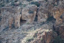
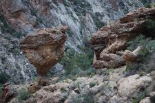
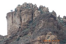
DSC_7234 El Shield.JPG
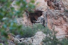
front (monument is on right side of picture)
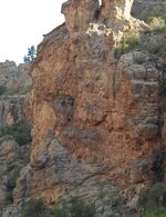
DSC_7248 Shield back side.JPG
back of monument

Is this the Shield you were talking about with an elephant on it Bill?

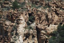
the next set is above the death rock
above death stone.jpg
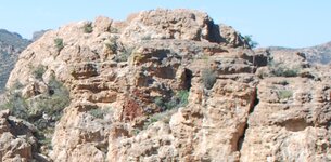
This is very top of the peak over the cliff dwellings.
explanation of shadow signs needed, they can be seen at the very top rocks of the peak
this was cropped from next picture so you could see everything
DSC_7265.JPG
Full Picture
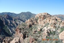
DSC_7264.JPG
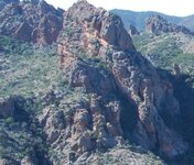
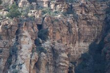
this is the opposite side of the same peak above the Death Stone (which was unfinished BTW)
cut side.jpg
if I was mining this area, it would be here
 

Last edited:

Azquester

Bronze Member
Dec 15, 2006
1,736
2,596
Primary Interest:
All Treasure Hunting
I know that area where the cave is I've been close to it. Great Photo's Sailaway! There at least three mines I found in that cave area.

The shadows on top of where the cave dwellings are look to be showing a mine shrine or mission (Bell) direction.
It's hard to tell either the shot was not taken from the walkers trail or it's the wrong time of year, day etc. I have a photo some where of the shield with the elephant I'll see if I can dig it up.

Good work still!
 

sailaway

Hero Member
Mar 2, 2014
623
815
Primary Interest:
All Treasure Hunting
The Photos were taken from the bore hole across the canyon over by the Gonzales Mine. This bore hole only goes back in about 4 feet to solid rock wall.
DSC_7133 Bore Hole.JPG
Bore Hole
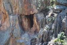
DSC_7269 Gonzles Mine area.jpg DSC_7247 Lower Gonzales Tunnel.JPG
..............Area of Gonzales Mine ...................... Tunnel

The ones from higher up were taken from above the center mine shaft.
DSC_7121 Center Hole.JPG DSC_7227 Upper Center Shaft.JPG
these lower pictures show how time of day really does have to do with what you see.

Bill I have some questions though.

There were no known mines or missions in the Superstitions according to historians and the Park Service,
so how could the sun signs point to something that we are told did not exist?
The Northern limit was the Gila River for those living in Sonora back then.
Going into hostile Indian territory and high desert to do hard rock mining,
not just placer mining would be suicide back then, unless there was a cover up?
Was there a consorted effort that included military forces to support the poor miners
that would be willing to endure the hardship that area places on the human body?

I know first hand how tough this area is and to get the last set of pictures almost cost me my life.
Came very close to Heat Exhaustion.
 

Last edited:

Azquester

Bronze Member
Dec 15, 2006
1,736
2,596
Primary Interest:
All Treasure Hunting
Shadow made signs and sun made signs were not only used for missions, but also mining exploration trail markers. Like I said though it may just be an anomaly in nature, wrong time of year or day...if it is a shadow bell it was probably used for mining other than a way to a mission....but all mines required a trail too a shrine far from the mine from known water sources that were for human consumption. As a triangle going to and from a mine with a cross and mission bell showing the way too a shrine and a secret walkers trail too the actual mine. That walkers trail would be signed with "X's" as an inbound trail or ingress. Usually with shaft or door symbols open air light sky superior trails or dark and light elongated hearts that were "Stacked" with an "X" + Door symbol + Heart which looks similar to a heart with ears both in contrast or in light reflection. This was the superior trail or secret trail towards the gold mine. Normally it would be along a compass degree line that was given from the known good water source.

("Jim Price" Treasure Trails volume 1)


The Photos were taken from the bore hole across the canyon over by the Gonzales Mine. This bore hole only goes back in about 4 feet to solid rock wall.
View attachment 1223492
Bore Hole
View attachment 1223497 View attachment 1223498
..............Area of Gonzales Mine ...................... Tunnel

The ones from higher up were taken from above the center mine shaft.
View attachment 1223493 View attachment 1223499
these lower pictures show how time of day really does have to do with what you see.

Bill I have some questions though.

There were no known mines or missions in the Superstitions according to historians and the Park Service,
so how could the sun signs point to something that we are told did not exist?
The Northern limit was the Gila River for those living in Sonora back then.
Going into hostile Indian territory and high desert to do hard rock mining,
not just placer mining would be suicide back then, unless there was a cover up?
Was there a consorted effort that included military forces to support the poor miners
that would be willing to endure the hardship that area places on the human body?

I know first hand how tough this area is and to get the last set of pictures almost cost me my life.
Came very close to Heat Exhaustion.
 

sailaway

Hero Member
Mar 2, 2014
623
815
Primary Interest:
All Treasure Hunting
Is it strange the Sun sign of the bell is exactly where I had marked the Sierra Bell Ringer before I had ever been there? I had called it that because the faults in this area form a Bell shape in the same direction as the sun sign.

http://www.azdema.gov/museum/famousbattles/pdf/Indian Wars in Arizona Territory -context.pdf
Apache Wars Fish Creek.PNG

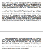
Here we have historians that are now confirming there was mining activity in the area by Americans and Mexicans prior to the Mexican American War?
If there were no known mines in the Superstitions why were there listed American and Mexican Miners joining the first Arizona Guard Including the Leader? Why does Geronimo confirm in his autobiography that he killed Mexican Miners and soldiers just south of Fish Creek Canyon (Rogers Through Trail which is exactly 12 miles southeast from the Salt River) before the Americans could get to him on January 24, 1864?
https://archive.org/stream/geronimosstoryof00gerorich/geronimosstoryof00gerorich_djvu.txt

So is the Park Service still covering up the fact that there were miners early on in the Superstitions?
or is this another mistake by the government historical researchers?

Yes, the mineralized areas are isolated and hard to find, but there are numerous volcanic intrusions throughout the mountains. Remember all it takes to bring gold to the surface is Faults crossing Quartz Diabase with super heated water (Hydro thermal activity) coming up the fault zone.
 

Last edited:

gollum

Gold Member
Jan 2, 2006
6,729
7,596
Arizona Vagrant
Detector(s) used
Minelab SD2200D (Modded)/ Whites GMT 24k / Fisher FX-3 / Fisher Gold Bug II / Fisher Gemini / Schiebel MIMID / Falcon MD-20
Primary Interest:
All Treasure Hunting
http://www.azdema.gov/museum/famousbattles/pdf/Indian Wars in Arizona Territory -context.pdf
View attachment 1224418
Here we have historians that are now confirming there was mining activity in the area by Americans and Mexicans prior to the Spanish American War?
If there were no known mines in the Superstitions why were there listed American or Mexican Miners joining the first Arizona Guard Including the Leader? Why does Geronimo confirm in his autobiography that he killed Mexican Miners and soldiers just south of Fish Creek Canyon (Rogers Through Trail which is exactly 12 miles southeast from the Salt River) before the Americans could get to him on January 24, 1864?

Sailaway,

One thing to keep in mind is the distinction between Tonto Natl Forest, Superstition Wilderness Area, Lost Dutchman State Park, etc. Many people don't differentiate between Goldfield, Superstitions, Eastern Supers. There were many well known Silver Mines on the East End of the Supers, as well as rich gold mines on the West End (Mammoth, Wasp). Most geologists when referring to the "barren of mineralization" Superstitions are referring to the area most often centered in LDM Lore (a circle whose circumference is five miles centered on Weaver's Needle and to the North). When Julia Thomas and Rhinehart Petrasche first went looking for the LDM after Waltz's Death, the must have stepped/rode over the outcropping that THE SAME YEAR (1892) turned out to be one of the richest gold mines in US History (Mammoth Mine).

Now, when the Mammoth was almost played out, they broke into an old shaft that had a very rich vein running through it. When they followed this old shaft to the end, it was sealed by ironwood logs and a large flat capstone. This was the Mormon Stope of the Mammoth Mine. It lasted a little over a year before playing out in 1953 (I believe). I think in that year, they got over two million dollars in gold. There is a picture of the ironwood logs in Ludwig Rosencrans' Book "Spanish Gold and the Lost Dutchman". I will post a scan when I get home tonight. I believe that was the second Peralta/Gonzalez Mine found (LDM is first). Pit Mine may be the third Peralta/Gonzalez Mine found.

Mike
 

Azquester

Bronze Member
Dec 15, 2006
1,736
2,596
Primary Interest:
All Treasure Hunting
Sailaway,

As a matter fact I was just at Rogers Trough yesterday! I met my Son-In-law from Gilbert up there while dropping off my wife so she could go maternity shopping with my oldest Daughter at some local malls. There's a GPAA claim back in there off forest service road 1900 which is connected by 172 going to Rogers Trough. You have to turn left on the road going too Queen Valley to get there. Since all the rains hit it washed out the old rough roads (Believe me when I say it's rough back there the first time I took my Excursion and it took me hours to get back to the claim this time it took 15 minutes on the quad) going into the claim. We got lost and ended up taking 172 way, way back in there. Just prospecting and detecting. I had a gold pan and metal detector's with us, but, I have never seen so many bugs in all the years I've been hiking Arizona! So much rain this year it's bringing out those small Gnat's like crazy! I forgot my head net of course so we could only bend down and dig targets with our tee shirts over our mouths. Fresh flash flooding just occurred up there and the storms were moving in again! Every wash was wet and some still running! This is a very stormy year around here and I hate dealing with all those darn bugs! We got lost as the forest road 1900 was in a wash. We finally found it about 3:00 PM. So we did some prospecting in there.

Make's it impossible to get back deep in there and camp anywhere. It was a test run for my quad I just installed a new gas tank. I busted one of the hubs right front I believe during a massive roll over down in Tucson. But during the test drive I noticed that the front wheels were towed out badly. I may have busted the other hub somewhere. Your right, lots of mineral zones back in there black sands everywhere Quartz faults and zones of green stone. Red Iron dirt's and clay's. The whole area is a wash out so any Gold may be deposited in new area's. Check it out on Google Earth sometime Sailaway it's a bad ass area!
 

Last edited:
OP
OP
sgtfda

sgtfda

Bronze Member
Feb 5, 2004
2,351
3,887
Mesa Arizona
The GPAA gave up that claim. Outback Gold. Lots of mica. Little gold. There is a shortcut if you know your way around. Not a place to be if it's raining. You take any photos or video for our viewing pleasure
 

Azquester

Bronze Member
Dec 15, 2006
1,736
2,596
Primary Interest:
All Treasure Hunting
Why I sure did!

I only took a few photos of my rig. Since it took us so long to find the right road we spent most of the day just riding around missing the turn off that had been washed out. We stopped under the huge trees down the road from the 172 turn off just looking for another way in.

View attachment 1225218 View attachment 1225219


Once at the old claim we finished detecting down the wash on the east end of the now gone mining claim. Bullet shells and scrap metal. Ate about a hundred gnats digging a few holes. That was when the storm started back in so we high tailed it back outa there fairly quick!

I like that area. Nice scenery in there. It would have made some good Videos but time wasn't on our side.

You can see my beat up Gold Bug 2 and I brought a Titan for my Bro.


The GPAA gave up that claim. Outback Gold. Lots of mica. Little gold. There is a shortcut if you know your way around. Not a place to be if it's raining. You take any photos or video for our viewing pleasure
 

sailaway

Hero Member
Mar 2, 2014
623
815
Primary Interest:
All Treasure Hunting
I have been on the old Gpa claim on rd 1900 last month. If you make it back to the claim, you will find that there is not much there, but if you cross the wash where the west claim marker is and climb to the top of the ridge, then look to the east and you will see on the next ridge over some old workings.
 

cactusjumper

Gold Member
Dec 10, 2005
7,754
5,388
Arizona
Getting back to the Stone Maps, for many years it's been postulated that the location where they were found (Queen Creek) was an important part of deciphering them. Since new evidence seems to indicate that portion of the story is false, some of the old theories don't seem to work as well.

As I have been saying for years, I believe, the trail starts at the bottom of Heiroglyphic Canyon, goes up over the Main Mountain past the south side of Superstition Peak and follows the wash down into West Boulder. Down the south side of the of the trail, you will pass the large and small holes on the Stone Maps. Those are, likely, Harry La France's cave of gold bars.

You may also remember that that location was very important for Travis to find. I believe it indicates a larger cave behind a small entrance.........exactly as Harry La France described it.

Good luck,

Joe Ribaudo
 

Last edited:

sailaway

Hero Member
Mar 2, 2014
623
815
Primary Interest:
All Treasure Hunting
Joe, where were the maps exactly found? For those not knowing where the old highway 60 is from the west side of Superior towards Queen creek, the road is now not where the old highway is when the stone maps were found. Those with Google Earth can go look and will see the old road goes straight west out of town where the new road curves slightly to the south of the old road. If you look closely you can see the old road as it continues away from the new road. This old road follows queen creek drainage. so any where along this old road is the location of the find.
queen creek valley.PNG
Any where in this area shown to where it rejoins the new highway could be the maps original location. so there are 12 miles of creek that could be the location of discovery. Without knowing exactly where the stones were found it leaves a large margin of error for locating the exact starting point for those thinking the discovery location would be the starting point. However anyone that knows the area we know that heavy rain moves a lot of rock. Discovery location even involves how far down the creek these stones were found from their original location that they may have been placed.
 

Last edited:

Azquester

Bronze Member
Dec 15, 2006
1,736
2,596
Primary Interest:
All Treasure Hunting
Like I've said in the past I believe the Stone Maps were a generalized conceptual drawing for all major mine sites with gold or silver. A guide for Free Masonry performed at each site with the landscape artist that creates the site using his own judgment for the blending of existing landscapes into the functional mapping at that site. The stone maps are not required or needed once there just a guide for tourists.

It should work in any mountain range that has a major gold mine of the crown and since it's been shown they were not dug up at the bridge site in Queen Creek it sets the stage for my theory that I hypostasized from the beginning and only supports my findings all along. That being said they should work with all major mining sites in or out of the Superstitions.
 

Top Member Reactions

Users who are viewing this thread

Latest Discussions

Top