The Pearl Ship

coffeeshark

Newbie
Mar 6, 2013
1
0
San Diego
Primary Interest:
Shipwrecks
Hi Everyone,

I'm new to this site. I have had a life long interest in topics like this. My family would take dive trip to the Keys when I was young, I always dreamed of finding something. Now, as I live in San Diego, this peaked my interest. I've been backpacking several times in the Anza-Borrego area, and would love to incorporate searching for a lost ship into my activities.

I've seen the posts of people saying they know the location of the pearl ship or different ships, I would love any information, whether it be north or south of the border.

This is a cool site, I wish I knew of it earlier.

Thanks!
 

jackrook

Jr. Member
Nov 1, 2010
68
17
Glendale, Ca
Primary Interest:
All Treasure Hunting
I will be in the Indio are this weekend. Saturday we are taking our trucks to the Bradshaw trail. Any clues or pointers???
 

fuzz2070

Greenie
Mar 8, 2013
17
7
Primary Interest:
All Treasure Hunting
WEll, I am brand new here, but this story is one I grew up with. I was raised in the Imperial Valley, and my Grandparents homesteaded in the Cochella Valley. Anyway, Oroblanca, you are right, and Kimberly, sorry but you are wrong. Since I grew up there and also had a lot of input from the older generations, many things may not have been general knowledge, one, is if you travel up the west side of the Salton sea, you can see water marks on the mountains, divided by by some colored in betweens, this is the high and low tidal marks made on the mountains, also if you go up to these you will find old indian fish traps, made to take advantage of the tides. These two things indicate a connection to the sea. If it were a landlocked lake, this would not have happened with only a short time connected to the sea. It takes many years of connection(hundreds if not thousands) to make such marks. And indeed it did flood in 1907, it was history I had to study. But one other thing, at the bottom of the Salton sea is a salt mine, this accumalation of salt only happens when there is a dried sea or ocean. Ask a geologist. But as stated it flooded and has had agricultoral runoff ever since, the two rivers flowing into it are the New River and the Alamo. At one time as a teenager I worked for a man named Harry Arrington, he had a"country store", and loved treasure hunting, as well as my family, so I got paid to go and look for things, the best of my recollection we went to a place called "Coyote springs, it was supposed to be close to there according to Harry. Didn't find it, but more likely as one post said, the superstitions was a more likely spot. If I ever get to retire and do treasure hunting again, I will spend my winters down there, I have knowledge of several treasures in the IV and south of the border. Everyone good hunting!!jim
 

Isayhello2u

Full Member
Sep 15, 2006
110
27
california
Primary Interest:
Other
hi and hello to new folks. Fuzz2070 im going to disagree with you on a couple of points. one the lake when it existed was landlocked the fish bones left by the Indians that are used to help date the lakes occurrences are of fresh water fish such as the razorback sucker and boneytail chub. and there is not and never has been a salt mine under the sea.
the New Livermore salt works was not a mine. they got their salt from mineral hot springs.
they would flood an area with the salty mineral water. let it evaporate then use a donkey engine to scrape the salt up into piles.
 

urban

Newbie
Mar 15, 2013
1
0
Primary Interest:
All Treasure Hunting
i am new and also havent read all 16 pages so i dont know if it has been covered but i found that the report said this,
"The Salton Basin, once connected to the Gulf of California, is characterized by a shallow marine environment. For the past several million years, sediments that once filled the Grand Canyon were eroded by the Colorado River and deposited in the Gulf of California, eventually building a huge delta, blocking off the Salton Basin from the ocean. Once separated from the Gulf of California, the Salton Basin would periodically dry out as the Colorado River drained directly into the Gulf of California. At other times, the river would change course and fill the basin. These prehistoric inundations have been called Lake Cahuilla or Lake LeConte.

The present-day Salton Sea was formed in 1905 when flood flows on the Colorado River rushed into the Salton Basin (Salton Sink) through a temporary diversion channel until the breach was finally filled by the Southern Pacific Railroad Company in 1907. After an initial high stand of about -195 ft msl, the sea receded to about -250 ft msl by 1920. Since then, with the expansion of agriculture in the Imperial and Coachella valleys and increased agricultural run-off, the surface elevation of the sea has risen to its current elevation of about -227 ft msl. The elevation of the sea has remained relatively stable at its current level since the 1980s, indicating that the inflow of about 1.34 Maf is equal to evaporation at that elevation.".
 

czachary

Jr. Member
Feb 27, 2013
57
20
Primary Interest:
All Treasure Hunting
Just went through all 16 pages and wow how amazed i am. Golloum and tropical really know there stuff, while pegleg has done some incredible research on the topic. A few things come to mind, if the historical individuals actually found parts of the ship, why was it not reported and some kind of excavation happen while it was visible each time. Secondly has anyone actually put boots on the ground out there recently. This is an amazing and incredible plausible puzzle of a that I think could actually be solved with a little luck and knowledge!
 

fuzz2070

Greenie
Mar 8, 2013
17
7
Primary Interest:
All Treasure Hunting
Hello Isayhello2u, again we will disagree, tell me, have you seen the stripes I was talking about? They are high and low tide marks. If as you present, then they would not be distinguishable by being staedy water marks. just a thought, but think of while the Colorado connects, the water will be of a certain water flow, but if tides are present over thousands of years, it will mark high and low. just food for thought.
 

Isayhello2u

Full Member
Sep 15, 2006
110
27
california
Primary Interest:
Other
ive seen the marks i think its possible that the twice daily tidal bore coming up the outflow of the ancient lake may have had an effect.
but im not convinced there was a tide (can you show an oceanside cliff photo with tide marks for comparison?) I still believe the water was fresh.
by fresh i dont mean a snow melt crystal blue fresh water like big bear was but a warm brackisn muddy mineral laden lake.
I was told that the recent water circa 1907 was a little less brackish than the water that flowed by blythe at the same time 1907 period having had time to settle and drop its sediment
 

jackrook

Jr. Member
Nov 1, 2010
68
17
Glendale, Ca
Primary Interest:
All Treasure Hunting
I got the book from Bill Pfost. It's an informative read but most of the information is common knowledge. The good thing about the book is that all the info is at your finger tips, you don't have to search the web. If anyone would like to read it, send me a private message and we can work something out. It's more of a magazine. More or less 40 pages. Alot of illustrations.
 

Back-of-the-boat

Gold Member
Apr 18, 2013
6,890
8,515
California
Detector(s) used
AT GOLD/Garrett /C.Scope cs4PI/Garrett(carrot) pro pointer/ 5x8 double d coil and sniper coil/Lesche digger/Lesche "T" handle shovel.
Primary Interest:
All Treasure Hunting
The story I was told as I grew up was about a ship that is buried in the sands of the Glamis dunes and most of the wood that was ever found from ship has been burned up by people playing in the dunes as they also burned the plank road that used to cross the dunes my Mother was told these stories from her Father. A lot of the areas in So.Cal. desert are on Indian reservations so the native theory does hold water.I am a native from the mountains above the desert have heard most of these stories growing up there.
 

Isayhello2u

Full Member
Sep 15, 2006
110
27
california
Primary Interest:
Other
I think its better Jackrock if they buy their own copy. Bill's wish for that booklet is to have it provide money to preserve local history in the valley where he grew up.
the first three editions he self printed and gave away free to a local museum for them to use as a fund raiser. The current magazine format edition the money is split between
the new publisher and the Salton Sea Museum. The Salton Sea Museum is in need of every penny it can raise as its looking to find a new/ permanent home.

hello Steve Welcome to the discussion
 

jackrook

Jr. Member
Nov 1, 2010
68
17
Glendale, Ca
Primary Interest:
All Treasure Hunting
I think its better Jackrock if they buy their own copy. Bill's wish for that booklet is to have it provide money to preserve local history in the valley where he grew up.
the first three editions he self printed and gave away free to a local museum for them to use as a fund raiser. The current magazine format edition the money is split between
the new publisher and the Salton Sea Museum. The Salton Sea Museum is in need of every penny it can raise as its looking to find a new/ permanent home.

hello Steve Welcome to the discussion

I get what you're saying and I support their quest for funding. I'm not asking for a penny. And if people could afford it, I'm sure they would've got it themself. If anyone wants it, send me a PM
 

fuzz2070

Greenie
Mar 8, 2013
17
7
Primary Interest:
All Treasure Hunting
Well I am back Isayhello2u, hopefully I can post this link,http://www.parks.ca.gov/pages/639/files/SaltonSeaWebBrochure2008.pdf. Well, unfortunatly it is not not a link you can click on, sorry. But it is from the state of California, they agree with me, sorry, I agree with them. I do believe it has been both a lake and connected to the sea, as for high and low water marks on rocks next to the oceans, I will work on. Please be patient with me. Fuzz
 

fuzz2070

Greenie
Mar 8, 2013
17
7
Primary Interest:
All Treasure Hunting
WEll Isayhello, got a link to a place that has at least one pic, maybe more of tidal marks!kimberleymedia.photoshelter.com, I hope this helps, not to nessacarily persuade you.
 

Isayhello2u

Full Member
Sep 15, 2006
110
27
california
Primary Interest:
Other
hey fuzz can you tell me the search keywords or parameters so i can find the images you are looking at at the kimberleymedia site? i get a not there message on your pdf link.

meanwhile found a nice youtube video history of charlie clusker by user TheDesertEmpire1
 

tjscotty

Newbie
Apr 24, 2010
3
0
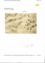
Here is an old satellite photo of capt. Iturbe's ship. I will reveal the exact location to anyone who can supply a thermal imaging camera and helicopter ride to take a current close up picture. my email juan de iturbe.jpg [email protected]
 

Top Member Reactions

Users who are viewing this thread

Top