Alpha and Omega? and Maybe More

BruceW

Greenie
May 13, 2004
14
1
Denver CO
Primary Interest:
Cache Hunting
Hi all,Here is a recent photo of a monument that I originally found quite a few years ago. Unfortunately at the time, I took the photo at the wrong time of day and from the wrong angle and it left me stumped as to where to go next on the trail. I had given up on ever finding anything on that trail and didn't have time to go out there again until a few months ago. I went back and read through Rangler's and Old Dog's threads and I owe you guys a HUGE Thank You!!! as I now realize that I stumbled across what I think is an Alpha Monument:

Alpha2Resized.jpg

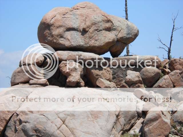
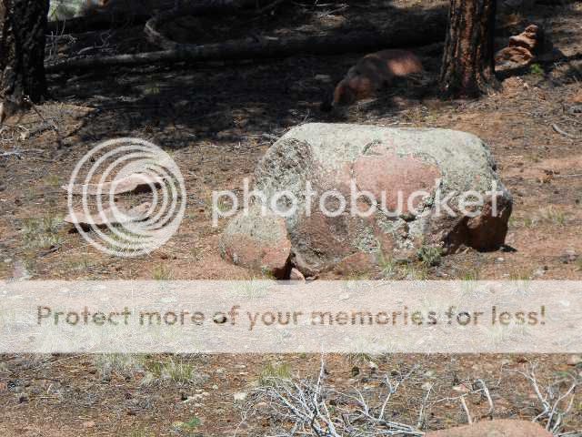
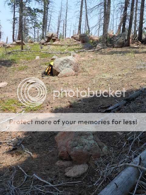
I don't know if you can tell, but this thing is huge. The top rock is the size of a Honda Civic.It appears that the two humps on the top left make up the lobes of a heart. The two dark shadows (one on the left and the one in the bird's eye) I think make up the owl with the beak in the middle. Also the hoyo appears to be an owl shape with the lower ear pointing to the right toward what I think is the omega. (will post that photo farther down the page)Also what I think is the neatest part of this monument is that the shadow of the owl's right eye, the beak and the shadow forming the top of the bird's head form a flying eagle; the symbol for John and also the direction to go South. It doesn't show so well in this photo because I took it standing on a rock so I am looking straight on instead of up at it.There is a cross above the beak, and the beak looks like it is a dog (the black dog?). Then the shadow made by the beak looks like it is the Spanish boot which points to a dagger with the point pointing down (South). Also there is what looks like a "50 varas" symbol shadow that makes up the bird's forehead. I haven't been able to find any numbers for a compass heading, so I am wondering if they would use symbols instead of numbers. Also below the big rock, there is a duck next to the white dog along with a bunch of other stuff. Now here is a wider shot of this thing with what I think is the Omega marker to the far right and separate from this monument:

AlphaOmegaatNoonResized.jpg


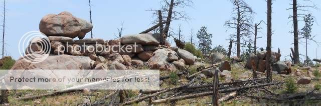
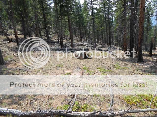
And here is the first photo of what I think might be the Omega. I was just taking a snapshot of stuff in the area when I took it so I cut off the white dog. This was taken with my old camera so it didn't handle the light conditions too well & really darkened the shadows.

OmegaBeforeCleaningResized.jpg


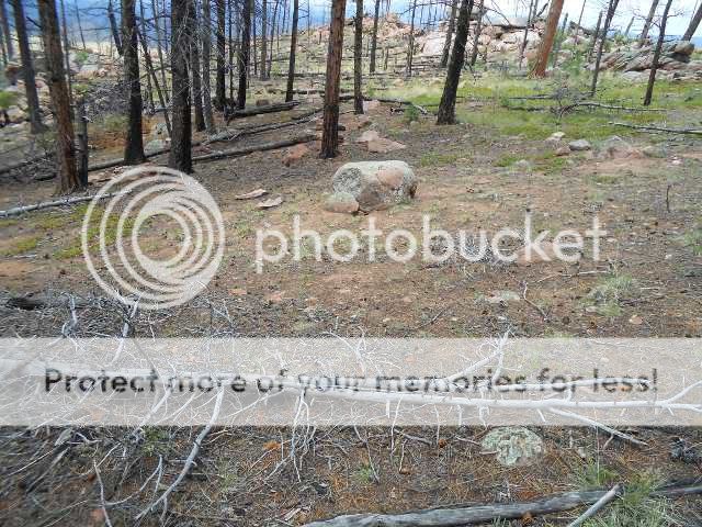
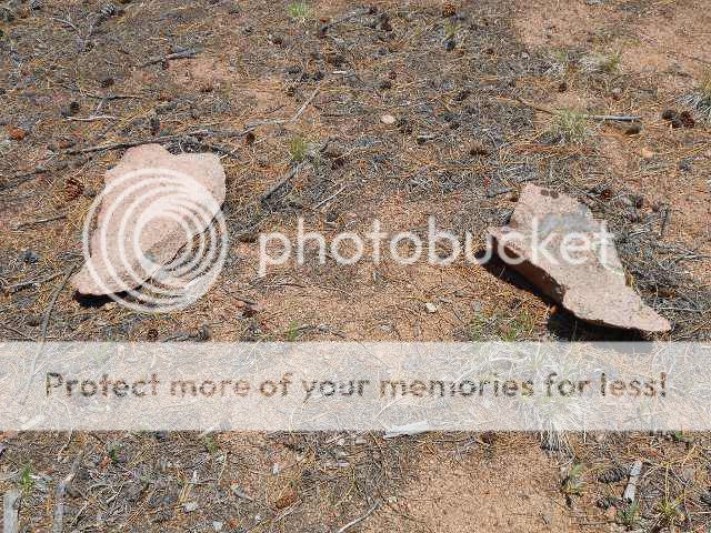
And here is a better shot after I cleaned it up:

Omega4Resized.jpg


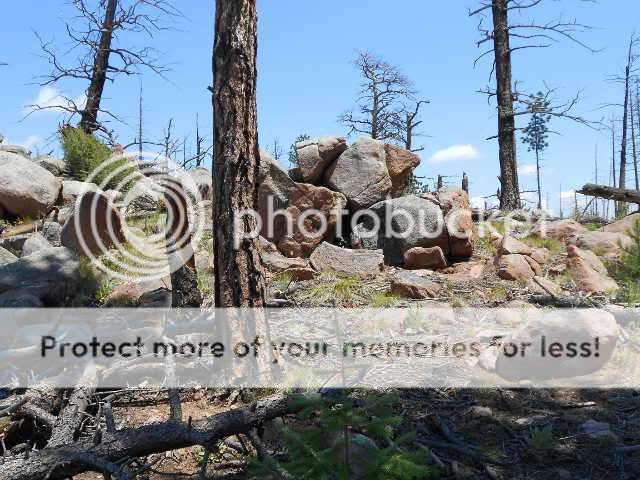
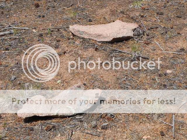
And here is a little closer shot:

Omega3Resized.jpg


I think the main rock is the owl with the two shadows for eyes. The outer outline of the shadows below it make an "M". To the right of that on top of the gray rock is the heart and below that is a shadow bird that I took to be an eagle again. It looks like the "V" is in that mess to the left of the shadow "M". The black dog is in the front, I think, but there also looks like there could be one to the far left to the left of that upturned slab rock. The white dog is to the upper right along a line from the shadow bird's right wing.

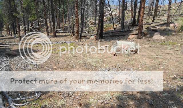
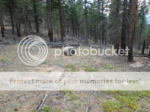
Again I couldn't find any compass headings or figure out any distance measure, but I think I did see a 50 or a "5X" somewhere on there. But as it worked out, all I had to do was look south to see this odd rock:

Site1FromAlphaareaResized.jpg


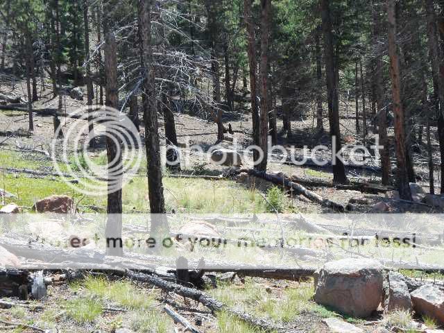
That flat topped rock in the center is due south from the first monument and magnetic south from the second and about 50 paces from each.

I will post more photos of that in my next post as this one is getting pretty long.

I am hoping the pictures come out ok. This is my first crack at posting them on Tnet. I reduced their size and uploaded them to my Photobucket page and then pasted the links here, but looking at the preview I see they came out full size. Anyway, feel free to browse around my Photobucket album to see more photos. Here is the link:

Pictures by Bruce212 - Photobucket
 

OP
OP
B

BruceW

Greenie
May 13, 2004
14
1
Denver CO
Primary Interest:
Cache Hunting
Part 2 On to the flat topped rock:

I just want to note first that I am not sure if the site in the first post that I said I thought was the Omega is in fact an Omega, or if maybe the first monument is the Omega and this is the first site after the omega. Also don't know how many more steps there are after this first site. It seems the farther I go, the more confused I get.


These first 3 photos are an overview of this area:


070412Site1LayoutTnet.jpg


LayoutSite1fromNE2Resized.jpg


OverviewSite1Resized.jpg


Here are some closeups of the center rock:

MainRockCloseupBESTResized.jpg


BootBirdCloseupResized.jpg


And here is a closeup of the bird shadow.


BirdShadowCloseUp2Resized.jpg


Unfortunately I don't have a closeup of the boot shadow on the bottom right of that center rock, but it has what looks like 5 "toes" on it and the squiggly shadow line of the face profile above it looks like it might be a 50 varas sign. So I am thinking 50 varas (or is it feet?), verified by the 5 "toes", in the direction of the front of the boot. But I don't know if I start from the boot/main rock or from the triangle. I have also wondered if I don't get the distance by adding up the sides of the triangle rock (and there are 2 sides of that stone that have triangles). There is also the question of the bird. Is that the direction of travel? and is that reversed because of the duck on the north side of the site? Also I suspect that the next sign will be underground because of the snake's head on the lower right side of the main rock. This, along with the boot, is touched by a line drawn from the flat side of the triangle to the upper right of the main rock. Any help you guys can give me on this will be greatly appreciated.

I did see in an old post where someone mentioned that the duck faced away from the "important sign that unlocked the site", so I think that the triangle-snake-boot line is the relevant one but I'm not sure. By the way, the triangle from the main rock to the duck to the triangle rock makes an equilateral triangle with a distance of 6 paces/varas for each side or "666". I took this as further verification to ignore the duck.

Here is a photo of that line from the triangle rock:

LayoutSite1FromNEResized.jpg


What is confusing is that it also appears that the line from the triangle rock to the lion's head passes through the main rock at about where the bird shadow would be. So this is where I am stuck and am hoping for some help on which direction to go and how far and measured from what point. Strangely enough, I only noticed the boot shadow when I got home and looked over the photos from my last trip. Out at the site, I didn't recognize it so I didn't have the chance to explore in the direction it pointed. Am hoping to get back out there tomorrow to have a look around and check things out again.

Hope you enjoyed these photos & I will try to put up some more in the future. Also I would like to again say Thank You to Old Dog and Rangler for their threads analysing all of the signs and monuments. If you guys want to copy & paste any photos to your threads, feel free to do so. I am really interested in seeing your analysis.

Thanks,
Bruce
 

OP
OP
B

BruceW

Greenie
May 13, 2004
14
1
Denver CO
Primary Interest:
Cache Hunting
I forgot to mention above that in exploring this area, I have found the number "45" on a lot of markers. Couldn't figure out what it meant. "45 degrees" didn't make sense and they were on markers that pointed in all sorts of directions. I finally looked up John 4:5 and it reads:

"He cometh therefore to a city of Samaria, which is called Sichar [Sychar], near the land which Jacob gave to his son Joseph."

and that didn't make any sense either. Finally it dawned on me to Google "Sychar, Samaria" and found that Sychar means "falsehood" or "drunkeness". So it appears that when you see 45 on a marker (or part of a marker) around a John site it may be telling you that that is a "false trail".

Bruce

7/15/2012
I got a pm this morning that said that the "near the land which Jacob gave to his son Joseph" part was the relevant part of this verse. I did some more searching, and I have to agree. Here is what I found out about the land given to Joseph:

[Commentators long made the mistake of supposing that Shechem, now called Nablous, was the town here called Sychar. Sheckem lies a mile and a half west of Jacob's well, while the real Sychar, now called 'Askar, lies scarcely half a mile north of the well. It was a small town, loosely called a city, and adjoined the land which Jacob gave to Joseph ( Genesis 33:19 ; 47:22 ; Joshua 24:32 ), Joseph's tomb being about one hundred yards east of it.

The trail I was following goes in an easterly direction, and what I suspect was the mining area lies to the south which fits. So it appears the markers where I saw 45 were signposts showing where another trail split off and not meant to deceive. Hope this helps & also hope I didn't discourage/mislead anyone.

Bruce
 

Last edited:

Shortstack

Silver Member
Jan 22, 2007
4,305
416
Detector(s) used
Tesoro Bandido II and DeLeon. also a Detector Pro Headhunter Diver, and a Garrett BFO called The Hunter & a Garrett Ace 250.
Primary Interest:
All Treasure Hunting
BruceW,

Did you notice this large "chip" from the end of the rock that just HAPPENS to be propped against the parent stone?? Could it be hiding something??
BootBirdCloseupResized.jpg
 

OP
OP
B

BruceW

Greenie
May 13, 2004
14
1
Denver CO
Primary Interest:
Cache Hunting
Yes I did & thank you for mentioning it. (seems there is so much going on with these markers, it is hard to remember everything & fit it all in) I haven't been able to make heads or tails of that chip other than it helps to make the bird shadow in the ground and it also points to those two flat stones. It goes through the first one that at one angle looks like a turtle. Then it hits the point of the far one that looks sort of like a heart or it could be an owl. I'll have to look at my photos again, but I think those two stones also parallel a line from the lion's head to the duck. But that leads me to believe they aren't relevant to finding the next step along the trail because it would be too risky to use those stones for anything too significant as they are so easily moved. I also thought that maybe the chip was half of a heart or that there might be a compass heading on the buried part, but decided not to disturb it as I was afraid of messing up the bird.

The other arrow for where the chip came from also leaves me scratching my head, too. I can't make out any sign, but can't help but think they did it for a reason. Maybe the reason will be revealed farther on down the trail like it will mimick another monument or maybe the next signs will form a diamond shape and the bottom one is covered/underground. It could also be that this sign is represented by the corner that is covered. However, I think the trail is going to continue south (but I am not sure) so maybe the duck reverses that diamond making this site the north corner.

Here is a shot from the lion's head to the main rock that shows how those two stones lay, the duck on the left in the shadows.


Lion2MainRock2TriangleResized.jpg


and here is a shot of the 2 flat stones

HeartnTurtle2Resized.jpg


HeartnTurtleResized.jpg


Actually that other rock doesn't look much like a turtle, I guess. Have no idea what it is, but I also don't think it has anything to do with finding the distance and direction. Can't help but wonder why it is paralleling that line, though. In case you haven't guessed yet, I spend alot of time scratching my head:icon_scratch:

Bruce
 

Last edited:

hadji009

Hero Member
Dec 29, 2008
711
193
illinois
cool stuff, u might have a parrot head,(twisted fork) is the post u might catch something from. below parrot u might have white dog, perrot..JPG shadow dog.
 

OP
OP
B

BruceW

Greenie
May 13, 2004
14
1
Denver CO
Primary Interest:
Cache Hunting
Thanks for the help Quinoa. Hadn't thought of the leg=league idea. Depending how many stages there are in the trail, that could work out about right. (looks like I will get my exercise)

I noticed those common diamonds/cross hatching, too & thought that helped to confirm that the 2 monuments were related. I think the idea of measuring around the triangle is the right one & will try that when I get up there today. Also thanks for the ideas on the layout. I am leaning more toward the idea that it will be a diamond layout. Shortstack's question about that cutoff slab got me thinking about that & it would fit in with the diamonds on the first 2 monuments.
Could be something to the triangle thing, too. There is a big lion's head monument off a little ways that if I recall correctly had a bell shaped shadow on it and I remember seeing a 3-5-5 written on a marker somewhere. I know the 3 was the largest #, and I think the two 5s were under it but can't remember for sure. Just thought it was odd because it didn't follow the 1-2-3 pattern that we have heard about. Was thinking that it could mean an isosceles triangle.
Bruce

I think that first big boulder with the one "leg" means one league. It also has a diamond carved into the rock face below and to the left.
The second monument to it's right could be saying a couple things. It has a diamond also, maybe it's a backup for the first. But also, it has 2 dots, and a triangle cut onto the right side of it. Maybe you measure the distance around the triangle and convert to feet. Maybe it's the second corner of a triangle. The big flat rock south of it the with the slab cut out it would be the first corner (one round slab cut out = first corner, two dots = second corner). See if there is a third corner. Just guessing, but it gives something to go on. Great Pics!
 

OP
OP
B

BruceW

Greenie
May 13, 2004
14
1
Denver CO
Primary Interest:
Cache Hunting
I didn't think about that part being a bird, but see where it could be. I just took it as some pointer meant to take someone in the wrong direction. I forgot to mention that shadow dog and also that I can't help wondering what that face that gets highlighted might mean. Really stands out. As for the white dog, I thought it was in the upper right corner just under the tip of the log. You can see his eye & then his nose points back to the monument. I have to admit that I know nothing about what those dogs mean or how they are supposed to be used other than I have seen them used as points to draw lines from to verify the lineup of other points.

cool stuff, u might have a parrot head,(twisted fork) is the post u might catch something from. below parrot u might have white dog, View attachment 654082 shadow dog.
 

OP
OP
B

BruceW

Greenie
May 13, 2004
14
1
Denver CO
Primary Interest:
Cache Hunting
and this guy is looking down for something? View attachment 654090

Yes. I took that as meaning to look at the boot shadow (although I have wondered if maybe that isn't a rabbit) with what I think might be a snake's head in the back of it. It is leading me to believe the next sign will be buried but like most of this stuff, I just don't know for sure. I also thought that the outline of that face might be that squiggly "50 varas" sign, but it really isn't a textbook example so I am not sure whether to believe it or not. However, the boot appears to have 5 notches in the shadow in the front so that could verify the 50 varas. I am going to look in that direction the next time I am up there and see what I see.

Bruce
 

OP
OP
B

BruceW

Greenie
May 13, 2004
14
1
Denver CO
Primary Interest:
Cache Hunting
yeah, I know what you mean about multiple meanings. The more I think about it & looking at the size, I wonder if measuring around it or parts of it & converting might give me a measurement to that 2nd marker.


The single leg could also mean 100 feet or 100 varas, it just stands for "one" unit of measurement. If there were three "legs" it would be 3 leagues, 300 feet or 300 varas (3 units of measurement). The diamond has been said to mean a league, but it means other things as well. The places I have seen it , it doesn't mean a league. That's the problem with these signs, multiple meanings, so alot of trial and error. Hope you can figure it out.

There is also a carving of a "knife" to the left of your "Parrot" that has the diamond I mentioned earlier in it's handle. I am assuming this is just pointing out north to the left though.
 

usernotfound

Sr. Member
Sep 7, 2011
495
148
Detector(s) used
T-2
Primary Interest:
All Treasure Hunting
Bruce, if you have not outlined the site on paper, maybe you should and if you do...maybe you can scan the outline. I would like to see it. You can use Google earth and measure distances between monuments, degrees, and such. I see your white dog, black dog, owl, and others. Keep in mind that monuments are supposed to be see from the trail at a particular angle. Take for example the flat rock that happens to be proped on that shell shaped rock. The carving picture looks like the letter "a"... meaning "to go." Not trying to insult your intelligence and I haven't had a chance to read all your post. Please excuse the quixotic post.
 

OP
OP
B

BruceW

Greenie
May 13, 2004
14
1
Denver CO
Primary Interest:
Cache Hunting
Hi UNF,

I have been meaning to get these plotted out, but haven't gotten it done yet. That is a good idea about Google Earth. Went up to the site this afternoon, and with all of the deadfall trees, it is impossible to get accurate measurements with a tape measure.

I see an A on the slab that is sticking out of the ground that forms the bird shadow. I had missed it before. If that is the rock you are talking about, you are right on. I followed the bird's tail and found what I think is the next marker/layout about 80 feet straight east & about 70 ft from the triangular shaped rock. Lines up perfectly with the duck's body and the triangular shaped rock so I think that is confirmation. I'll try and post the pics yet tonight.

I know what you mean about the angle to see these things from. It' just as important as the time of day, too. I am amazed at how those shadows and signs just pop when you get things right. I am having the best luck at right around 1 pm because of daylight savings time. You are also right about the angle. The alpha I took from a little west of south to see the hoyo better. But on the one I called the omega , I am looking east or northeast at the same time of day as the shadows showed up best and made sense. From the south it is just a jumble of rocks, but the east end of the main monument makes a huge turtle behind it.
 

OP
OP
B

BruceW

Greenie
May 13, 2004
14
1
Denver CO
Primary Interest:
Cache Hunting
The Next Sign

As I mentioned before, I got up to the site again today and found what I think is the next marker. The layout looks right. It was about 80 ft east of the shadow bird's tail and about 70 ft from the triangular shaped rock. It also lines up perfectly with a line through the duck's body and the triangular shaped rock so I took that as confirmation.

I didn't take time to go in the direction of the boot shadow, but think now that it was just telling me that the birds tail was the important sign. All speculation there so that may be wrong, too. Was happy to be able to get from point A to B. Unfortunately I got up there too late to get photos where the shadows would be right so will have to do that another time.

Site 2 head rock 2 Resized.JPG

Not sure if this is supposed to be a duckling or some other bird or something else.

Here are a couple of shots of the layout around it. That turtle shell looks interesting, but I have no idea what it means at this point, & I will have to get a better photo of those numbers on the rock next to it.

Site 2 layout 3 Resized.JPG Site 2 layout 10 turtle shell M Resized.JPG


Here are a couple of shots of how this marker lined up with the first site. You can barely see one side of it sticking out from behind a tree:

Line up w big dog M Resized.JPG Lineup Dk Tri to S2 M Resized.JPG Lineup from bird M Resized.JPG

It's funny, but I had not seen that big dog head in the upper left. Hadn't looked at it from the correct angle before. I had seen the red triangle rock and it reminded me of the one on the right side of the monument I think is the omega. They both point directly at that center stone. I will have to check the angle on that and see if it matches the angle made by the lines from this 1st site to the 2nd one.

I also continued on east another 65-70 ft & found this one.

odd rock closeup Resized.JPG Odd rock wider view Resized.JPG

Haven't had time to go over the other site to see if this one is relevant or not, but it looked like it had been worked. Also noticed that rock that looks like a spike in the 2nd one.

Also, someone asked earlier about the measurements on the triangle on the omega? marker. There are two triangles together there and share the same top side. The smaller one is 20" on the left side and 23" on the top and bottom. The larger one that includes the smaller one is 34" on the left side and 33" on the bottom side (roughly one vara?). From there to that roundish rock came out to about 140 ft. Don't look at that as a definite number, though, because I was measuring over a bunch of deadfalls.

Bruce
 

hadji009

Hero Member
Dec 29, 2008
711
193
illinois
1st pic number 17 may be baby turtle comming out of nest? the other thing that looks different is the long slash mark on other new photo bottom right stone,it might be man made?
 

OP
OP
B

BruceW

Greenie
May 13, 2004
14
1
Denver CO
Primary Interest:
Cache Hunting
That's a possibility. I just went with my first thought when I saw it & thought "duckling". It is bugging me that it was almost too easy to find and have a feeling it meant to reverse and go back.

As for that slash, I think you are right & and thanks for pointing it out. I had seen the front side of it in another photo & wondered why it was there. It got me thinking again about that whole site. I think that stone (or one close by) will line up with another stone to point out something to the south of that center rock. I am thinking now (seems I change my mind more than I change my socks but that's what these markers do to me) that maybe the center rock represents the center of that diamond shape that was slabbed off on the SW side of it. The new rock could be the east corner, and that other flat topped rock in the foreground of the 6th picture in the first post may be the north corner. If that is correct, I am thinking that the slab they left in the ground covering the south corner is the important one. It could be that the southern marker, if it is there, will line up with that new marker to the east and point to something to the southwest. If the cache site is to the southwest, that would explain why they slabbed off that corner of the center rock and buried it. A line from that slab would also parallel a line from that shadow that I thought was a boot. (I know...again with the boot? but there has to be some reason they went to the trouble of making it.) Unfortunately that is all going to be back in the trees so I'm hoping they didn't use shadow signs for anything important.

I think the next trip out there I am just going to cover the other 3 cardinal points and go from there. I also want to take a look under that turtle shell and see if there isn't a message or sign.

Bruce
1st pic number 17 may be baby turtle comming out of nest? the other thing that looks different is the long slash mark on other new photo bottom right stone,it might be man made?
 

Last edited:

Top Member Reactions

Users who are viewing this thread

Top