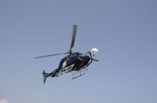
Bedrock Profiling on Placer Gold claim with new technology

OP
OP
M

mulletator

Jr. Member
May 16, 2015
98
118
British Columbia
Primary Interest:
Prospecting
Reed Lukens, are you talking about a placer or hardrock operation?

If you have a tunnel in hardrock why would you want to hire someone to find the bedrock depth? Or is this a drift mine in alluvial material?
 

Reed Lukens

Silver Member
Jan 1, 2013
2,653
5,418
Congres, AZ/ former California Outlawed Gold Miner
Detector(s) used
Tesoro Vaquero, Whites MXT, Vsat, GMT, 5900Di Pro, Minelab GPX 5000, GPXtreme, 2200SD, Excalibur 1000!
Primary Interest:
All Treasure Hunting
Reed Lukens, are you talking about a placer or hardrock operation?

If you have a tunnel in hardrock why would you want to hire someone to find the bedrock depth? Or is this a drift mine in alluvial material?

I'm sorry, 2 different applications, the $20,000.00 specifically marks pockets of gold from satellites and it actually shows you the pockets but it can't tell you the depth...
 

OP
OP
M

mulletator

Jr. Member
May 16, 2015
98
118
British Columbia
Primary Interest:
Prospecting
How exactly do you "mark pockets of gold from satellites?"

I was working with a company in the Yukon a couple of years ago that had data like that. It was produced by a team of Russian scientists from Perm University. They attempted to use hyperspectral data to hone in on gold deposits. The sales pitch was convincing but the results were anything but. One big issue is that you can't get thermal imagery from satellites, at least not useful imagery. The multi-spec data is in horribly low resolution, even today.

You can use techniques like that to find areas where gold is likely to occur based on some criteria. I'm working on a similar system using drones but it won't actually show you gold, especially hard rock gold. So you're right that it can't tell you the depth, I suspect that it can't tell you where the pockets are to any degree of certainty either.

I'm curious though, that was a few years ago and technology moves pretty fast. Do you know the name of the company? I'd like to see what they're up to.

Our seismic system isn't really related to that. We use seismic to map the surface to bedrock depth. Our system doesn't show you gold either but it does show low spots in bedrock and hidden paleo-channels.
 

Reed Lukens

Silver Member
Jan 1, 2013
2,653
5,418
Congres, AZ/ former California Outlawed Gold Miner
Detector(s) used
Tesoro Vaquero, Whites MXT, Vsat, GMT, 5900Di Pro, Minelab GPX 5000, GPXtreme, 2200SD, Excalibur 1000!
Primary Interest:
All Treasure Hunting
I don't know the company name but it was in Spain, they did a sample shoot of one of the mines in this area that is a known producer, and according to my source, the pics looked good, but being that you couldn't get the depth, it's not worth it in my book. It shows the hot spots but it could be a mile or more deep... Let me see if I can get one of the guys to chime in here with more info. I also saw this about 5 years ago and I wasn't too impressed back then. I was just talking with a guy about other things and he brought this up... I haven't seen any pictures myself.
 

Last edited:

IMAUDIGGER

Silver Member
Mar 16, 2016
3,400
5,194
Primary Interest:
All Treasure Hunting
Mulletator, be aware that drone photogrammetry and Lidar mapping requires professional state licensing in most US states.

You may already be aware of this.

Amazing technology.
 

OP
OP
M

mulletator

Jr. Member
May 16, 2015
98
118
British Columbia
Primary Interest:
Prospecting
Mulletator, be aware that drone photogrammetry and Lidar mapping requires professional state licensing in most US states.

You may already be aware of this.

Amazing technology.

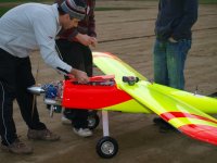
Thanks, I've been working professionally with drones since 2011. I know the rules.
 

OP
OP
M

mulletator

Jr. Member
May 16, 2015
98
118
British Columbia
Primary Interest:
Prospecting
Thanks, I've been working professionally with drones since 2011. I know the rules.
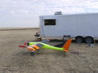
I got in pretty early. I was part of a team that developed a 14-foot wingspan drone that was designed for long-range aeromagnetic and LiDAR surveys from 2011-2013. I received some of the first permits for beyond line of sight flights.

The ones that we use now are smaller though.

322444_3062334996411_305666509_o.jpg
411688_3062334636402_1045913491_o.jpg
 

Minerrick1

Greenie
Apr 28, 2020
19
42
Primary Interest:
All Treasure Hunting
I was talking to Reed about the company that approached me about doing remote surveys for mining claims. I believe they are a Spanish company, and they offered me a "demo" of their product and I suggested a friend of mine's lode claim for a demo. The problem was we didn't have any 3D mapping to offer to them of of the mine in question (we only had 2d), so they could only give us a 2d map of prospective gold deposits, hence we didn't get a depth. If we could have offered up a 3d model, the company said they would have been able to pinpoint a deposit. I am reaching out to their rep (again) to see if he can offer a discount price for only doing 20 acre surveys. We had a bit of a language barrier as he spoke only Spanish and I only spoke English so our comms had to be by google translate.
 

OP
OP
M

mulletator

Jr. Member
May 16, 2015
98
118
British Columbia
Primary Interest:
Prospecting
I was talking to Reed about the company that approached me about doing remote surveys for mining claims. I believe they are a Spanish company, and they offered me a "demo" of their product and I suggested a friend of mine's lode claim for a demo. The problem was we didn't have any 3D mapping to offer to them of of the mine in question (we only had 2d), so they could only give us a 2d map of prospective gold deposits, hence we didn't get a depth. If we could have offered up a 3d model, the company said they would have been able to pinpoint a deposit. I am reaching out to their rep (again) to see if he can offer a discount price for only doing 20 acre surveys. We had a bit of a language barrier as he spoke only Spanish and I only spoke English so our comms had to be by google translate.

I'm really curious about this. It sounds like you're not explaining it properly though. So they are using satellite data, I assume multi-spectral data. What does that have to do with whether you have a 2D or 3D model on the ground?

I have experience with people offering the exact same scenario and their results were speculative at best. I'd love to get more info on this, a company name would be awesome.
 

Minerrick1

Greenie
Apr 28, 2020
19
42
Primary Interest:
All Treasure Hunting
https://movinmarine.com/en/ it helps if you speak Spanish, because the guy I was speaking to didn't speak a lick of english. We did everything via google translate. From the looks of their website, they deal with international mining firms; so there is probably something there.
 

Minerrick1

Greenie
Apr 28, 2020
19
42
Primary Interest:
All Treasure Hunting
This is my 2nd response.... I could have sworn it would have posted... so here I go again, just in case my response got lost in the ether.

The company is https://movinmarine.com/en/- I don't believe there is any staff that speaks English. The rep I was dealing with didn't speak a lick of English and we had to communicate via Google Translate. The generate a pretty cool map, but without the depth dimension, it was useless. The depth dimension was our fault because we couldn't offer them a 3d view of the claim. From the looks of their website, they deal with large international mining companies.
 

Clay Diggins

Silver Member
Nov 14, 2010
4,886
14,262
The Great Southwest
Primary Interest:
Prospecting
Movin'Marine claims to be using aerial ground penetrating radar (GPR). Not satellite.

All regulations in the U.S. regarding GPR strictly forbid airborne deployment. Off-the-ground operation is limited to a height of less than one meter. Radar can not determine metal deposits, only ground densities.

I would move on from Movin'Marine. YMMV

Heavy Pans
 

OP
OP
M

mulletator

Jr. Member
May 16, 2015
98
118
British Columbia
Primary Interest:
Prospecting
Thanks for sharing the links.

The MovinMarine process doesn't have anything to do with satellites. It is literally ground penetrating radar but not the frequencies typically used in GPR and it's used in a very different way. So it's not really GPR, more of a radio soil scan.

They are basically shooting three different frequencies of radio into the ground and measuring the absorption. It's actually similar to the NDVI technique that I'm experimenting with. They claim that that radio energy penetrates the soil a certain amount and by measuring what percentage of each wavelength is absorbed they can come up with a profile of what elements are present.

They are also using a thermal camera and adding heat emissivity to the equation. This system doesn't really have anything to do with satellites other than GPS. It sounds like they're using the GPS L-band as one of their radio frequencies for testing, which is interesting.

In essence, what they're describing is a crude mass spectrometer used for analyzing soil for certain elements (ie. gold). There are a ton of variables that can skew this data. It would be difficult to have any kind of certainty. Very cool stuff though. The end result is a rough geochem map of the area that they survey. That can be very useful since they can cover a large area in a short time.

This doesn't seem to match up to what Minerrick1 and Reel Lukens are describing though. This is helicopter-based radar scanning. It's not using satellites (other than GPS) and it would be difficult to get any sort of reliable depth information.

It's interesting and I think there is some merit to the technique. It can give similar results to a soil sampling program although not nearly as accurate. I think it's pretty cool and as long as the conditions are just right it can give you a broad area idea of where gold deposits are likely to exist.

https://movinmarine.com/en/radar-m2®/technical-note.html
 

Reed Lukens

Silver Member
Jan 1, 2013
2,653
5,418
Congres, AZ/ former California Outlawed Gold Miner
Detector(s) used
Tesoro Vaquero, Whites MXT, Vsat, GMT, 5900Di Pro, Minelab GPX 5000, GPXtreme, 2200SD, Excalibur 1000!
Primary Interest:
All Treasure Hunting
Thanks for sharing the links.

This doesn't seem to match up to what Minerrick1 and Reel Lukens are describing though. This is helicopter-based radar scanning. It's not using satellites (other than GPS) and it would be difficult to get any sort of reliable depth information.

https://movinmarine.com/en/radar-m2®/technical-note.html

I was assuming it was satellite because the guy was from Spain, so they did a fly over for the test. Now I know lots more then I did about it from the brief discussion that we had.
 

Top Member Reactions

Users who are viewing this thread

Top