Best handheld gps device for mapping

49er12

Bronze Member
Aug 22, 2013
1,238
1,627
Rolling Rock, Pennsylvania
Detector(s) used
Minelab xterra, Whites DFX, Notka Makro Simplex. Folks the price don’t mean everything, the question is are you willing to put in the time to learn the machine, experience will pay off I guarantee it.
Primary Interest:
All Treasure Hunting

A#1

Hero Member
Feb 18, 2018
532
657
Traverse City, Michigan
Primary Interest:
Other
Honestly, I prefer an Samsung brand Android cell phone.....or a tablet. I use both, tablet in the truck, cell in my pocket.

Really a much more versatile and useful tool than a standalone GPS.

I have an app thats like a current plat map of my whole state. OnxHunt (yearly subscription)(Requires cell service, or "some" internet)

I have a app that provides all the functionality of a GPS, plus older topos, satellite view, basic road map, track recording, and I can take pictures and noted with every waypoint i mark. I can also export all that to Google earth on PC, or import marked places from Google Earth. Backcountry Navigator (free or low cost single purchase)

I have an app where I can overlay jpeg of an older map, and see my GPS location in 1885. Maprika (free)

You don't need cellular service to use the hardware, just a WIFI connection, that you cand also find free if you look around.

With cell service you can add in realtime weather. (free)

I owned a couple Garmin units, they were okay, I gave them away. My Toughbook laptop has built-in GPS, and can realtime on Google Earth, but I never use it. I get all I need from the above.
 

Last edited:

Flipperfla

Sr. Member
Dec 2, 2018
265
524
Fl.
Detector(s) used
Garrett
Primary Interest:
All Treasure Hunting
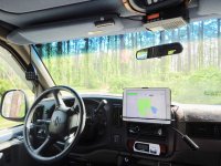
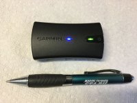
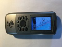
349FC877-8B93-46B2-B351-D353814EBE93.jpeg 9424B8A6-504E-44E0-AF6B-4AB3DE885561.jpeg For navigation, research, google earth, mapping, Gaia,live track log, portable use an I pad air2 with a Verizon jetpac for wi-fi and a Garmin glo2 with Bluetooth link with the iPad for real-time navigation in the truck. Great for bringing up all sorts of data, maps, Google Earth real-time. When getting down and dirty I use a Garmin 76CX that I can load topo software or marine charts. Waterproof, it even floats! I just load my numbers of prospective sites and into the woods I go. I can load the marine charts and it mounts in my Skiff and interfaces with its electronics. I also keep my track log for research and logging grid patterns on beaches. I worked at a West Marine and sold all makes a models of GPSs for years. Garmin is one of the better manufacturers, easy to use, good customer support. CBA006F9-FAD8-4574-AB78-EBDFB6EDA706.jpeg
 

Last edited:

Top Member Reactions

Users who are viewing this thread

Latest Discussions

Top