Clue Concern 4 Peaks

Somero

Hero Member
Sep 10, 2012
680
498
Primary Interest:
All Treasure Hunting
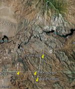
If the clue actually ment 4 peaks as seen as one peak, and directly south was weavers needle, the path would be as shown.
The line being the sight line,

The blue squigly spot on the left side of the line,across from route 88, is Tortilla flats. Where the wine glass is looking thingy.
Canyon lake is the one on the left, with the square, and the car front end.

Click image for larger version. Name: 4peaks to weavers nedle.jpg Views: 14 Size: 53.7 KB ID: 814505

I really don't think it would be a straight line. My experience would suggest more of a triangular area, the farther away from 4 peaks the more East West direction you can travel and they still look like one peak. Say at 20 miles distant from 4 Peaks your East West Area could be 10 miles across. Of course I could be wrong.
 

roadrunner

Bronze Member
Jan 28, 2012
1,230
520
Pinal Mountains,Arizona
Detector(s) used
Garrett Groundhog-2012-1st MD.
White's Goldmaster V/Sat-2nd-MD-2013
Tesoro Lobo-2015-3rd
Primary Interest:
Prospecting
Look at google earth.If I was say 2 miles,east or west of the line I drew,4 peaks would not appear as 1 solid peak.4 peaks looks like the back of a dinosor kinda.Scales standing straight up.
Now,we need the canyon that runs east to west,with a small one going north.Or what ever it is said,that would narrow it down quite a bit just as a look see.
Even if you went 5 miles on each side,but to me buy looking at the way I posted,it wouldnt take much of a declination to see a difference from a single peak,and weavers due south.

My thinking also,if it was between these objects,why didnt he say it lies between 4 peaks, and Tortilla flats(didnt he have a house at tortilla flats).
Or say between weavers needle and tortilla flats.
Unless he said such a broad area just to confuse,like always,
 

393stroker

Hero Member
Jun 27, 2012
505
789
HOUSTON
Detector(s) used
Garrett pro-something
Primary Interest:
All Treasure Hunting
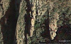
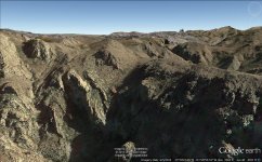
I think that the left side of the Waltz`s doodle looks like 4 Peaks as viewed from the south, and the right half is Weavers. And when Waltz drew this he was trying to show what you will see from the area of his mine. I noticed on top of this flat rock what looks like a cross next to a heart. But you know how GE is. Cross+heart.jpg cross+heart 2.jpg
 

roadrunner

Bronze Member
Jan 28, 2012
1,230
520
Pinal Mountains,Arizona
Detector(s) used
Garrett Groundhog-2012-1st MD.
White's Goldmaster V/Sat-2nd-MD-2013
Tesoro Lobo-2015-3rd
Primary Interest:
Prospecting
The picture on the right,is that 4 peaks in the distance?
So you think the doodle is actually to be split in half?
One side is looking north,and the other looking south?
Kinda a split image or drawing on piece of paper to shopw 2 separate directions or views.

Well I just loked at it and it looks to me like a view looking south from an overhang,or cave.
 

OP
OP
S

Somero

Hero Member
Sep 10, 2012
680
498
Primary Interest:
All Treasure Hunting
393

I think my bearings are correct here, that would put you a little N.NW. of Fremont Saddle on the ridge line to get that alignment, interesting thought on the Doodle.
 

393stroker

Hero Member
Jun 27, 2012
505
789
HOUSTON
Detector(s) used
Garrett pro-something
Primary Interest:
All Treasure Hunting
The picture on the right,is that 4 peaks in the distance?
So you think the doodle is actually to be split in half?
One side is looking north,and the other looking south?
Kinda a split image or drawing on piece of paper to shopw 2 separate directions or views.

Well I just loked at it and it looks to me like a view looking south from an overhang,or cave.
Yes, the doodle may be in two directions, who knows? The image is facing to the south. I`m thinking that up near the top of the ridge would be a good area to check out. You can park about 3 miles away, but it`s mostly up hill. But then it`s mostly down hill on the return.
 

roadrunner

Bronze Member
Jan 28, 2012
1,230
520
Pinal Mountains,Arizona
Detector(s) used
Garrett Groundhog-2012-1st MD.
White's Goldmaster V/Sat-2nd-MD-2013
Tesoro Lobo-2015-3rd
Primary Interest:
Prospecting
The picture on the left,would there by chance be another stone outcropping with those 2,making it 3 stones by them selves.
Just Google earthed your location.That spot is like 100 yards east of my line.There is also a main wash,valley, due west, 1/4 mile that runs right to tortilla flat.Have to look at a topo for the name.
 

Last edited:

393stroker

Hero Member
Jun 27, 2012
505
789
HOUSTON
Detector(s) used
Garrett pro-something
Primary Interest:
All Treasure Hunting
The left image is a close-up of the area in the right image. I circled the area where it looks like a cross next to a heart on top of the flat portion of the rock outcropping. Just below the circled cross and heart on the left side there looks like a funnel looking depression., who knows what one might find if you keep at it.
 

roadrunner

Bronze Member
Jan 28, 2012
1,230
520
Pinal Mountains,Arizona
Detector(s) used
Garrett Groundhog-2012-1st MD.
White's Goldmaster V/Sat-2nd-MD-2013
Tesoro Lobo-2015-3rd
Primary Interest:
Prospecting
Well I put in the co-ordinates from the picture on the left.
Maybe your mouse moved and there not right.
I will go look again because where i am at,does not look like yours. Kinda.
 

393stroker

Hero Member
Jun 27, 2012
505
789
HOUSTON
Detector(s) used
Garrett pro-something
Primary Interest:
All Treasure Hunting
Well I put in the co-ordinates from the picture on the left.
Maybe your mouse moved and there not right.
I will go look again because where i am at,does not look like yours. Kinda.
When you move the mouse to hit the file tab the c-o`s change, I don`t know how else to lock it in.
 

roadrunner

Bronze Member
Jan 28, 2012
1,230
520
Pinal Mountains,Arizona
Detector(s) used
Garrett Groundhog-2012-1st MD.
White's Goldmaster V/Sat-2nd-MD-2013
Tesoro Lobo-2015-3rd
Primary Interest:
Prospecting
What you do is put your spot in the center of the square,click on the center.Then go up to the left corner and click on placemark.The the box drops down and you can name your place mark.
then click on done.
The other way to do it is after your mouse has stopped where you want it,write down the CO'S,then put them back into the search bar at top left,click on search, and as soon as the screen opens,click on the placemark tab,upper left on the tool bar,then name your place mark.The push pin will show where your mark is right away.If it does not,you have to do it over again.

If you go back and look at my pic,you will see the corners of the placemarks in my screen shot.
try it my way and see if you can get a better set of Cos,or if they are truly what is showing.I mean,that is uncanny if true your spot is within 100 feet of my line. Especially from 2 different people.
 

Last edited:

roadrunner

Bronze Member
Jan 28, 2012
1,230
520
Pinal Mountains,Arizona
Detector(s) used
Garrett Groundhog-2012-1st MD.
White's Goldmaster V/Sat-2nd-MD-2013
Tesoro Lobo-2015-3rd
Primary Interest:
Prospecting
Now I see what somero and others have said about the relation of 4 peaks.
I was on the 202 today,by Greenfield, and noticed that when looking to the east,4 peaks appeared as 1 mountain,but had 4 peaks on top of it, and weavers was to the south,although i could not see weavers,I knew where it was. So as somero pointed out,it would appear that he was standing at a point in a triangle shape. But,just a lot closer.So what does this mean,was he standing at a side view,or in a straight line as I posted,I will post another pic of my possible triangle.
 

Last edited:
OP
OP
S

Somero

Hero Member
Sep 10, 2012
680
498
Primary Interest:
All Treasure Hunting
The 2 outer lines would be roughly where 4 Peaks may look like 1, I say roughly as I have not been to those points yet. The center line is from the Needle.


roadrunner

Bronze Member
Jan 28, 2012
1,230
520
Pinal Mountains,Arizona
Detector(s) used
Garrett Groundhog-2012-1st MD.
White's Goldmaster V/Sat-2nd-MD-2013
Tesoro Lobo-2015-3rd
Primary Interest:
Prospecting
Well I drive back and forth from flornce junction, to mesa and phoenix every week.
My though is my pic here.
I would think that the spot would lie in the top part of the triangles.
In other words,take and draw a line from the farthest point west,to the farthest east,then take just the top section.
heres why.
I cannot see weavers needle from Apache junction,all the way to florence junction.I can see weavers after I cross the tracks at the turnoff to Queen Valley,and through the canyons to superior.
Now,if you are south of that line on the west side of the sups,the flat iron and sups block weavers.
Triangle.jpg
 

markmar

Silver Member
Oct 17, 2012
4,117
6,259
Primary Interest:
All Treasure Hunting
If the clue actually ment 4 peaks as seen as one peak, and directly south was weavers needle, the path would be as shown.
The line being the sight line,

The blue squigly spot on the left side of the line,across from route 88, is Tortilla flats. Where the wine glass is looking thingy.
Canyon lake is the one on the left, with the square, and the car front end.

Click image for larger version. Name: 4peaks to weavers nedle.jpg Views: 14 Size: 53.7 KB ID: 814505

I really don't think it would be a straight line. My experience would suggest more of a triangular area, the farther away from 4 peaks the more East West direction you can travel and they still look like one peak. Say at 20 miles distant from 4 Peaks your East West Area could be 10 miles across. Of course I could be wrong.

This clue don't says how the Weavers Needle is directly south from Four Peaks , but says how from above the mine , you can see the Four Peaks in line like one peak , and in a straight line , opposite to Four Peaks is the Weavers Needle . This clue is in relation with the mine and this mean how the mine is between Four peaks and Weavers Needle ( with approximation ) . Dr. Thorne said this clue and instead " a straight line between Four Peaks and Weavers Needle " , he said how the Four Peaks and Weavers Needle are at the ends of the compass . Maybe this to confused you .
 

Jan 2, 2013
4,541
1,971
somewhere between flagstaff, preskit
Detector(s) used
Whites prism III
Primary Interest:
Relic Hunting
post civil war sarge...
information as found in will barnes, Arizona place names....
it is supposed to be named after Pauline weaver...
he didn't show up in the territory until around 1857 or so...
la paz placers...peeples valley....
was with the calif. column for a bit...left them at the pima villages...after the pichacco peak affair.
 

Last edited:

Top Member Reactions

Users who are viewing this thread

Top