FINDING METEORITES WITH GOOGLE EARTH

05Duramax

Jr. Member
Jan 6, 2008
41
2
ALASKA
Detector(s) used
FISHER F75 LTD, Bounty Hunter Ultra Mag (camo), GARRETT PRO POINTER
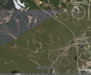
Has anyone out there tried using google earth to find small craters around where they live to hunt for meteorites. Would this be waste of time looking for this debris. Sorry if this was already brought up, but I noticed quite a few small craters where I used to live (Mountain Home ID). What I saw was definitely craters and not a bombing range or from volcanic activity.

Later D
 

UncleVinnys

Bronze Member
Dec 27, 2007
1,150
170
Hancock Street, Folsom, CA
Detector(s) used
Minelab Equinox 600
I haven't done that yet myself, but I HAVE heard of people doing that, on one of the meteorite web sites.

I did see what looked like a small impact crater on the side of the highway in new-mowed grass, and it stood out like a missing tooth. Alas, I was doing 70 on my way to an important meeting and couldn't stop. Good luck.
Try also places like the Great Salt Lake - you may see something dark stand out from the background.
 

xXx

Hero Member
Nov 17, 2004
580
58
back in Indiana again
Detector(s) used
Multiple land, beach, underwater and specialty units
here are some by my house from Google Earth.
xXx
 

Attachments

  • craters.jpg
    craters.jpg
    69.2 KB · Views: 1,962

UncleVinnys

Bronze Member
Dec 27, 2007
1,150
170
Hancock Street, Folsom, CA
Detector(s) used
Minelab Equinox 600

xXx

Hero Member
Nov 17, 2004
580
58
back in Indiana again
Detector(s) used
Multiple land, beach, underwater and specialty units
No farming has ever been done in this area. These "circles" are only a few blocks from the beach here in Myrtle Beach.
 

rcbob166

Jr. Member
Nov 3, 2008
27
0
Myrtle Beach, SC
Detector(s) used
Garrett ACE150
UncleVinnys said:
Pretty sure those are farmer's watering circles.
They have crops and a water truck and this contraption
that rolls around a center point watering the crops.

As David said, these are strikes ,,if you look at them on google earth and zoom back out you can see that the go
clear from myrtle beach area to south of Raliegh NC....
No farming there,,am going to try to pin point one close to here and MD the area for any possible fragments.

This shot is just south of Raliegh........
 

Attachments

  • Image1.gif
    Image1.gif
    466.4 KB · Views: 1,524

Johnnysan

Full Member
Jan 3, 2009
182
4
Detector(s) used
Whites Classic 5-ID / Garrett Ace 250
Google Earth is great. A guy I work with was run down while riding his bike. He used Google Earth to find the car and the house where the lady lives. She's in jail now.
 

Gilligan

Bronze Member
Sep 23, 2007
1,105
288
Seymour Johnson AFB, NC
🥇 Banner finds
1
Detector(s) used
Fisher F75 LTD, Deteknix Scuba Tector
Primary Interest:
All Treasure Hunting
Ahhh, good ole Mtn Home, I was stationed at the base back in 1982-83. Had alot of fun there, tubing Andersen Ranch Dam and stuff. As I recall, there was a place that we went to toward Boise, I think, that was an old missle launch silo. You could go down into it, there were these big rooms and stuff. Have you ever been to this site or heard of it? Thanks, I am in NC now and was wondering about it.
 

NC Gold

Newbie
Feb 2, 2009
1
0
UncleVinnys said:
Pretty sure those are farmer's watering circles.
They have crops and a water truck and this contraption
that rolls around a center point watering the crops.

I know scientists use aerial photos to find LARGE craters that have
eroded somewhat

http://130.15.144.99/rasc/Library/Articles/holle.jpg

and try this - see the photo at bottom right:
http://images.google.com/imgres?img...ial+crater+&start=20&gbv=2&ndsp=20&hl=en&sa=N

These are called Carolina Bays.
http://en.wikipedia.org/wiki/Carolina_bays
 

Top Member Reactions

Users who are viewing this thread

Top