Geronimo Head/Garden Valley/Cactus Hiway/Sunken Valleys

ghostdog

Sr. Member
Apr 22, 2007
286
15
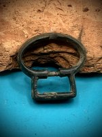
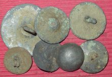
Locations that might hide a sunken hidden valley the Peraltas worked are Garden Valley,or Geronimo head mountain.Their is a cactus hiway the Peraltas mapped,that leads to various mines,useing compass delinations at points along the path.. At one time the Sugaro cactus"s of this hiway had large ax head type stones embetted high up in them to be used as a directinal path finders. If you stand at certain points in the Supers.,with the right map, you will be shocked to see the map come to life like a 3d hologram. Barry Storm found some of the Cactus stones.A lot has been found,but not all.
Try looking for the Silver Antolope,found and lost and found and gone.

"Someone on this board deleted a post of mine in another thread realateing to the above imformation." Shame on you,care to fess up?
 

djui5

Bronze Member
May 22, 2006
1,807
293
Mesa, AZ
Detector(s) used
None
Primary Interest:
Prospecting
The "stones" in the Saguaro that "Barry" found pointed N, S, E, and W.
 

Springfield

Silver Member
Apr 19, 2003
2,850
1,383
New Mexico
Detector(s) used
BS
rangler said:
....with the appropriate "declination" for the time period that gave Barry the confirmation he needed that is was in the Peraltra timeline.

For your information, you don't need declination to establish the cardinal directions. Ask any Boy Scout how to do it.
 

djui5

Bronze Member
May 22, 2006
1,807
293
Mesa, AZ
Detector(s) used
None
Primary Interest:
Prospecting
Springfield said:
For your information, you don't need declination to establish the cardinal directions. Ask any Boy Scout how to do it.

That's not what he was saying. He was saying the declination of the stones lent themselves to the mid 1800's era :) This is the first time I've heard this.
 

OP
OP
G

ghostdog

Sr. Member
Apr 22, 2007
286
15
For Dju15, 3 questions,on a previous post you stated their may be a more than 2 hidden canyons or valleys in the Supers.
A-Can you post more imformation on this subject that you have knowledge of
B-Where do you think they may be located
C-Since you live close to the Supers.,and your up their on a regular basis,can you tell us about your experiences.
thanks :D
 

djui5

Bronze Member
May 22, 2006
1,807
293
Mesa, AZ
Detector(s) used
None
Primary Interest:
Prospecting
ghostdog said:
For Dju15, 3 questions,on a previous post you stated their may be a more than 2 hidden canyons or valleys in the Supers.
A-Can you post more imformation on this subject that you have knowledge of
B-Where do you think they may be located
C-Since you live close to the Supers.,and your up their on a regular basis,can you tell us about your experiences.
thanks :D

A: I haven't really hiked in all of them, so I'm not sure what they are like. I know of at least 3 though in various places in the mountains.
B: See A
C: I have too many to tell about in a single post :) I thought about keeping a Journal but haven't yet. I did write this one neat article if you wanna read it though. It's the first article on this page:

http://www.thelostdutchman.net/searcherscluesmaps.html
 

rangler

Bronze Member
Jul 12, 2004
1,320
201
The Land Of The Free Because Of The Brave!
Detector(s) used
for solutions to the jesuit code -email pics to: [email protected]


;[email protected] locations needed! oro bro!
Primary Interest:
Other
Quote from: Springfield on Today at 07:01:31 AM
For your information, you don't need declination to establish the cardinal directions. Ask any Boy Scout how to do it.

Posted by: djui5 That's not what he was saying. He was saying the declination of the stones lent themselves to the mid 1800's era This is the first time I've heard this.


Correct!

The North magnetic pole has been moving an average of 10km (6.21 miles) per year over the last century! Today, the magnetic pole is located somewhere near Ellef Ringnes Island, in Canada's far North. The pole is always moving, but it moves slowly enough that it only needs to be accurately measured for maps or charts every few years. Ancient marks that point to the North can be dated by how many degrees the declination is 'off'.. there are charts that Barry used to find this nice discovery.

Thanks
rangler
 

OP
OP
G

ghostdog

Sr. Member
Apr 22, 2007
286
15
Good imfo dju15 thanks

Rangler, I did not learn that imfo when I was a boy scout, or an Indian guide for that matter,well put.

The stones Barry found in the Saguaro by compass declination are for the year 1847,Northwest,. However this may not be the year the stones were placed in the cactus. In order to arrive at this type of compass imfo you must goback in time and than forward to the year your doing the declination. Their are other math calculations involved.

Gollum, Storm, owned and worked and lived at low grade jade mine in the Mojave , he thought it was a old Aztec site, his last days may have been in a VA hospitial.
 

Springfield

Silver Member
Apr 19, 2003
2,850
1,383
New Mexico
Detector(s) used
BS
rangler said:
Quote from: Springfield on Today at 07:01:31 AM
For your information, you don't need declination to establish the cardinal directions. Ask any Boy Scout how to do it.

Posted by: djui5 That's not what he was saying. He was saying the declination of the stones lent themselves to the mid 1800's era This is the first time I've heard this.


Correct!

The North magnetic pole has been moving an average of 10km (6.21 miles) per year over the last century! Today, the magnetic pole is located somewhere near Ellef Ringnes Island, in Canada's far North. The pole is always moving, but it moves slowly enough that it only needs to be accurately measured for maps or charts every few years. Ancient marks that point to the North can be dated by how many degrees the declination is 'off'.. there are charts that Barry used to find this nice discovery.

Thanks
rangler

What you say is true of course, but magnetic declination is simply an annoyance that is easily overcome by users of even a crude compass. But what you don't know is whether the old maps were using magnetic or true north. Other than very crude maps which primarly charted topographical features, most 'accurate' charts used true north, since TN is simple to determine - a fact well known by even amatuer cartographers for millenia. Without a disclaimer, there is no reason to assume an old map is based on magnetic declination.
 

Old Dog

Gold Member
May 22, 2007
5,860
397
Western Colorado
Most of the older maps were based on a true North dictated by either stars or the sun,
this was determined with an Astrolabe.
The declination will be slightly different for this determination.
 

rangler

Bronze Member
Jul 12, 2004
1,320
201
The Land Of The Free Because Of The Brave!
Detector(s) used
for solutions to the jesuit code -email pics to: [email protected]


;[email protected] locations needed! oro bro!
Primary Interest:
Other
springfield

I am not sure - but you seem to be missing the point,
Barry Storm was-with the help of charts from the US Navy
I believe, to determine what year the marks were set
by where MN was at that time period. Period.

The marks were the stones set in the cactus
near Black Mesa, in the Supers, it wasn't a paper map
for which what you say is true.

au h2o ;D
rangler
 

Top Member Reactions

Users who are viewing this thread

Top