Help with arial photo experienced tneters take a look

xdanthemanx

Sr. Member
Oct 25, 2007
361
56
clarkston michigan
Detector(s) used
E-trac & XLT
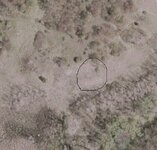
OK im pretty new at this stuff, i just got a detector and am doing some research on a story i heard when i was 10 yrs old, i had a rough idea where the location was and this is arial pretty much fits the description that was given to me, i would have loved to shown this to my frind that originally told me the story but he died back in 82 so i dont have that option this looks like it may actually be something any ideas??????
 

Attachments

  • site1.jpg
    site1.jpg
    46.3 KB · Views: 1,696
OP
OP
xdanthemanx

xdanthemanx

Sr. Member
Oct 25, 2007
361
56
clarkston michigan
Detector(s) used
E-trac & XLT
hey i was just wondering if anyone knew what would leave those shapes....foundation maybe? i dont want it to be anything i will eventually find out but haver a few other sites im researching also.
dan
 

ArmyOps

Tenderfoot
Nov 21, 2007
9
0
Central PA
Detector(s) used
Garrett AT Pro, Ace 250, GTA 350 , Master Hunter CX Plus
Dan, Many factors are involved in aerial photo interpretation. Anyone can guess, but to make an educated guess, takes a little education. (Of course) Apply the factors known, such as region, history, past culture etc. A simple search of the WIK Ency could help. Look at the trees, roads, paths, bridges, telephone poles etc (If Any) and get a base of measurement or scale. You can then get a good idea of your target size. Without the location and background history and the lack of definition or an index of relative known targets, you can guess till the cows come home. Have you checked to see if there are other pics of the area from other sources?

Would be nice to have a friend in NSA to scoot a sat into your target's orbit and get some high tech shots. Thermal and close up in high res would be nice.

It is definately man made. Posibbly a foundation. Depending on the location, it may be listed on an older map. If it is state side and circa 1740s on, you may be able to find it on a Beers Map.

Good luck. ..................Be more than glad to help, and I dont jump claims.

Don
 

Gypsy Heart

Gold Member
Nov 29, 2005
12,686
339
Ozarks
Can you pm me the cordinates and I will google earth it to get a better look....and then let you know ......your secret site is safe with me
 

Jeffro

Silver Member
Dec 6, 2005
4,095
143
Eugene, Oregon
Detector(s) used
Fisher CZ5, White's GM VSat
UncleVinnys said:
My guess: A starting line box for off-road vehicle races.

Looks to be a good guess with all those trails and ruts around. Motocross?
 

Top Member Reactions

Users who are viewing this thread

Latest Discussions

Top